
By Roselyn Fauth
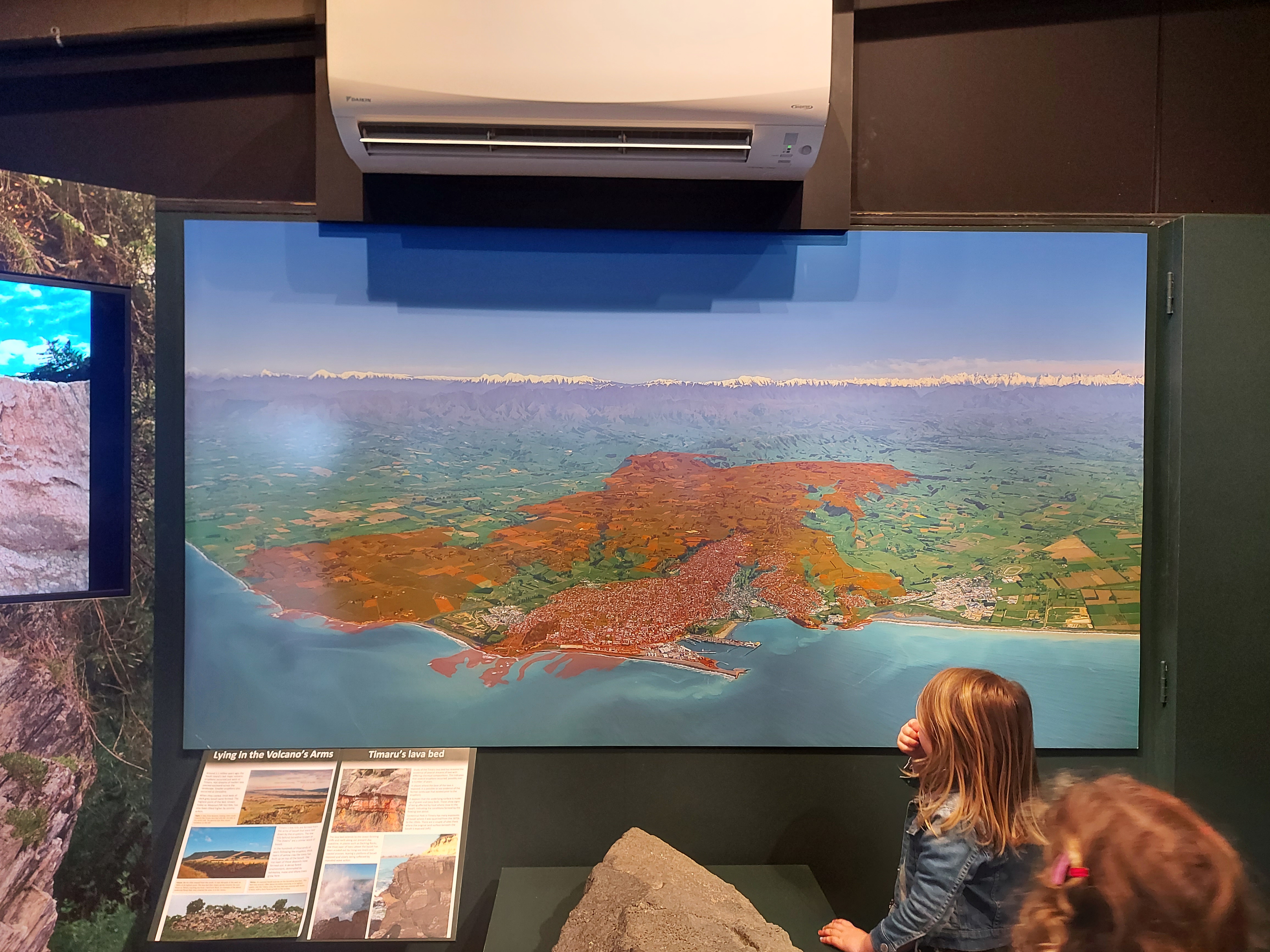
Annabelle Fauth admiring her grandad Geoff Cloake's lava photo and illustration on display at the South Canterbury Museum 2023
One small question can start a very long side quest.. when I was about nine, I asked my dad a question that seemed perfectly ordinary at the time. “Is Mount Horrible extinct?”
Neither of us knew that it would spark a fascination still going more than 30 years later. Dad eventually learned so much about Timaru’s lava flow that he photographed the city from above and overlaid where the basalt can still be found today. His work was displayed for several years in the South Canterbury Museum’s geology exhibition, helping visitors see a landscape normally hidden beneath their feet.
Fast forward a few decades. This morning, my daughter and I were looking through her palaeontology science badge work. One question asked whether dinosaurs had lived in New Zealand, and where their fossils had been found. Simple enough. Then my brain did what it always does... what about Timaru?
I had learned quite a bit about how our land changed: ancient seas, lava, rivers and ice-age dust. But I had never really stopped to wonder about the life living on those changing surfaces and swimming in the seas around them.
So I went back to Dad’s research, reminded myself what he had taught me, and began today’s side quest...
FYI... I am not a geologist or palaeontologist. I am a curious South Cantabrian trying to nut out what published research, museum collections and geological maps can tell us. I have done my best, here is what I found...
Yes, dinosaurs lived in New Zealand
Joan Wiffen found New Zealand’s first recognised dinosaur fossil at Mangahouanga Stream in inland Hawke’s Bay in 1975. Te Papa identifies the specimen as a toe bone from a meat-eating theropod, found in rocks about 70 million years old.
Further fragments found there include plant-eating and meat-eating dinosaurs, along with a pterosaur, a flying reptile that lived alongside dinosaurs but was not itself a dinosaur.
Dinosaur fossils have also been found on the Tīoriori coast of Rēkohu Wharekauri, the Chatham Islands.
So the first part of my daughter’s question has a definite answer. Yes, dinosaurs lived on the ancient landmass that became New Zealand. But no dinosaur has been confirmed here in Timaru. I have not found a published scientific record of a dinosaur bone, tooth, egg or footprint from Timaru or South Canterbury. That does not prove dinosaurs were never nearby. It means we do not yet have direct local evidence, and this is an important difference. Dinosaurs lived elsewhere on Zealandia. Dinosaur-era rocks also survive within the wider Canterbury geological region. But neither fact proves that a dinosaur walked across the particular piece of land that eventually became Timaru.
For now, the South Canterbury dinosaur remains missing...
300 million years ago: Sea life at Kākahu, before dinosaurs.
265 million years ago: Gondwanan plants grew nearby.
200–145 million years ago: Dinosaurs, forests and marine reptiles.
145–66 million years ago: Flowering plants spread as Zealandia separated.
66 million years ago: Non-avian dinosaurs disappeared.
48–22 million years ago: Warm seas, turtles, whales and shellfish.
About 2 million years ago: Lava flowed towards Timaru’s ancient coast.
Past 250,000 years: Glaciers and wind-blown loess reshaped the land.
Today: We live on a stack of lost worlds.
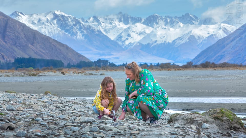
Sunday drive to Mesopotamia. Belles and I are bashing rocks with hammers on the hunt for aggates. Photo taken by Geoff Cloake.
Timaru did not look like Timaru
During the dinosaur era there was no Caroline Bay, no harbour, no Canterbury Plain and no South Island shaped like the one on today’s map.
University of Canterbury geologist Andrea Barrier studied how the offshore Canterbury Basin developed as Zealandia separated from eastern Gondwana. Her research describes a major period of crustal stretching and faulting from about 110 to 85 million years ago, followed by later layers of sediment.
This is a regional reconstruction, not a street-by-street map of ancient Timaru. It suggests a landscape changing over immense periods: raised areas, low basins, rivers, lakes, coastlines and sea. Different parts of the crust moved differently. So it is misleading to imagine modern Timaru simply bobbing up and down in one fixed spot.
Familiar names are only signposts, and throughout this story, I use names such as Timaru, Pareora and Mount Horrible to help us locate things. But keep in mind those places did not have their modern shapes. The coast moved. Seas advanced and retreated. Sediment built up. Older surfaces were buried or eroded. Much later, rivers, glaciers, wind and people continued reshaping the land.
Whenever we place a modern town on an ancient map, it should come with a warning: Modern coastline shown for orientation only, some local fossils are older than dinosaurs, at Kākahu, south-west of Geraldine, scientists found conodont fossils and rare fish scales in marble.
A 1971 paper in Nature described them as the first fossils found in New Zealand that could clearly identify rocks of Carboniferous age. These fossils are roughly 300 million years old. Dinosaurs did not appear until tens of millions of years later. Conodonts were extinct marine animals, known mainly through their tiny tooth-like feeding elements.

Page from the "Official Guide: Timaru and surrounding districts". Aoraki Heritage Collection, https://aorakiheritage.recollect.co.nz/nodes/view/8923
Kākahu preserves evidence of a sea older than the dinosaurs.
Kākahu also has plant fossils from the Paleocene, 66 to 56 million years ago, held by Te Papa. These belong to a completely separate, much younger chapter after the non-avian dinosaurs had disappeared.
One place can contain several lost worlds, but they did not all exist at the same time.
Fossil shells tell us the sea was here, but how do scientists know that parts of inland South Canterbury were once beneath the sea?
They read the evidence in the rocks:
- shells and other marine fossils
- sandstone, mudstone and limestone
- microscopic fossils
- sediment grains
- the order of the layers
The South Canterbury Museum has taken generations of local families fossil hunting at Evans Crossing on the Pareora River. Museum reports describe Eocene sandstone beds more than 40 million years old and marine molluscs from around 40 million years ago. Those fossils are far younger than the non-avian dinosaurs. We may not have a local dinosaur, but we can hold evidence of an ancient sea.
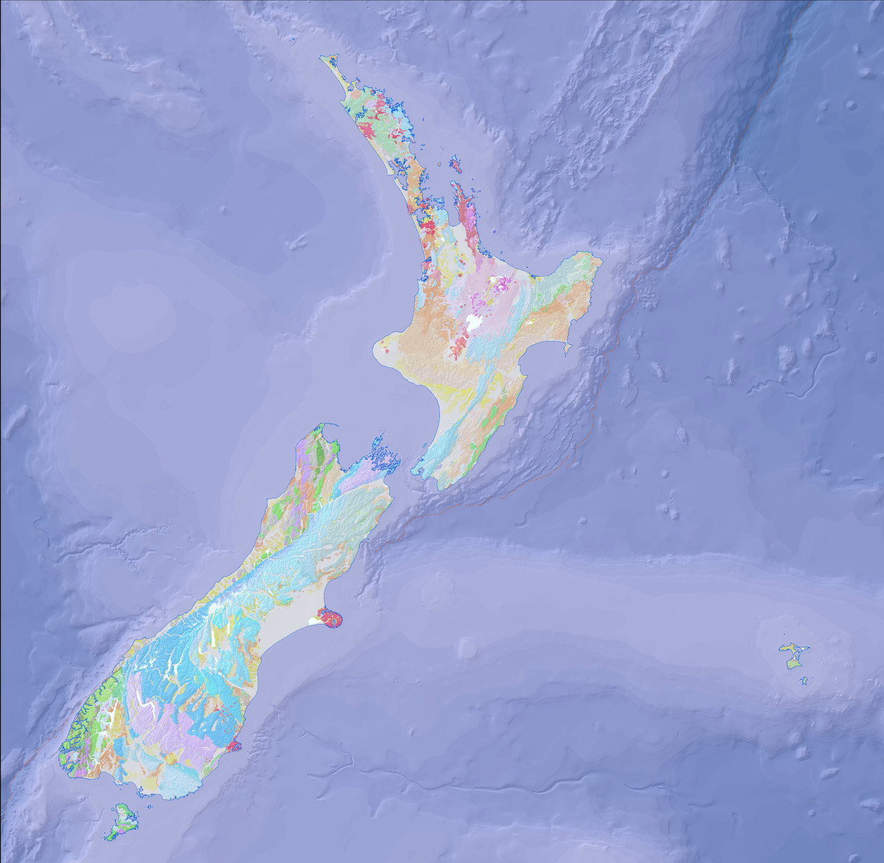
GNS Science. 2014. NZL GNS 1:1M geology. 2nd edition [Data set]. Lower Hutt (NZ): GNS Science. https://doi.org.10.21420/VRX8-CD71. https://data.gns.cri.nz/geology/
Marine reptiles were not dinosaurs
Near Mount Potts at the top of the Rangitata River, Julius von Haast found ichthyosaur fossils in 1861. Canterbury Museum describes these as the first ichthyosaur fossils found in Aotearoa.
Ichthyosaurs were streamlined marine reptiles. Some looked remarkably dolphin-like, although dolphins are mammals and appeared much later. They lived during the age of dinosaurs, but they were not dinosaurs.
As a simple starting point:
- Dinosaurs lived mainly on land.
- Ichthyosaurs, plesiosaurs and mosasaurs lived in the sea.
- Pterosaurs flew above them.
The full family tree is more complicated, but this helps us avoid putting every large prehistoric reptile into the dinosaur basket.
We found the dinosaurs’ neighbours
The Mount Potts fossils do not prove that dinosaurs lived in South Canterbury. They do show that prehistoric marine reptiles occupied waters near the wider region. Canterbury Museum says the high-country rocks involved remain poorly explored and may still contain important discoveries.
Perhaps suitable dinosaur-bearing rocks were eroded? Perhaps they are buried? Perhaps a fragment has been found but not recognised? Or perhaps no dinosaur remains were preserved here at all? At present, we do not know.
Later seas held turtles and early whales
After the non-avian dinosaurs disappeared, South Canterbury’s seas were still full of life. Richard Kohler’s University of Otago doctoral research documents Eocene marine turtles and early whales from New Zealand’s middle-to-late Eocene marine sediments, including specimens associated with the Waihao area.
This gives South Canterbury its own remarkable prehistoric animal story. No confirmed dinosaur, but ancient turtles and early whales.
Lava arrived much later
The dark basalt beneath parts of Timaru belongs to a very recent chapter by geological standards. The University of Otago describes Wapouri / Mount Horrible as the site of the youngest known episode of volcanism in the South Island, dating the Timaru basalt to about two million years ago. The university says it appears to have been one eruptive episode that produced a broad lava field and then stopped.
Te Ara gives an estimated age of about two to 2.5 million years and says the lava reached the Timaru coast, forming reefs that later sheltered vessels.
By then, the non-avian dinosaurs had been gone for more than 60 million years.
- The lava reached a different coastline
- It is tempting to imagine lava flowing towards Caroline Bay.
- But Caroline Bay did not exist in its present form.
The lava travelled from near Wapouri / Mount Horrible towards the coast of its own time. Since then, sea levels, erosion, sediment, rivers and human engineering have continued to alter the shoreline.
Dad’s aerial overlay helped people see where that ancient lava remains beneath modern Timaru. But the modern streets sit on top of the story. They were not part of it when the lava flowed. Lava came first. Today’s coastline came later.
Ice-age dust covered the land
The pale material above much of Timaru’s darker rock is loess: very fine silt carried and deposited by wind.
Te Ara says loess accumulated over much of lowland South Canterbury during glacial periods over approximately the past 250,000 years. It also records that Timaru journalist and amateur scientist John Hardcastle recognised in 1891 that these deposits represented repeated periods of cold climate.
The dust did not arrive in one event. Cold periods brought new loess. During warmer pauses, soils formed. Later dust buried those older surfaces. The cliffs are not just dirt. They are layers of climate history.
The ground is a stack of lost worlds
South Canterbury was not made in one event.
Its rocks preserve chapters separated by enormous spans of time:
- a sea at Kākahu before dinosaurs
- shifting land and water during Zealandia’s breakup
- later seas filled with shells, turtles and whales
- lava travelling towards an ancient coast
- ice-age dust settling over the land
Each happened on a different version of the landscape and modern Timaru is only the latest layer.
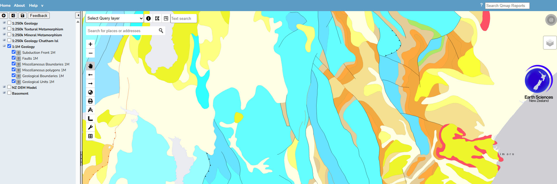
https://data.gns.cri.nz/geology/
What do we know?
Well established...
- Dinosaurs lived in New Zealand.
- Kākahu contains marine fossil evidence from before dinosaurs evolved.
- Marine reptiles lived in Canterbury waters during the Mesozoic Era.
- Pareora and Waihao preserve evidence of later marine life.
- Lava erupted from near Wapouri / Mount Horrible about two to 2.5 million years ago.
- Loess accumulated across lowland South Canterbury during repeated glacial periods.
Possible, but not proven...
- Dinosaurs may have lived somewhere on Zealandian land near the area that became South Canterbury.
- Dinosaur remains may survive in rocks that have not yet been found or identified.
Still unknown...
- Whether a dinosaur ever walked across land associated with modern Timaru.
- Whether a South Canterbury dinosaur fossil is waiting in a riverbed, rock face or museum collection.
How do we know?
Scientists have built this story from:
- fossils
- geological mapping
- rock layers
- sediment grains
- microscopic organisms
- museum collections
- chemical testing
- field observations
- comparisons with other sites
Interpretations can change as new evidence is found. That is not science failing, it is more that it is science working.
The dinosaur is still the missing piece
I began this side quest wondering whether dinosaurs ever lived around Timaru... I did not find a dinosaur. Instead, I found evidence of seas from before dinosaurs, creatures that lived alongside them, marine life from the worlds that followed, lava from the South Island’s youngest known volcanic episode and dust from repeated ice ages.
Dad’s question was about what shaped the land.
My daughter’s question was about what lived on it.
Together, those two questions have completely changed the way I look at home. The rocks can tell us that seas were here. They can show us that lava travelled towards a coastline that no longer exists. They can preserve shells, turtles, whales and tiny animals almost too small to see. But they cannot yet tell us that a dinosaur lived here.
For now, that remains part of the mystery.
Every landscape has a story. Some just take a little longer to read.
Before you go... Next time you look towards Mount Horrible, walk beside the Pareora River or stand above Timaru’s dark rocks and pale cliffs, remember that you are not looking at one landscape.
You are looking at many lost worlds, stacked one above another.
Visit Pareora River and Hunt for Fossils
Fun Fact: The name may originally have been Pureora, a rite performed for the recovery of the sick, and was named by the early explorer Rakaihautu
The Pareora Dam historic structure built between 1878 and 1879 as part of Timaru’s early municipal water supply. It provided water to the district for decades before being superseded. Evans Crossing a few km down river, is a ford where the road crosses the Pareora River on a gravelled flat. The official distance is 4 km return, taking around 90 minutes at a steady pace.
The ford is generally passable in dry conditions, but river levels rise quickly after rain. Do not cross when the river is flooded or fast-flowing, and 4WD is recommended for vehicles.
If you want to hunt for fossils, check the water quality first... https://www.lawa.org.nz/explore-data/canterbury-region/river-quality/pareora-riverpureora/pareora-riverpureora-at-evans-crossing
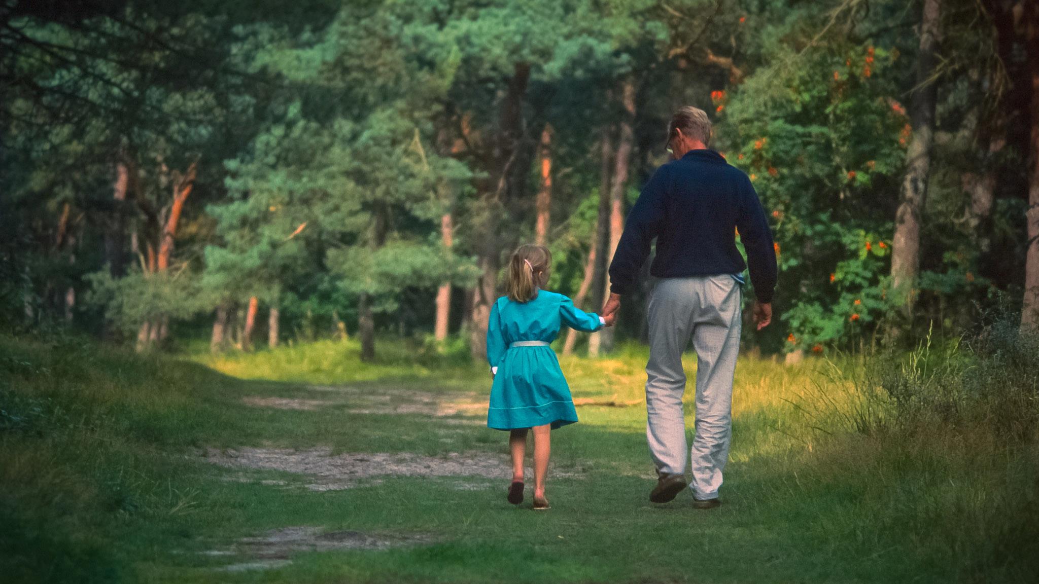
Walking at Pareora with my Opa when I was little when he visited from Texel to Timaru 1987 - Photo Geoff Cloake
The Pareora River flows through a landscape shaped by ancient geological processes. Its catchment lies between the Hunter Hills and the Canterbury Plains, formed from uplifted greywacke bedrock overlain by layers of river gravels, silts, and loess deposited over thousands of years. As the river descends from the hills, it spreads across these unconsolidated gravels, creating a braided, mobile channel that shifts with floods. This geology gives the river its wide bed, unstable banks, and naturally changeable course, particularly near the coast.
Long before European arrival, it was part of a lived and travelled landscape for Ngāi Tahu, particularly whānau connected to Arowhenua. Before Ngāi Tahu, the Pareora River lay within the rohe of Waitaha. For Waitaha, rivers were central to life, identity, and survival, providing food, travel routes, and spiritual connection. The Pareora would have been part of an interconnected network of waterways and wetlands that sustained communities and embodied ancestral relationships with the land. This deep association reinforces the understanding of the river as a living entity, valued and respected across generations of tangata whenua.
The Pareora River and its surrounding wetlands were an important part of everyday life for Maori. They provided rich mahinga kai, including tuna, īnanga, waterfowl and useful plant resources, and formed seasonal travel routes linking inland hunting areas with coastal settlements. The river also held deep cultural meaning, understood as a living ancestor connected to whakapapa rather than something to be controlled. Naturally braided and changeable, flooding was part of its rhythm, reflected in the name Pareora, commonly interpreted as “the spreading or plentiful waters”.
After the arrival of European's, the pastoral settlement expanded inland in the 1850s. The river was mapped, crossed, and increasingly used as a boundary and water source for farming. Its unpredictable flooding shaped how land was used and remembered, while its gravels and flows supported early rural infrastructure.
By the 1870s, Timaru’s growth created an urgent demand for a reliable water supply. The Pareora was selected to supply the town, leading to the construction of waterworks and the dam that transformed the river into engineered infrastructure. Over time, continued modification altered natural flows, sediment, and ecology. By the twentieth century, newer intake systems replaced earlier works, leaving the original dam redundant.
Today, the Pareora River remains a working landscape shaped by Māori knowledge, settler ambition, and engineering intervention. It is valued for recreation, heritage, and ecology, while ongoing discussions reflect wider questions about balancing safety, history, and river health.
Poor water quality in the Pareora River has been caused by long-term land use changes, particularly intensive farming. Agricultural runoff, stock access to waterways, and the loss of wetlands and riparian vegetation have increased nutrients, sediment, and contamination in the river. River modification and historic engineering have further disrupted natural flows and habitats, reducing the river’s ability to recover and leading to ongoing ecological stress.
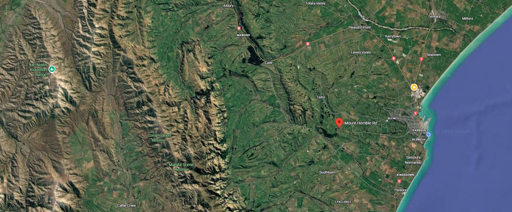
Drive to the top of Mt Horrible Road: This hill known as Waipouri/Mt Horrible is part of South Islands most recent volcanic activity. It is part of the Banks Peninsula–Timaru volcanic field. The area formed when lava flowed like fingers across the landscape around 2.5 million years ago towards what is now the sea forming reefs. The hard basalt (bluestone) created by these lava flows resisted erosion, leaving the elevated landforms that now shape Timaru’s southern hills. Many of Timaru's main roads like North Street follow these rises towards to the ocean. Much of the 'bluestone' has been used in local bridges, culverts, infrastructure, port development, erosion control and buildings was constructed from this quarried volcanic rock. As you drive upward, you are quite literally travelling over the remains of molten lava.
Mt Horrible Road is the remains of an ancient volcanic landscape, which is now extinct with no risk of future eruption, the volcanic field is considered geologically dead.
The well-known Castle Claremont is on this road. It was built for the Rhodes family using local bluestone. It was known as Claremont back then. Now that the trees are taller you can't see much from the road, but the property is available to rent for events and accommodation.
Keep an eye out for bluestone bridges and culverts of the Pareora–Maungati area, survivors of 19th-century infrastructure. They were built mainly in the 1870s and 1880s by local road boards, using locally quarried basalt and lime mortar. They were often produced nearby, to create durable crossings capable of withstanding floodwaters. Constructed by hand, these low, solid structures enabled the movement of people, stock, and goods, linking farms with markets and the port. Still quietly doing their job today, they are easily overlooked, yet they form part of the same working landscape as the water races, dams, reservoirs, and lime kilns that supported settlement and survival in South Canterbury.
Follow the Zig Zag road down from Fairview to Pareora.
Listen for native birds at Claremont Bush: It takes about 30mins walking up hill where macrocarpa and conifers were planted in the 1860s. Along the walk you can see the regeneration of plants including totara, matia, mahoe, hen and chicken ferns, coprosma, cabbage treets, matipo and kowhai. See if you can spy or hear bellbirds(korimako), fantails (piwakawaka), riflemen (titipounamu), grey warblers, brown creepers, and native pigeons (kereru). A wonderful WuHoo is to see the rare native climbing daisy with a bright yellow flower can sometimes be seen in this bush. The turnoff to Claremont Bush Road is about 2km from the zigzag. If you get to the Pareora River bridge you have gone too far. There is a great voluntary effort for trapping pests to help the native flora and fauna. The 3km track is a loop that leads to the top and back down again. No dogs are allowed, no toilets, and no bikes.
Find the monument for the Holme Station Saleyards: The sale yards were on the corner of the Pareora River Road and Holme Station Road. From 1908 – 2008 the Holme Station Saleyards were in use as a stock sales and meeting place for farmers, stock agents and many others from the surrounding community for a century. See if you can spy the "Holme Station Saleyards commemorative stone." Holme Station was one of the major early pastoral runs in South Canterbury. It was originally part of the Pareora estate, settled and expanded by English pioneer Edward Elworthy from the 1860s onward. Holme Station became a large and influential sheep and farming property inland from Timaru. The yards would have been important to the rural economy of the Timaru district, supporting sheep, cattle and possibly other stock sales in a region where pastoral farming was dominant from the late 19th century on.
The first sale was on February 11 1908. Farmers, went along to get an idea of the price to expect for their sheep. The sale always had "a community feel" and it was always great to see the same people each year. It was the women of the district who were the catering team, they were volunteers, and enjoyed the day as much as anyone working together in the small corrugated tin shed and catching up on the social chatter. They always pulled together to put on the morning tea with fruit cakes and sandwiches.The sale was often during the week but when it fell on a school holiday the farmers would bring their children and wives along and they all knew each other from school. The children played and ran around the sale yards and around the the stock trucks creating a life time of memories.
Find fossils in the Pareora River: You can spy fossils on the shore or wade and paddle to find more in the ankle deep river near the Evens Crossing Ford. Park by the river, unpack a rug and a picnic and spend the day paddling, throwing rocks, catching cockabullies. Look for limestone rock that is smooth on one side, with fossils that could be 50 million years old on the other side. Sadly the river is not in great health and is often unsuitable for swimming. The Pareora River/Pureora at Evans Crossing is the upstream site on this hill-fed river in South Canterbury. You can check here: https://www.lawa.org.nz/explore-data/canterbury-region/swimming/pareora-river-at-evans-crossing/swimsite
The Pareora area is well known for its marine fossils, which come from a time when much of South Canterbury lay beneath the sea. The most common fossils found in river gravels, banks, and nearby sedimentary layers include shells of molluscs such as bivalves and gastropods, as well as brachiopods, echinoids (sea urchins), and occasional shark teeth. These fossils date mainly from the Oligocene to Miocene periods, around 30 to 5 million years ago. They are present because the region was once covered by a shallow sea. Over time, marine sediments built up on the seafloor, trapping shells and sea life. Later tectonic uplift raised these layers above sea level. As rivers like the Pareora cut down through the landscape, they eroded these ancient marine beds, washing fossil fragments into the river gravels and exposing them along banks and terraces.
Fossils in the Pareora area are protected because most are found on public land, conservation land, riverbeds, or coastal areas. Under the Heritage New Zealand Pouhere Taonga Act, removing them without permission is illegal. Fossils are considered part of New Zealand’s scientific and natural heritage, and taking them removes important context needed for research and understanding. Any fossils of scientific importance should be reported to a museum such as the South Canterbury Museum or GNS Science, rather than collected. A good rule of thumb is: look, learn, photograph, but leave them where they are.
This sandstone dates from the Eocene, approximately 40 million years ago, he Pareora fossils are likely to belong to the genus Zeacolpus.
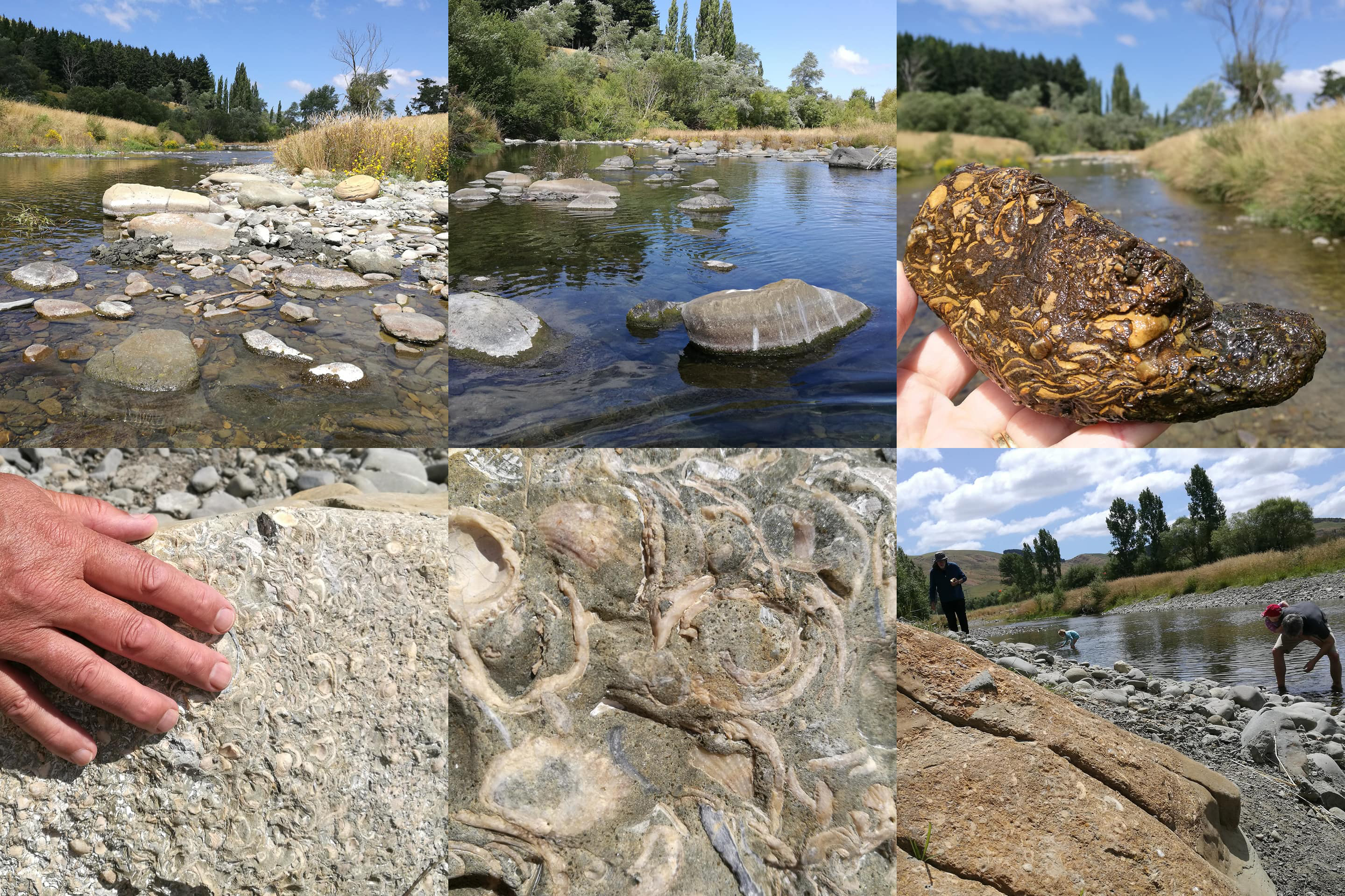
Snaps from our afternoon at Evans Crossing, Pareora River. While the kids hunted for cockabilies, us big kids hunted for fossils! We spied so many that are 43--50 million years old, just lazing under our summer sun. Finding this biggie on the side was an awesome WuHoo moment. These fossils are remnants of marine organisms from the Tertiary period, preserved in the sedimentary layers of the region. If you're planning a visit, it's advisable to bring appropriate tools like a chisel or screwdriver, containers for collected specimens, and protective eyewear. Always ensure to follow local guidelines and respect the natural environment while exploring. You can walk up to the dam from here, and there's a great swimming hole on the other side of the Ford. If you’re keen to ID your finds or want to see more, the South Canterbury Museum in town has a great fossil collection and heaps of info. And it's always a good idea to check its okay to swim with the LAWA website.
- You can find a sandstone specimen on display at the South Canterbury Museumm which was recovered from the Pareora River bed at Evans Crossing, in the area above.
- The Pareora area contains several beds of sedimentary rock from different geological ages, which contain distinct fossil assemblages.
- This sandstone dates from the Eocene, approximately 40 million years ago.
- Many of the rocks that contain fossils are abundant in turret shells, which have long, narrow, spiralled shells. The animals that occupied these shells lived on sandy sea floors and fed on organic particles suspended in the water, turret shells still live in the world’s oceans today, and you can see them on the shore at Waitarakao Washdyke Lagoon.
- Living turret shells can live in large groups, which might explain why so many are found at Parerora, as it is thought that a group of turret shells may have been buried rapidly by sediment during an undersea storm, eventually forming the fossil-bearing rock.
- There are more than 50 species of turret shell are known from New Zealand’s fossil record.
- The Pareora fossils are likely to belong to the genus Zeacolpus, there are 16 known fossil species of Zeacolpus found in New Zealand rocks dating from approximately 2 million to 60 million years old, and three species of Zeacolpus still live in New Zealand waters today.
- The Pareora specimens are too worn to identify to species level but erosion of the shells has exposed their chambered interiors.
See traces of a legacy deserving of recognition is the Downlands Water Supply Scheme, a pre-war Ministry of Works unemployment relief project. Established in the mid-1930s, the scheme has supplied reliable water to farmers in the area ever since and is widely regarded as a lifesaver in this water-scarce landscape.
The scheme arose from the Great Depression (1929–1939), a global economic collapse triggered by the 1929 Wall Street crash. In South Canterbury, the effects were severe as overseas prices for wool, meat, and dairy collapsed, undermining the region’s rural economy. Farm incomes fell sharply, unemployment rose, and hardship became widespread. In response, the government invested in labour-intensive public works, designed to provide paid employment while creating essential, long-term infrastructure.
The Downlands Water Supply Scheme was built largely by hand. Work was deliberately labour-intensive, with trenches dug manually, pipes laid by hand, and concrete structures such as intakes, valve blocks, and tanks formed on site using basic tools and limited machinery. The scheme was designed to maximise employment rather than speed, and its longevity reflects the skill, effort, and workmanship of those who built it.
The scheme itself is a reticulated rural water supply system, using river intakes, storage tanks, and gravity-fed pipelines to deliver water across the dry Downlands. Since the mid-1930s it has underpinned farm viability, stock welfare, and drought resilience, making it a cornerstone of rural life in the district. It stands as a strong example of how Depression-era public works created lasting value for South Canterbury communities.
When visiting the Maungati–Pareora area, this history can still be read in the landscape. Look for concrete intakes and small weirs on the Pareora River, modest valve blocks and inspection chambers, traces of old pipeline alignments, and storage tanks positioned on higher ground to allow gravity feed. These practical, durable structures are hallmarks of pre-war Ministry of Works engineering and quiet reminders of a time when water security, employment, and community survival were closely intertwined.
Walking to the Pareora Dam
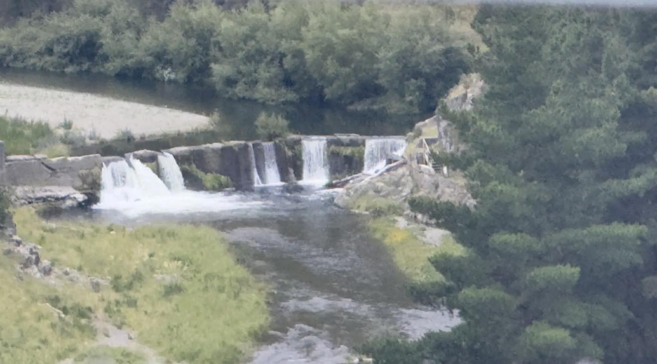
A 40-minute walk follows the route of the original water race to the Pareora Dam, a historic waterworks structure on the Pareora River, about 18 kilometres west of Timaru. The dam was built in 1878–79 by the Timaru Borough Council as part of one of the region’s earliest municipal water supply schemes. It was engineered by Henry Wrigg, the Borough Engineer, and constructed using day labour after contractor tenders proved too expensive.
The dam was commissioned as part of a new water supply system that officially opened on 16 December 1881, following improvements to the original race and intake. This system was developed after the Great Fire of 1868, which destroyed around three-quarters of Timaru’s wooden CBD and exposed the inadequacy of the town’s water supply. The broader scheme included water races, reservoirs, tunnels, and later pipelines, and marked a major turning point in the town’s development.
By the early 1900s, improvements to the system created surplus water that was used to power pelton wheels, turbines, and steam engines, contributing directly to Timaru’s industrial growth. In 1939, the open water race was replaced with a closed pipeline and a new intake dam was constructed further upstream in the Pareora gorge, making the original dam redundant.
The concrete gravity dam, built in a shallow V-shape across a narrow section of the river, now stands as a heritage structure rather than a working one. While the site may look inviting, jumping from the dam is extremely dangerous. The structure has degraded over time and is undermined, and there have been many serious injuries at the site, including the tragic death of a 17-year-old. Swimming near the dam is not advised. At times, the track has also been closed due to nesting falcons, which have swooped at walkers.
There is, however, plenty of shade and space nearby for a picnic, and the walk offers a powerful way to experience the layered history of water, engineering, labour, and survival that shaped Timaru and the wider Downlands.
Following on from this, the historic water supply reservoirs at Brookfield Road form another key chapter in Timaru’s relationship with the Pareora River and water security. Unfortunatly they are on private land and the public can't see them.
After the Great Fire of 1868 exposed the town’s vulnerability, the Timaru Borough Council committed to creating a reliable municipal water supply sourced from the Pareora. Central to this plan was a large storage reservoir on the outskirts of town, fed by a long water race from the river. The first reservoir was excavated in 1874–75 by James Fraser, formed by earth embankments and lined with bluestone and concrete, with a capacity of more than 23 million litres. Although ambitious, the initial scheme failed when water did not reliably reach the town, highlighting the trial-and-error nature of early colonial engineering.
Rather than abandon the project, the council invested further. In 1880, funding was secured to improve the intake and upgrade the water race, and Edward Dobson & Son redesigned the system on scientific principles. When it opened on 16 December 1881, it finally delivered a dependable supply for domestic use and firefighting. As Timaru grew, demand increased, and in 1910–12 the original reservoir was enlarged and a second, concrete-lined polygonal reservoir was built alongside it.
These reservoirs served the town for decades and later supported industrial growth, with surplus water powering pelton wheels, turbines, and steam engines. Although they were decommissioned after new reservoirs were built on Claremont Road in 1960, they remain an important part of Timaru’s heritage. Now grassed and earth-formed, and located on private land, they link directly to the Pareora Dam, water races, tunnels, and pipelines, together telling the story of how Timaru learned to secure water, survive crisis, and grow into a permanent town.
Blue Rocks Swimming Spot: Park at Evans Crossing and walk up the river on the south side to get to the blue rocks swimming hole. The walk way for the Pareroa River walk is on the North side of the river and you'll see the track sign posted for the 40 minute walk to the dam.
NOTE: The council temporarily closes the Pareora Walking Track due to Kārearea - New Zealand Falcon nesting season. Kārearea are known for dive-bombing humans and animals that get to close and as they are nesting within the track this endangered little one could hurt itself or someone walking by too close to its nest which they often make on the ground. There are usually signs at the track entrance, and they provide social media updates when the track is open again (nesting season runs from around September to December). Check out the DOC website here for some cool information about the New Zealand Falcon/Kārearea: https://www.doc.govt.nz/.../birds-a-z/nz-falcon-karearea/
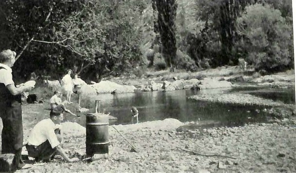
1959: the City and the Province to-day with some interesting glances at the past. Aoraki Heritage Collection, accessed 05/03/2025, https://aorakiheritage.recollect.co.nz/nodes/view/481
The next side quest: Why are there fossil seashells in the middle of South Canterbury? Feel free to join me on the history hunt and send through information...
Before Timaru: A Deep-Time Timeline
Dates in deep time are approximate. Modern place names are used only to help readers locate the story. The land, sea and coastline looked very different at each stage.
About 300 million years ago
A sea existed here before dinosaurs
Conodont fossils and rare fish scales found in marble at Kākahu provided evidence that some of these rocks are Carboniferous in age.
Conodonts were extinct marine animals known mainly from their tiny tooth-like feeding elements.
What this tells us: Parts of the rock record preserved in South Canterbury began in an ancient marine world, tens of millions of years before the first dinosaurs appeared.
Evidence: Confirmed from published scientific research and a University of Otago geological thesis.
About 252 million years ago
The age of dinosaurs began
The Mesozoic Era began approximately 252 million years ago. Dinosaurs evolved during the Triassic Period and became major parts of land ecosystems.
What this tells us: Kākahu’s Carboniferous conodont-bearing rocks were already extremely old when the first dinosaurs appeared.
About 110–85 million years ago
Zealandia began pulling away from Gondwana
University of Canterbury geologist Andrea Barrier describes major crustal stretching and faulting in the Canterbury Basin during this period as Zealandia separated from eastern Gondwana.
Her research concerns the offshore Canterbury Basin and provides a regional model rather than a precise reconstruction of ancient Timaru.
What this tells us: The region was not one fixed landscape. Different areas included raised land, low basins, rivers, lakes, coastlines and expanding marine environments.
Evidence: Supported regionally by University of Canterbury research.
About 85 million years ago
Zealandia was becoming an isolated continent
Te Ara explains that the New Zealand continent broke away from Gondwana about 85 million years ago, carrying plants and animals with it.
What this tells us: Dinosaurs already lived on parts of Zealandia before its separation was complete.
About 75–65 million years ago
Dinosaurs lived in ancient New Zealand
Fragmentary dinosaur fossils from this broad period have been found in New Zealand.
Joan Wiffen’s discoveries at Mangahouanga Stream in Hawke’s Bay provided the first accepted physical evidence that dinosaurs had lived here.
What this tells us: Dinosaurs were part of ancient Zealandia, although their New Zealand fossil record is very small.
South Canterbury status: No scientifically confirmed South Canterbury dinosaur fossil has yet been identified in the published sources examined for this blog.
About 66 million years ago
The non-avian dinosaurs disappeared
A worldwide mass extinction ended the age of non-avian dinosaurs.
Birds survived and are now recognised as living dinosaurs.
What this tells us: Later South Canterbury marine turtles, whales, shells, lava and loess all belong to worlds that came after the extinction.
About 66–56 million years ago
Plants grew at Kākahu after the dinosaurs
Te Papa holds plant fossils collected at Kākahu and identifies them as Paleocene in age.
These fossils belong to different and much younger rock layers than the approximately 300-million-year-old conodont-bearing marble.
What this tells us: Kākahu preserves evidence from more than one lost world. The fossils found there did not all live together.
About 48–34 million years ago
South Canterbury had ancient marine turtles and early whales
Richard Kohler’s University of Otago doctoral research documents turtles and early whales from middle-to-late Eocene marine sediments, including specimens associated with the Waihao area.
What this tells us: Long after the non-avian dinosaurs disappeared, parts of South Canterbury were covered by seas containing large marine animals.
More than 40 million years ago
The Pareora rocks preserve an ancient sea
South Canterbury Museum describes fossil-bearing Eocene sandstone at Evans Crossing on the Pareora River.
Marine molluscs found there provide direct evidence of an ancient marine environment.
What this tells us: Areas that are now riverbanks and farmland were once part of a seabed.
Important caution: The wider Pareora district contains several rock units. Not every fossil found along the river should automatically be assigned the same exact age.
About 2–2.5 million years ago
Lava flowed from near Wapouri / Mount Horrible
The University of Otago describes Wapouri / Mount Horrible as the site of the youngest known episode of volcanism in the South Island.
The university dates the Timaru basalt to approximately two million years ago and describes the eruption as one event that produced an extensive lava field before activity ceased.
Te Ara gives a broader estimate of approximately two to 2.5 million years and says lava reached the Timaru coast.
What this tells us: The dark basalt beneath parts of Timaru is very young compared with the dinosaur era.
Remember: The lava reached the coastline of its own time. Caroline Bay, the harbour and the present shoreline did not yet exist in their modern forms.
During approximately the past 250,000 years
Ice-age winds covered the land in dust
Te Ara explains that fine wind-blown sediment called loess accumulated across much of lowland South Canterbury during repeated glacial periods.
Warmer intervals allowed soils to form before later deposits of dust covered them.
What this tells us: Timaru’s pale cliffs and buried soil layers preserve evidence of repeated climatic change.
1891
John Hardcastle read climate history in Timaru’s loess
Te Ara credits Timaru journalist and amateur scientist John Hardcastle with recognising that the local loess represented repeated periods of colder climate.
What this tells us: South Canterbury played an important part in the early study of glacial climate and loess.
1861
An ichthyosaur was found near Mount Potts
Canterbury Museum says Julius von Haast discovered New Zealand’s first known ichthyosaur fossils near Mount Potts at the top of the Rangitata River.
Ichthyosaurs were marine reptiles, not dinosaurs.
What this tells us: Animals from the age of dinosaurs lived in seas near the wider Canterbury region.
1954
The Pareora district was mapped in detail
Norton James William Croxford completed his University of Otago MSc thesis, Geology of the Pareora District.
The study examined the Pareora basin, Mount Horrible, Timaru loess, basalt and local sedimentary formations.
What this tells us: The thesis is an important record of local field observations, although its terminology and dates need to be compared with modern geological research.
1971
Kākahu’s Carboniferous fossils were reported internationally. A scientific paper published in Nature reported conodonts and fish scales from Kākahu marble. What this tells us: The discovery provided important evidence for the age of some of Canterbury’s oldest exposed rocks.
1975
Joan Wiffen found New Zealand’s first recognised dinosaur fossil
At Mangahouanga Stream, Joan Wiffen found the first New Zealand fossil later accepted as dinosaur material.
Further discoveries transformed scientific understanding of New Zealand’s Mesozoic animals.
What this tells us: One determined amateur researcher overturned the belief that New Zealand had no dinosaurs.
Today
The South Canterbury dinosaur is still missing
We have evidence of:
a sea before dinosaurs;
regional rocks and environments from the dinosaur era;
marine reptiles that lived alongside dinosaurs;
later turtles, whales and shellfish;
lava flowing towards an earlier coastline;
ice-age dust covering the land.
What we do not yet have is a scientifically confirmed dinosaur fossil from Timaru or South Canterbury.
The honest conclusion: Dinosaurs lived in New Zealand. They may have lived on Zealandian land near the area that became South Canterbury, but that remains unproven locally.
Sources and acknowledgements
This article draws on research and collections made available by the University of Canterbury, the University of Otago, Te Papa Tongarewa, Canterbury Museum, South Canterbury Museum, Te Ara and the scientists and students whose work is named throughout the story.
Special thanks to the South Canterbury Museum for preserving and sharing the region’s natural history, and to my dad, Geoff Cloake, whose research into the Timaru lava flow first taught me to look beneath the landscape.
The scientific interpretation in this article remains my attempt to understand and communicate published research. Any errors are mine, and I welcome corrections or further information from people working in geology and palaeontology. Wilson
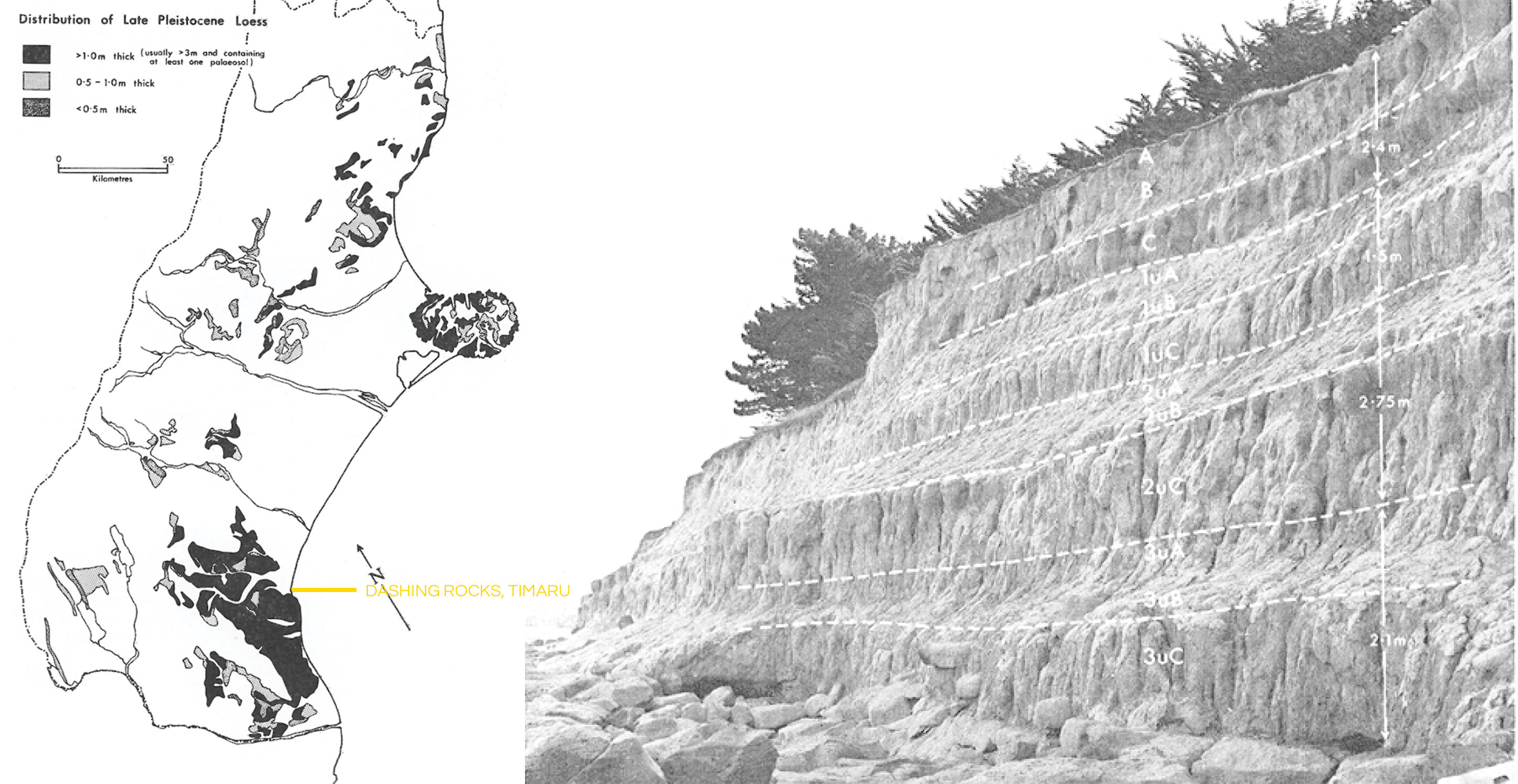
Nature and distribution of loess in Canterbury New Zealand p8
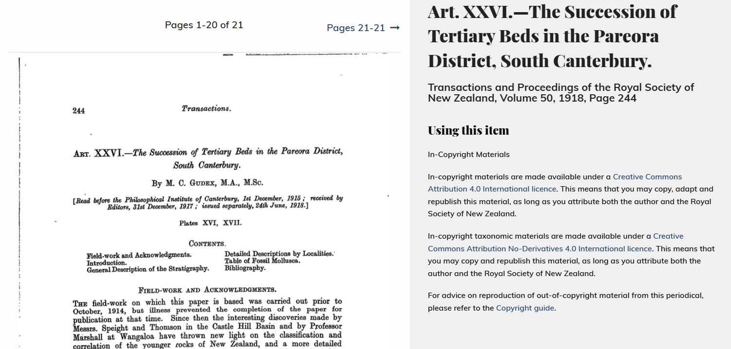
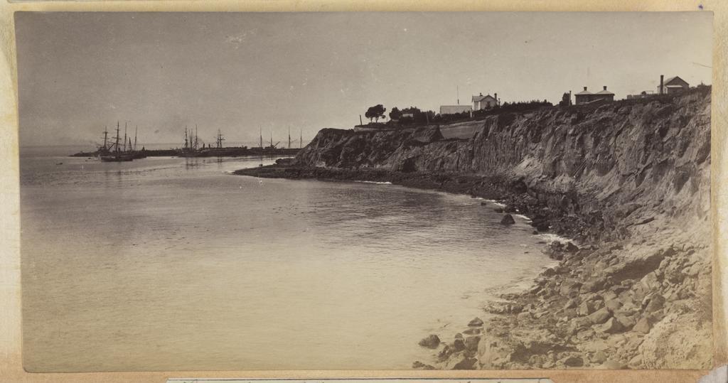
This photograph shows a rocky cliff area of coastline with the harbour and sailing ships in the distance. Unknown, Timaru coast (c.1880s). Hocken Digital Collections, accessed 23/07/2026, https://hocken.recollect.co.nz/nodes/view/58441
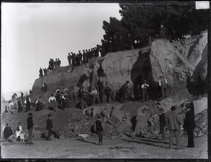
Working bee, 1897. Supported by ordinary citizens, these working bees transformed the area and provided the basis for James Craigie’s municipal improvements. Unknown photographer, South Canterbury Museum, 0488.
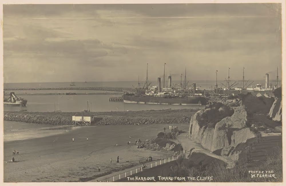
The Harbour from the Cliffs Timaru c 1909 Timaru by William Ferrier Te Papa O 051452
Sources and Further Reading
New Zealand dinosaurs and Joan Wiffen
Te Ara: “Dinosaur finder”
Records that Joan Wiffen found New Zealand’s first dinosaur fossils at Mangahouanga Stream in 1975.
https://teara.govt.nz/en/speech/9056/dinosaur-finder
Te Ara: “Fossils”
General overview of New Zealand’s fossil record, including dinosaur discoveries and Zealandia’s separation from Gondwana.
https://teara.govt.nz/en/fossils
Printable full article:
https://teara.govt.nz/en/fossils/print
Dictionary of New Zealand Biography: Joan Wiffen
Biography of the self-taught palaeontologist whose discoveries transformed understanding of New Zealand’s prehistoric reptiles.
https://teara.govt.nz/en/biographies/6w4/wiffen-joan
Te Ara: Dinosaur and pterosaur fossils
Introduces dinosaur and pterosaur material found at Mangahouanga Stream.
https://teara.govt.nz/en/photograph/9038/dinosaur-and-pterosaur-fossils
Te Ara: Chatham Islands natural history
Discusses the dinosaur fossil locality on the Tīoriori coast of Rēkohu Wharekauri, the Chatham Islands.
https://teara.govt.nz/en/chatham-islands/page-6
Canterbury Basin and Zealandia
Andrea Barrier, Tectonics, Sedimentation and Magmatism of the Canterbury Basin, New Zealand
PhD thesis, University of Canterbury.
Provides the regional framework for mid-Cretaceous rifting, basin development and later sedimentation. It focuses principally on the offshore Canterbury Basin and should not be treated as a precise map of ancient Timaru.
https://ir.canterbury.ac.nz/items/d164505b-7690-4b37-905f-04fa6028cb49
Te Ara: “Fossils”
Includes a general explanation of New Zealand’s separation from Gondwana and its fossil record.
https://teara.govt.nz/en/fossils
Kākahu geology and fossils
Keith David Hitching, Torlesse Geology of Kakahu, South Canterbury, New Zealand
BSc Honours thesis, University of Otago, 1977.
Describes the marble, chert, metagreywacke, metavolcanic rocks and structural geology around Kākahu.
https://theses.otagogeology.org.nz/items/show/100
“Carboniferous Conodonts and Fish Scales from Canterbury, New Zealand”
Published in Nature in 1971.
Reports conodont elements and fish scales from Kākahu marble and explains their importance for dating the rocks.
https://www.nature.com/articles/233117a0
Te Papa: Paleocene fossil plants from Kākahu
Collection information for plant fossils from Kākahu dated to the Paleocene, approximately 66–56 million years ago.
https://collections.tepapa.govt.nz/topic/11117
Pareora geology and fossils
Norton James William Croxford, Geology of the Pareora District
MSc thesis, University of Otago, 1954.
Covers the Pareora basin, Timaru Downs, Mount Horrible, basalt, local sedimentary formations and Timaru loess.
https://theses.otagogeology.org.nz/items/show/3
South Canterbury Museum: Fossil Hunt at Evans Crossing
Confirms Evans Crossing on the Pareora River as a recognised local fossil-hunting and public education site.
https://museum.timaru.govt.nz/explore/news/fossil-hunt
South Canterbury Museum: Natural-history collections
Explains that the museum holds local fossils and other natural-history specimens.
https://museum.timaru.govt.nz/explore/explore
South Canterbury Museum: “The Last 50 Million Years”
Information about a museum talk covering South Canterbury fossils and changing local environments.
https://museum.timaru.govt.nz/explore/news/museum-talk-the-last-50-million-years
South Canterbury Museum News, Autumn 2023
Includes museum information about Evans Crossing, Eocene sandstone and local marine fossils.
https://museum.timaru.govt.nz/__data/assets/pdf_file/0011/736616/2023-Museum-News-Autumn.pdf
Waihao turtles and early whales
Richard Kohler, Eocene Turtles and Whales from New Zealand
PhD thesis, University of Otago, 1996.
Documents Eocene marine turtles and early whales from New Zealand marine sediments, including specimens connected with the Waihao area.
https://theses.otagogeology.org.nz/items/show/324
Mount Potts and marine reptiles
Canterbury Museum: “Dinosaur dolphins survived in New Zealand long after extinction elsewhere”
Discusses New Zealand ichthyosaurs and records Julius von Haast’s 1861 discovery near Mount Potts at the head of the Rangitata River.
Canterbury Museum: Julius von Haast’s geological mapping
Provides background on Haast’s work as Canterbury Provincial Geologist and the development of geological mapping in the region.
https://www.canterburymuseum.com/explore/our-stories/searching-for-the-museum-founders-epic-map
Timaru basalt and Mount Horrible
University of Otago: “Wapouri / Mount Horrible, South Island’s Youngest Volcano”
Describes Wapouri / Mount Horrible as the site of the youngest known volcanic episode in the South Island, dated to approximately two million years ago.
Te Ara: South Canterbury landscape and geology
Discusses Mount Horrible lava, Timaru’s basalt reefs, loess and aspects of the region’s geological development.
https://teara.govt.nz/en/south-canterbury-region/page-2
Timaru loess and changing climate
Te Ara: South Canterbury landscape and geology
Explains that loess accumulated over lowland South Canterbury during repeated glacial periods and discusses John Hardcastle’s interpretation of the deposits.
https://teara.govt.nz/en/south-canterbury-region/page-2
Acknowledgements
This article draws on research and collections made available by:
- South Canterbury Museum
- Canterbury Museum
- Museum of New Zealand Te Papa Tongarewa
- Te Ara, the Encyclopedia of New Zealand
- the University of Otago
- the University of Canterbury
- the scientists, students, curators and fossil collectors whose work is named above
Special thanks to South Canterbury Museum for preserving and sharing the natural history of the region, and to Geoff Cloake, whose research into Timaru’s lava field first inspired this family side quest.
The article is a general reader’s attempt to understand and communicate published science. It does not replace specialist geological or palaeontological advice. Corrections, additional research and information about relevant South Canterbury specimens are warmly welcomed.