
By Roselyn Fauth
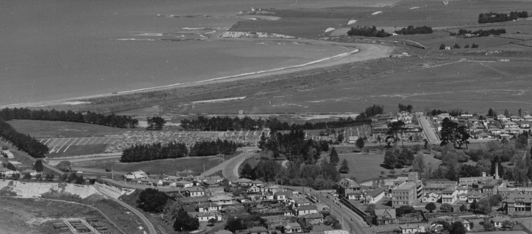
Alexandra Square - Oct 1956 crop from whites aviation survey photo https://tiaki.natlib.govt.nz/#details=ecatalogue.711006
Stand at the entrance to Timaru Cemetery and you are standing at the meeting point of architecture and authority. The bluestone piers and iron gates do more than mark a boundary. They reveal how a young settlement organised memory, regulated burial, and built dignity into stone.
When I Stand at the gate of Timaru Cemetery, I realise that I am standing at more than an entrance. This is a point where architecture, law and memory meet, this is our public cemetery, rather than a graveyard/churchyard
Timaru Cemetery Was Established as a Public Municipal Reserve
Timaru Cemetery is a public cemetery — owned, controlled and maintained by the municipality. It is not a parish churchyard. The land was vested under the Public Reserves Act 1854, and from 1870 onward its management was governed first by provincial ordinance and later by national statute. From the beginning, this was civic ground, shaped by regulation as much as by ritual.
The Entrance Was Designed as a Formal Civic Threshold of Stone and Iron
The bluestone entrance piers still frame arrivals and departures. Built of local basalt, commonly known as bluestone, they connect to a low stone wall that extends along part of the frontage but does not enclose the entire boundary.
A detailed description published in the Timaru Herald in 1904 records “a length of neat iron palisading fence on low stone wall”, with ornamental iron carriage gates and smaller pedestrian gates “hung on massive stone gate posts”. Stone, iron, planting and alignment combined to create a formal civic threshold rather than a defensive barrier. Other stretches were fenced more simply in wire with sawn posts and cap rail, reflecting staged development as land was added.
In 1897 the Cemetery Board called for tenders for the stone wall and entrance piers under architect James S. Turnbull. Earlier, in 1869, Richard Turnbull had gifted iron gates to the cemetery, demonstrating that controlled entry was valued from the outset.
Gates and Fencing Were Necessary to Protect Graves in a Grazing Settlement
The gates were practical as well as symbolic. Reports from the late 1860s describe fencing being damaged and cattle and horses entering to trample graves. In a young settlement bordered by grazing land, enclosure was necessary to protect burial ground.
The entrance complex extended beyond the gates. To the right stood a brick mortuary chapel, designed in 1881 by Maurice de Harven Duval. To the left stood the caretaker’s brick cottage and garden. The path ran between them, separating ritual space from administration and labour.
Behind the cottage were the caretaker’s office and tool house. By 1904 the trustees had asphalted principal paths and spent £150 on a double brick lavatory and water closet, one for each sex, positioned behind the cottage and drained to the lagoon. Those service buildings remain today, confirming that this was a maintained civic facility.
Provincial and National Legislation Controlled Burial, Governance and Monument Rights
The 1870 Cemetery Reserves Management Ordinance empowered Managers to expend funds on the burial of poor persons and required payment for exclusive rights before monuments could be erected. The Cemeteries Management Act 1877 transferred authority to Boards of Trustees. The Cemeteries Act 1882 created a national framework and guaranteed that cemeteries be open for the interment of all deceased persons. Later reforms under the Burial and Cremation Act 1964 transferred control to local authorities, a structure that remains in place today.
Stone wall and iron palisade stand alongside statute and regulation as visible expressions of civic order.
Burial Could Be Free, but Erecting a Monument Required Purchasing Exclusive Rights
Recorded burials began in 1860. By 1904 approximately 3,400 interments had taken place and the original five-acre reserve was nearly full. Sections were set aside for different purposes, including denominational areas and free ground.
Burial fees could be waived for those without means. However, erecting a monument required purchasing an exclusive right to a plot. The physical landscape reflects that legal distinction.
The Boundary and Buildings Evolved as the Cemetery Expanded
The stone wall does not extend around the entire perimeter. A second pair of matching bluestone piers marks another entrance, apparently designed for simpler closure, possibly by chain or removable barrier. The variation in boundary treatment reflects the cemetery’s gradual expansion.
In 1933 Percy Watts Rule proposed adapting the chapel to include a crematorium. The idea was debated but not carried out. By 1968 the chapel was demolished. The gates and bluestone piers remained.
The Cemetery Sits Within a Much Older Cultural Landscape
Burial traditions in this landscape long predate the establishment of the municipal cemetery. Ngāi Tahu have deep ancestral connections to this region, and Māori concepts of tapu and remembrance existed here well before colonial legislation formalised this reserve. The public cemetery represents one chapter in a longer cultural history of how communities honour their dead.
The Gates Continue to Mark a Regulated and Maintained Civic Space
Today families still walk through these gates to tend graves and remember. The threshold continues to perform its civic role.
His Worship the Mayor, Nigel Bowen, recently observed that the cemetery population now matches that of the District. The buildings inside the gate have changed and the law has evolved. But the bluestone piers still stand, carrying the ironwork and the memory of every stage of development.
The gates tell us that this was never simply a field of graves. It was planned, regulated, extended, improved and maintained as public ground. Stone wall, iron palisade, chapel, cottage, lavatories, paths and posts all speak of civic intention.
Stand at the gate and you can read the history in stone.