What really old photos tell us about earlier days of Timaru... Images from the Hocken Library of Timaru around 1860-70s
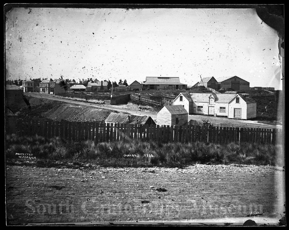
"A view of Stafford Street, Timaru, in 1864. Taken from George Street looking across the largely empty sections north of the Bank Of New Zealand building (out of shot on the right), towards the Cobb & Co livery stables on Beswick Street (top right). Inscribed with the title and "protected W. Ferrier". Ferrier was not the photographer who took the image, but clearly purchased the plate after he came to Timaru in 1881, perhaps from another retiring photographer (a common practise of the time)." - South Canterbury Museum 6116 https://timdc.pastperfectonline.com/photo/C9B559BC-4DE9-48C8-AF40-603871076306
Look closely at a photograph of Timaru taken in the 1860s or 1870s.
There may be a rough road, a few timber buildings, tussock on the hills and the sea much closer than it is today. Horses and carts stand where traffic now moves through the town. On the shoreline are surfboats, sheds and piles of cargo. Later photographs begin to show stone buildings, railway lines and streets taking on a more familiar shape.
It is tempting to look at these images and think we are seeing Timaru being born... we are not. The camera arrived relatively late in the story.
Long before survey pegs, sheep runs and Stafford Street, this coastline was part of the world of Kāti Huirapa and wider Kāi Tahu whānui. Timaru sat within a network of kāika, nohoaka, mahika kai, sacred places and travel routes. The coast itself was an ara tawhito, an old route linking communities north and south, while other routes led inland towards seasonal food gathering places. Heritage records also preserve the description of Timaru by Hoani Kahu of Arowhenua as an old pā and permanent settlement, with sacred, burial and canoe landing associations.
That matters when we look at early photographs. A stretch of apparently open hillside was not necessarily unused land. A beach without buildings was not a place without history.
The Canterbury Purchase of 1848 changed land ownership across a huge part of the region. Arowhenua Māori Reserve 881 was set aside during that process, and Kāti Huirapa families began moving there from Te Waiateruatī. The Crown had promised reserves sufficient for present and future needs, along with other benefits, but those promises became part of the long running Ngāi Tahu grievance known as Te Kerēme.
Against that much older human landscape, a Pākehā town began taking visible form on the Timaru shoreline in the early 1850s.
George and Robert Heaton Rhodes established The Levels run and used the coast at Timaru to bring in supplies and send wool out by sea. George Rhodes built a house and woolshed near the shore and developed a landing service close to what became Strathallan Street. In 1853 land controlled by the Rhodes family was surveyed as Rhodes Town. Three years later surveyor Samuel Hewlings laid out the government settlement immediately to its south. The two pieces of town planning helped create the slightly awkward street pattern that central Timaru still carries.
The sea was the town’s main transport route, but Timaru had no sheltered natural harbour. Ships anchored offshore while smaller boats carried passengers, wool, timber, food and merchandise through the surf. Capsizes and damaged cargo were part of the risk. By June 1859 a contemporary report described Rhodes Town growing quickly, with hotels, cottages and stores already built and many more under construction. Later that year more than a hundred immigrants from Britain arrived aboard the Strathallan, adding families, skills and labour to the settlement.
There were merchants and runholders whose names survive on maps and company records, but there were also boatmen hauling heavily loaded craft through the surf, builders, carters, labourers, domestic workers, shopkeepers, publicans and families trying to make homes in a small coastal town. Māori remained part of the district and its economy even as colonial settlement, surveying and land ownership changed the places around them. Women and children appear less often in the formal record, although they were living through the same fires, storms, shortages, immigration and rebuilding as the men whose names are more easily found.
Then, on 7 December 1868, three quarters of the commercial centre burned.
A strong north wester drove flames through a town still dominated by timber buildings. Contemporary reports said more than 30 buildings were destroyed and losses reached at least £70,000. The Timaru Herald office was among those lost. The disaster helped push Timaru towards stricter building rules, with new construction in the central area required to use brick or stone.
That is one reason photographs from the early 1870s can look surprisingly different from those taken only a few years earlier.
Timaru was rebuilding. Timber was increasingly joined or replaced by brick, local bluestone and Oamaru stone. Stores became larger. Streets were being formed and hills cut down to ease their gradients. The surviving Landing Service Building dates from this period, with its first section erected in 1870 and later additions. By 1875 the railway passed directly in front of it, another major change to the relationship between town and shoreline.
But that physical progress had another side. Railway construction in the early 1870s took part of Māori Reserve 884 at Upoko o Rakaitauheke, the area later known as Māori Park. It is a reminder that roads, railways and civic development did not simply improve a vacant landscape. They could also alter places with existing Māori ownership, use and cultural meaning.
So these old photographs deserve more than a quick glance.
Look at where the sea is. Follow the gullies and steep slopes before they were cut down. Notice the timber buildings that vanish between one photograph and the next. Find the surfboats, railway works, stores, hotels and cottages. Look at the people standing in doorways or beside horses and carts.
Then think about the people the camera missed.
A photograph records what stood in front of a lens for a fraction of a second. It does not show the generations of Māori history beneath the street, the argument over land ownership, the noise of cargo being dragged through the surf, the women working inside the buildings, the children growing up behind them, or the labour that went into remaking the town after fire.
That is what makes Timaru’s photographs from the 1860s and 1870s so interesting, they are not photographs of an empty place becoming a town... they are photographs of a place already carrying one history while another was being built across it. And once you know that, there is much more to look for in every photograph.
A view of Stafford Street, Timaru, in 1864. Taken from George Street looking across the largely empty sections north of the Bank Of New Zealand building (out of shot on the right), towards the Cobb & Co livery stables on Beswick Street (top right). Inscribed with the title and "protected W. Ferrier". Ferrier was not the photographer who took the image, but clearly purchased the plate after he came to Timaru in 1881, perhaps from another retiring photographer (a common practise of the time). - South Canterbury Museum 6116
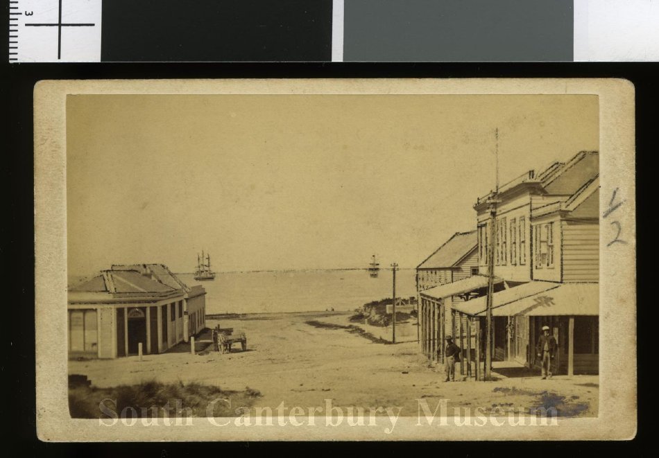
c1864 George St to East Timaru South Canterbury Museum 2094. The buildings of Clarkson & Turnbull plus the Post Office appearon the right. Two men are pictured standing outside the Post Office while a horse and wagon can be seen outside Russell Ritchie and Co. on the left. In the background two ships are visible in the roadstead.
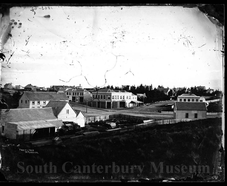
Corner of Stafford and George Streets Timaru South Canterbury Museum 6108
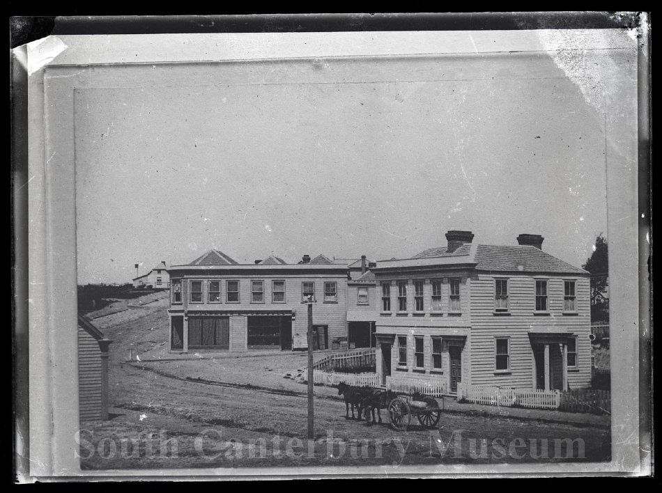
Gabites corner, Timaru. South Canterbury Museum 2019/049.32 https://timdc.pastperfectonline.com/photo/3B05B0B3-C62C-4CDF-9279-291299517379
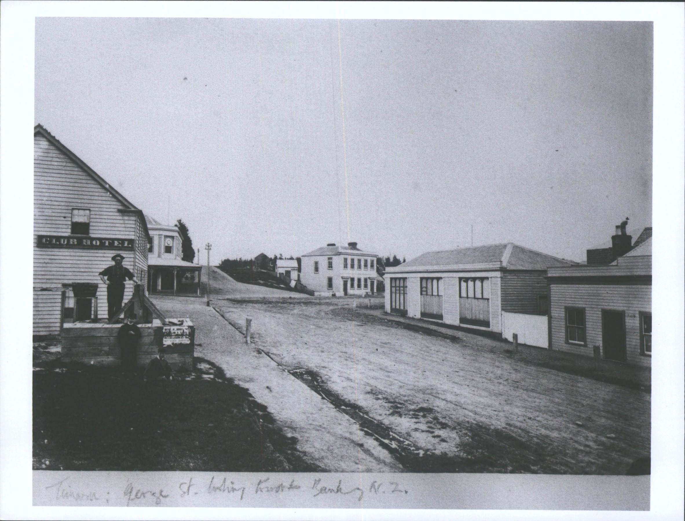
George St, Timaru, looking toward Bank of N.Z.. Hocken Digital Collections, https://hocken.recollect.co.nz/nodes/view/23463
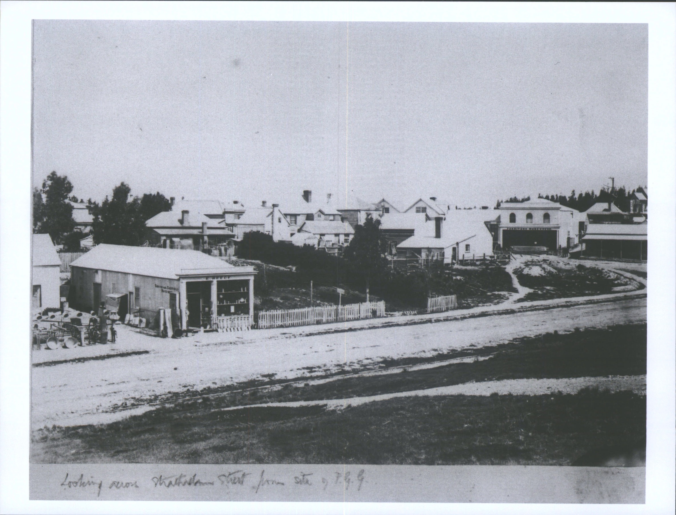
Looking across Strathallan Street from site of P.G.G.. Hocken Digital Collections, accessed 23/07/2026, https://hocken.recollect.co.nz/nodes/view/23481
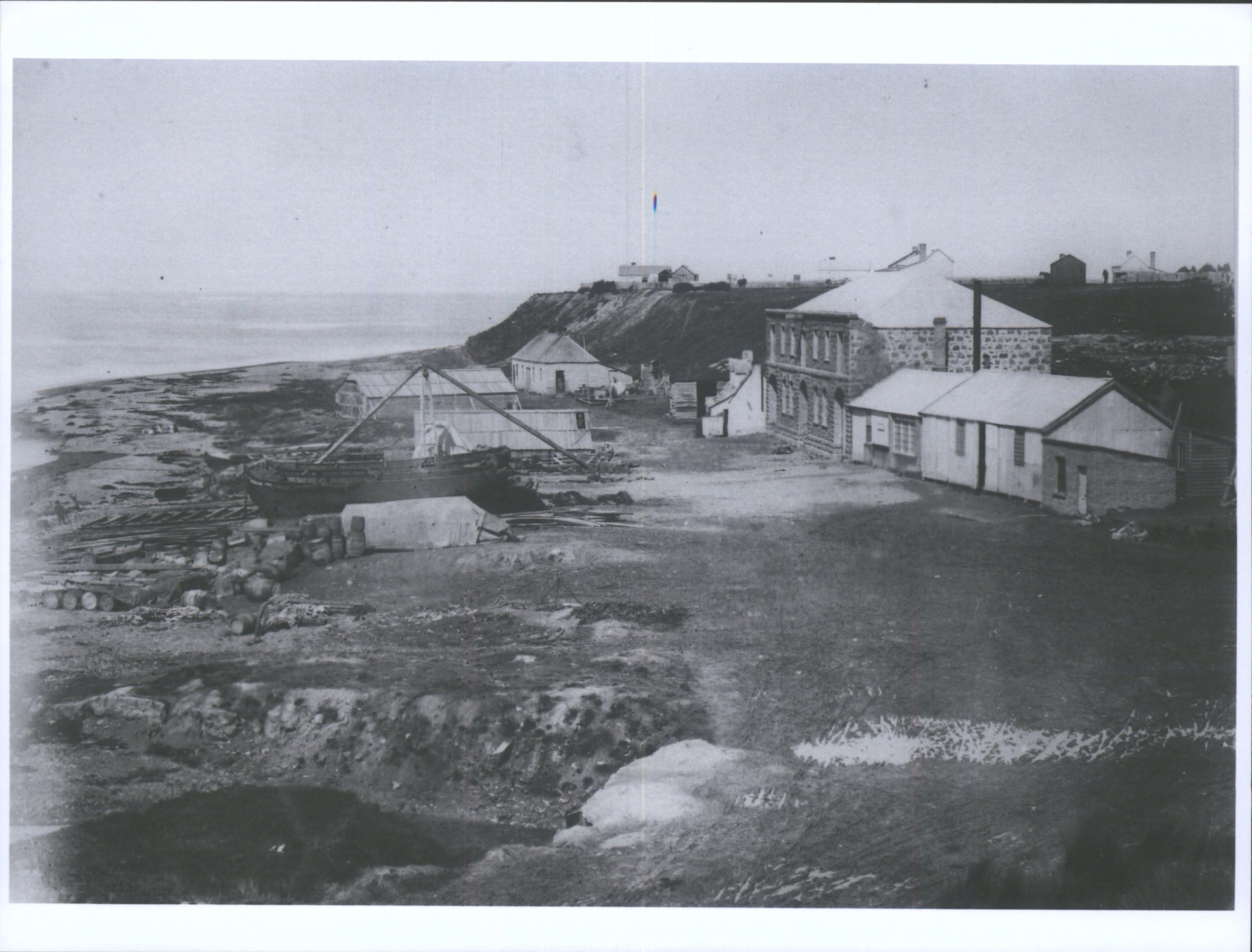
Boat launch. Hocken Digital Collections, accessed 23/07/2026, https://hocken.recollect.co.nz/nodes/view/23485
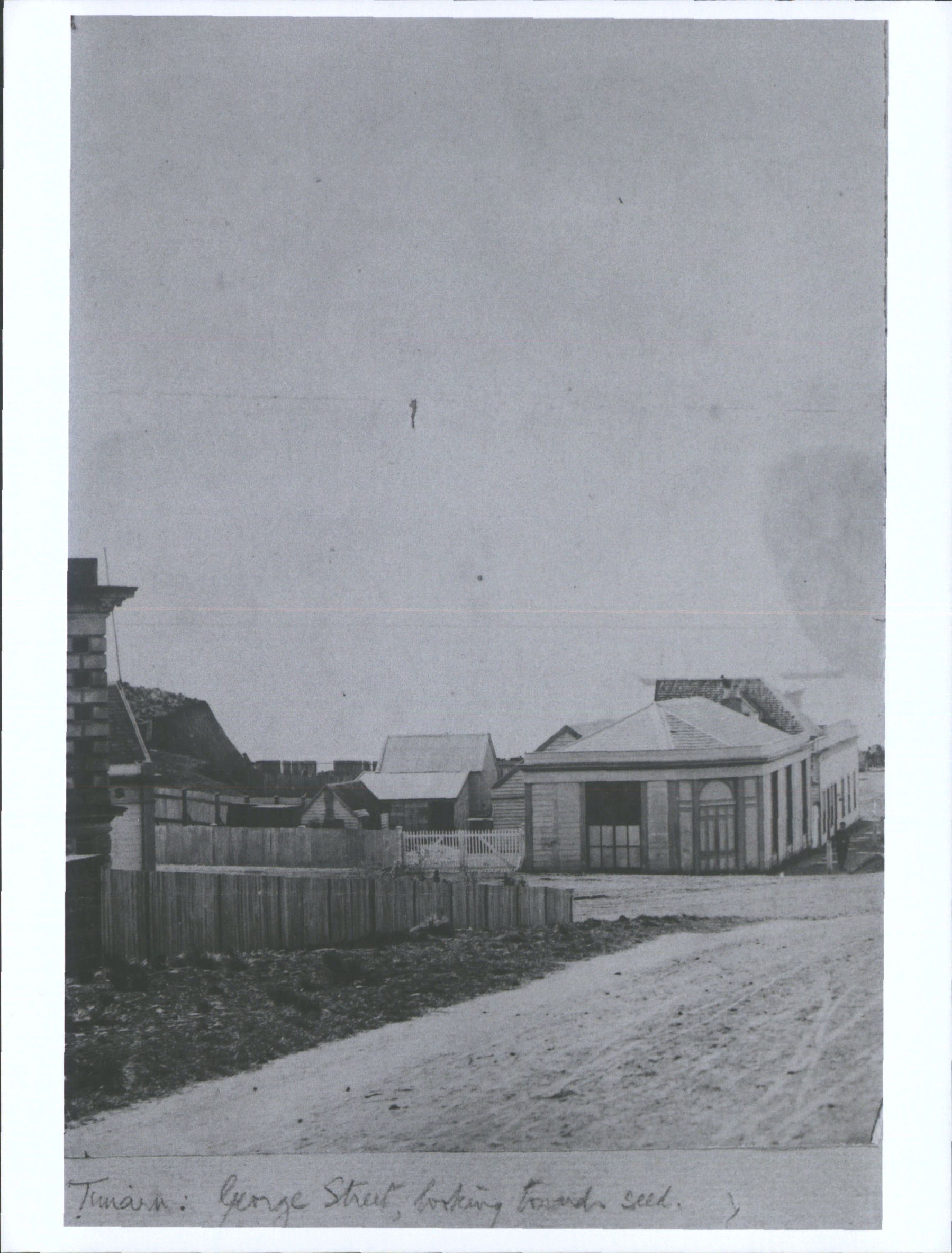
George St, looking towards seed. Hocken Digital Collections, accessed 23/07/2026, https://hocken.recollect.co.nz/nodes/view/23488
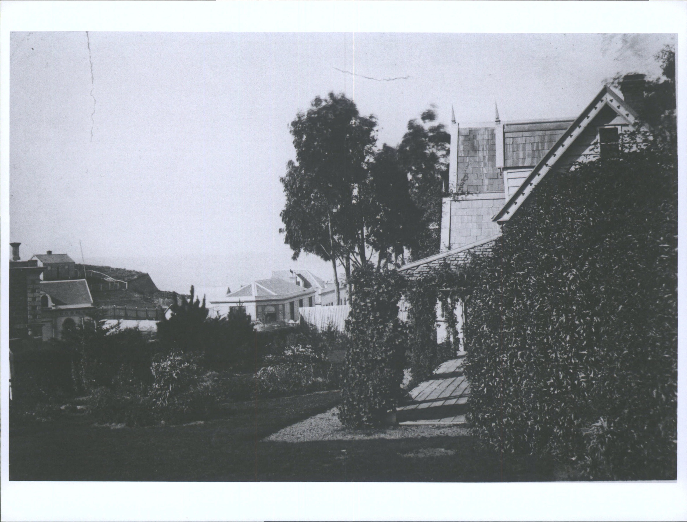
Guyzon House looking towards sea. Hocken Digital Collections, accessed 23/07/2026, https://hocken.recollect.co.nz/nodes/view/23492
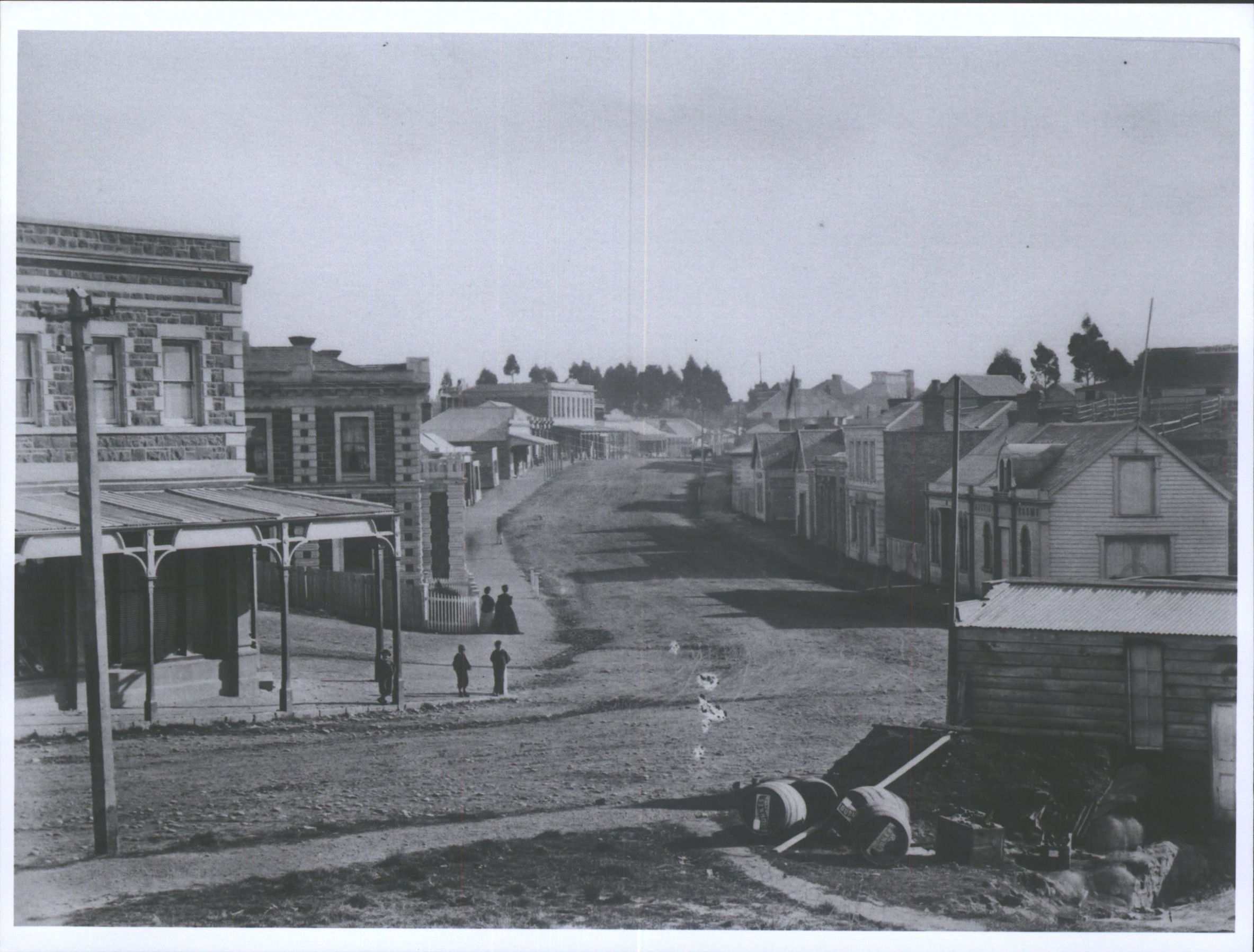
George Street. Hocken Digital Collections, accessed 23/07/2026, https://hocken.recollect.co.nz/nodes/view/23495
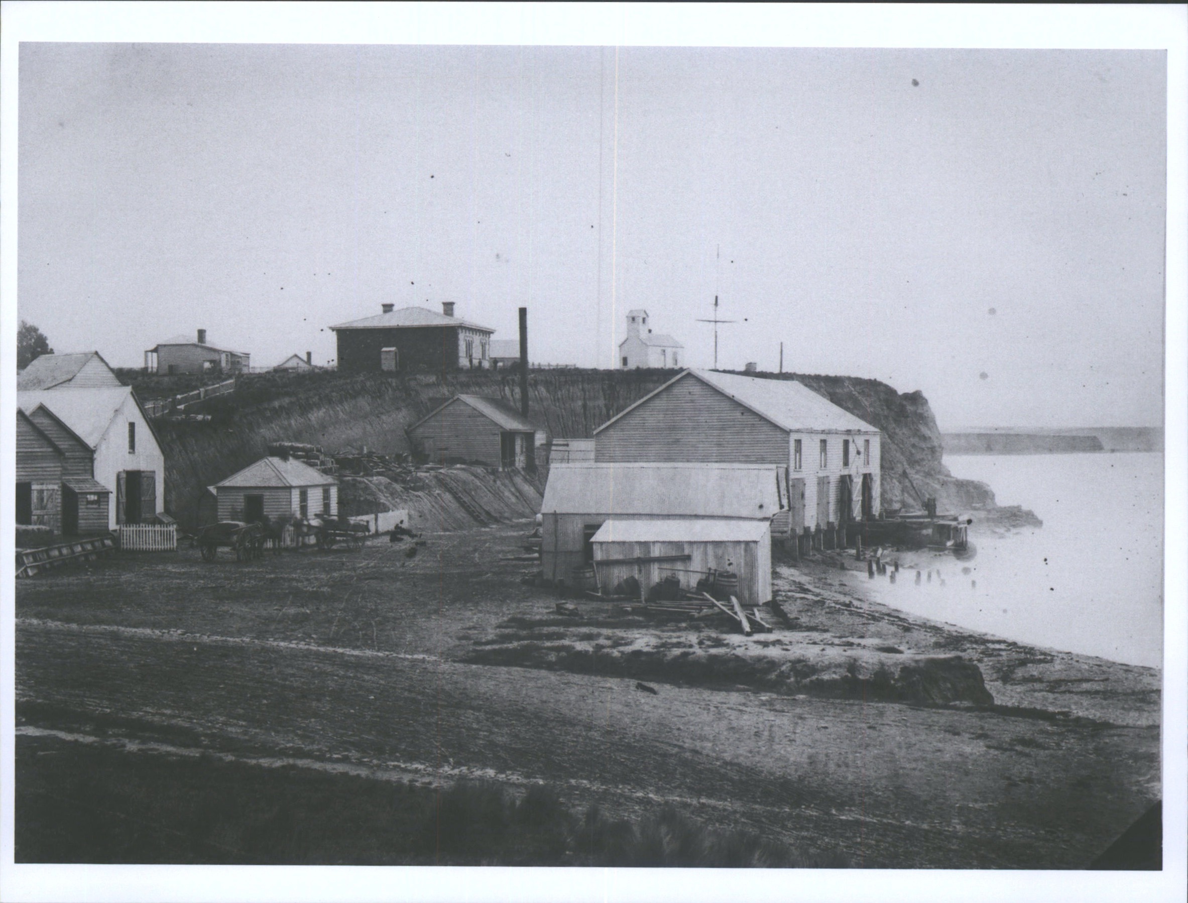
Timaru waterfront. Hocken Digital Collections, accessed 23/07/2026, https://hocken.recollect.co.nz/nodes/view/23499
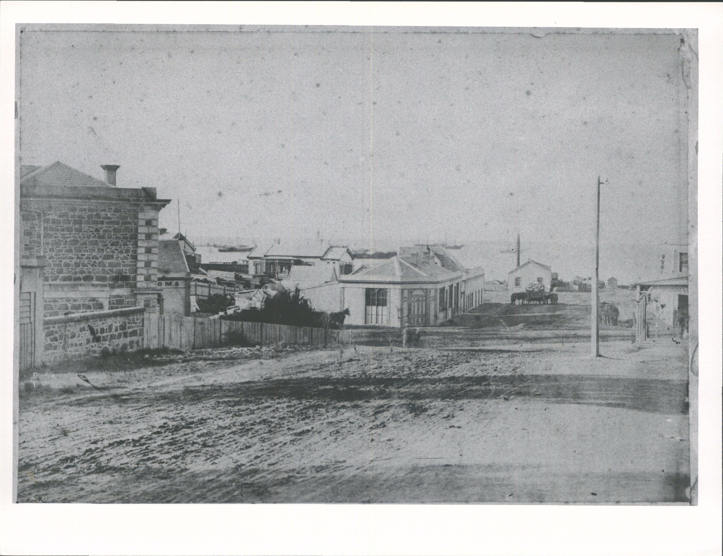
George Street, Timaru (1869-70). Hocken Digital Collections, accessed 23/07/2026, https://hocken.recollect.co.nz/nodes/view/23512
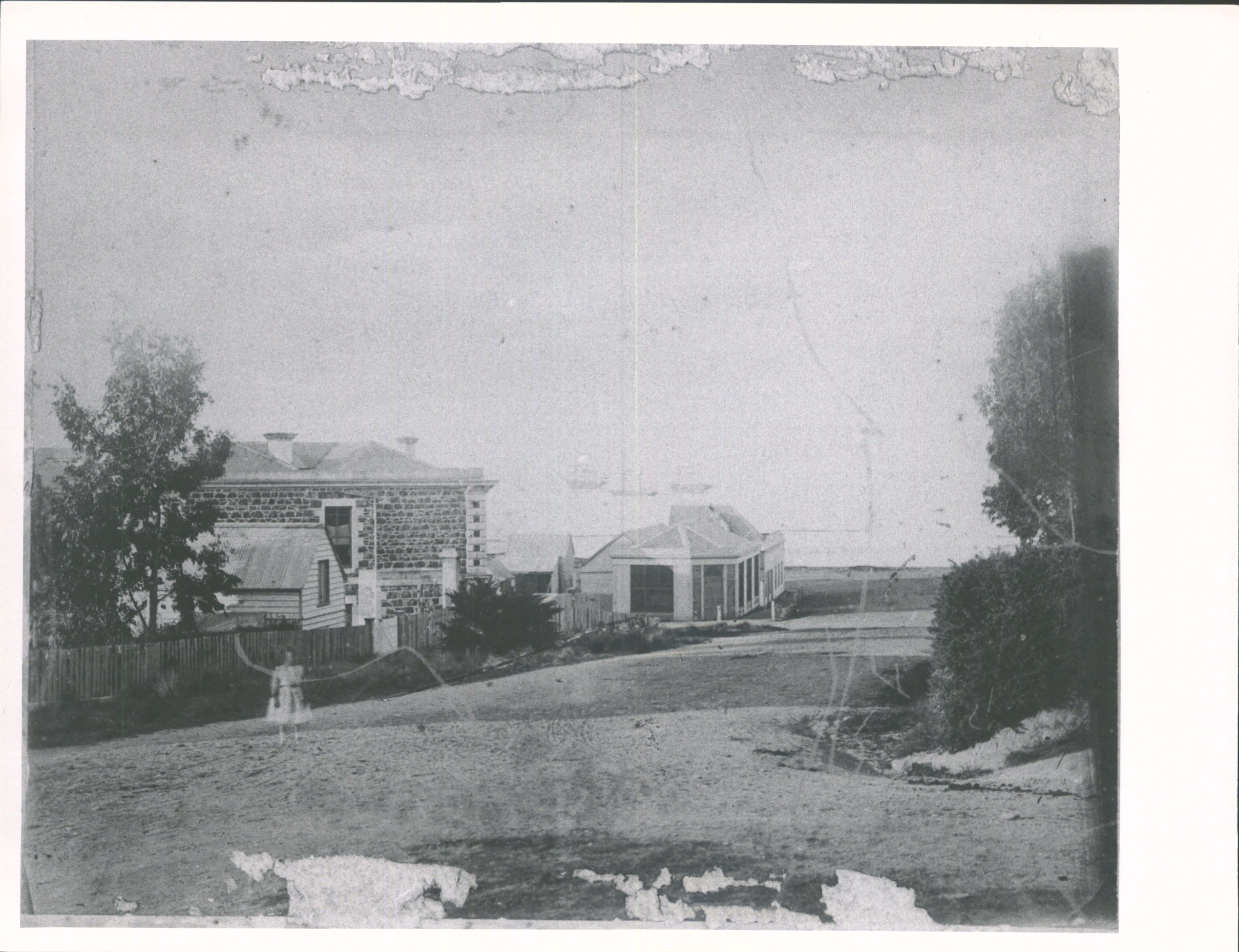
George St, Timaru, looking towards the sea (C. 1870). Hocken Digital Collections, accessed 23/07/2026, https://hocken.recollect.co.nz/nodes/view/23684
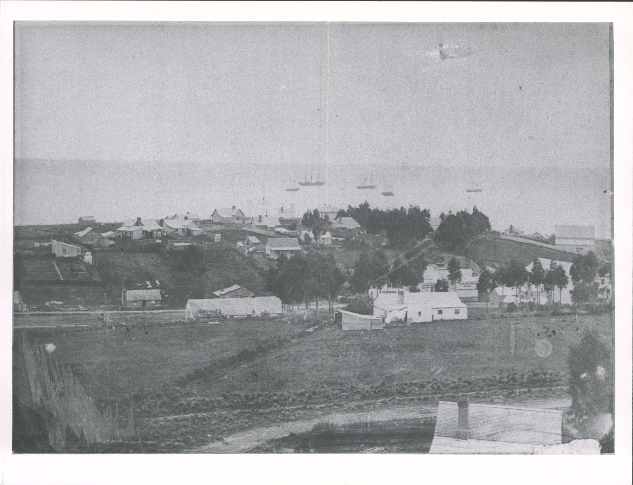
View over Timaru looking towards the Sea (1860-1870). Hocken Digital Collections, accessed 23/07/2026, https://hocken.recollect.co.nz/nodes/view/23632
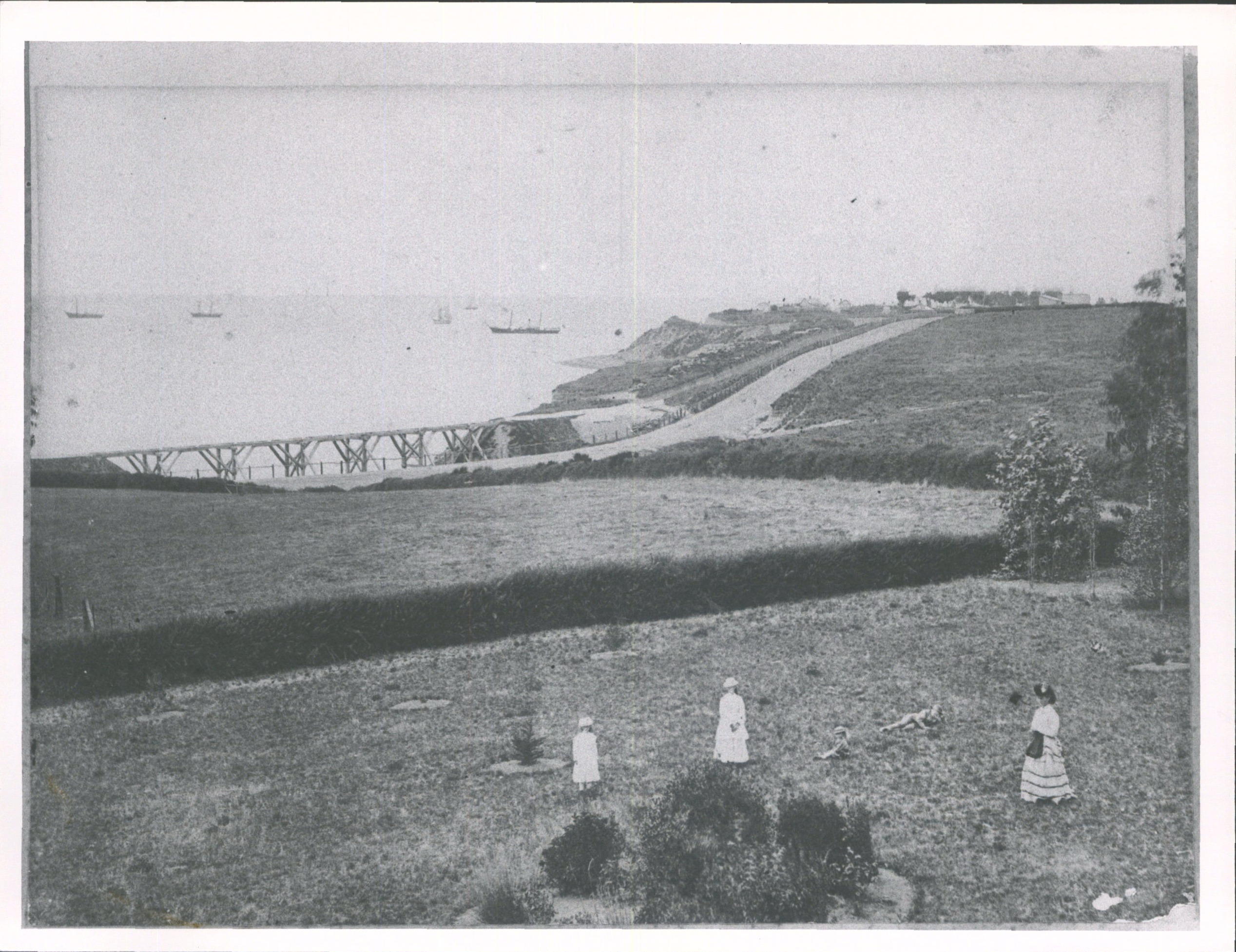
Looking towards the sea near Timaru (1871-1875). Hocken Digital Collections, accessed 23/07/2026, https://hocken.recollect.co.nz/nodes/view/23692
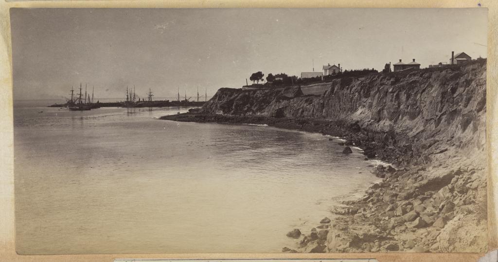
Timaru Caroline Bay rocky cliff area of coastline with the harbour and sailing ships in the distance 14797
This photograph shows a rocky cliff area of coastline with the harbour and sailing ships in the distance. Unknown, Timaru coast (c.1880s). Hocken Digital Collections, accessed 23/07/2026, https://hocken.recollect.co.nz/nodes/view/58441
Let's team this up with an article written in 1985, about Timaru's early European colony history: Timaru Herald, Timaru compelled to struggle for exsistence (06 Aug 1985). Aoraki Heritage Collection, accessed 20/08/2026, https://aorakiheritage.recollect.co.nz/nodes/view/799
Timeline: Timaru’s struggle for existence and early development
1852
- George Rhodes begins using the Timaru landing place.
- Supplies for The Levels station are shipped by sea from Lyttelton.
- Ships anchor offshore because there is no harbour.
- Food, clothing and tobacco are brought ashore.
- Whalers assist with landing cargo.
- Wool from The Levels is shipped out on returning vessels.
- A regular schooner service gradually develops for local runholders.
1853
- The Rhodes brothers purchase about 51 hectares of freehold land beside the landing place.
- This area becomes known as Rhodes Town.
- It later develops into the commercial heart of Timaru.
1856
- Samuel Hewlings surveys Government Town.
- The Canterbury Provincial Government had reserved about 107 hectares for the settlement.
- Government Town lies south of the landing place, near present-day Alexandra Square.
- Hewlings lays out streets generally parallel with the beach or at right angles to it.
1850s, date uncertain
- E. H. Lough surveys Rhodes Town.
- His street layout has to accommodate existing bullock tracks crossing Timaru’s hills and gullies.
- According to Sherry, the Hewlings and Lough street systems were not coordinated.
- The main south road becomes the main point where the two systems meet.
1857
- Soundings are taken around the Timaru roadstead.
- Mooring buoys are installed to mark safer positions for ships.
- The article identifies Lieutenant B. Woollcombe as beachmaster of the roadstead and Timaru’s first government official.
- The Rhodes brothers encourage H. J. Le Cren and Captain Henry Cain to establish a commercial landing and shipping service.
- Wooden surfboats replace the earlier whaleboats.
- The surfboats can carry up to about 10 tonnes.
- Boats are hauled ashore over skids using a capstan and cable.
1859
- The immigrant ship Strathallan arrives.
- According to the article, about 120 English settlers and their belongings are landed through the Timaru landing service.
- Sherry states that their arrival more than doubles the district’s population.
- Immigration contributes to increased building and employment.
- More cottages, shops and hotels appear in the growing settlement.
1862
7 March
- The Timaru Hotel is destroyed by fire.
- Samuel “Sam” Williams is the proprietor.
- Fifteen lodgers are reportedly asleep inside when the fire begins.
- Williams helps alert the occupants and reportedly loses almost everything except his books.
1862, later
- The immigrant ship Echunga arrives.
19 June
- Hugh Williams is sentenced to death at Christchurch after being convicted of starting the Timaru Hotel fire.
- Sherry, drawing on Johannes C. Andersen, states that Hugh Williams had earlier been refused liquor at the hotel.
- Sherry says he was unable to establish from the source he consulted whether the death sentence was ultimately carried out.
1863
- The immigrant ships Lancashire Witch and Victory arrive.
- Sherry states that Timaru’s population has grown to almost 1,000 after this period of immigration.
- According to the article, Timaru’s first permanent lighthouse is built.
- It has two lights.
- These lights are reportedly considered less effective than the earlier practice of lighting a tar barrel when a ship was due.
1864
- The Canterbury Provincial Government takes over the landing service.
- It becomes known as the Government Landing Service.
- In December, the May Queen sails from Timaru.
- Sherry describes this as Timaru’s first direct shipment of wool to Britain.
11 December 1867
- Sherry records what he describes as Timaru’s first asphalting.
- It is laid in front of Clarkson and Turnbull and the Post Office.
- He suggests it may have been experimental.
1868
- Timaru is still predominantly a timber town, with many buildings roofed in shingles.
- The central business district is concentrated along one main street.
- Timaru has no effective water supply for firefighting and no fire engine.
7 December 1868
The Great Fire of Timaru
- Fire breaks out at about 3.30 pm in the northern business block.
- Strong north-west winds and dry timber help the fire spread rapidly.
- Within less than two hours it reaches the southern block and buildings on the opposite side of the street.
- By about 6 pm, much of the commercial centre has been destroyed.
- The Post Office and telegraph office are lost.
- The offices of The Timaru Herald are destroyed.
- A total of 39 buildings are reported destroyed.
- Losses are estimated at about £70,000.
- Insurance payments total approximately £29,810.
- Sherry states that the fire began after a boy left a fire burning in a defective stove in a draughty shed containing wood shavings.
- The shed adjoined D. Munro’s furnishing warehouse.
- Goods removed from burning buildings are carried across the street and eventually towards the beach as the fire continues to spread.
8 to 10 December 1868
- Because the Post Office and telegraph office have been destroyed, news of the disaster cannot immediately be telegraphed.
- A messenger is sent to Oamaru, from where news is transmitted north and south.
10 December 1868
- The provincial superintendent contacts the Timaru Borough Council about assistance for fire victims.
- The council also discusses spending £2,000 on levelling hills and improving the main road north and south of Timaru.
11 December 1868
- £500 is voted for relief of people affected by the fire.
- According to Sherry, only about £120 is ultimately required.
- Insurance companies respond to the disaster by restricting cover on timber buildings.
- Insurance rates reportedly rise by 50 per cent.
- The Timaru Herald continues publication on a single sheet for about a fortnight while replacement materials are obtained.
Late 1860s
- Timaru Borough Council introduces stricter building regulations.
- Within defined areas, new buildings must be built of brick or stone.
- Roofs must be constructed using slate, tile or metal rather than combustible shingles.
- The 1868 fire accelerates Timaru’s transition from a timber settlement to a more permanent masonry town.
8 March 1870
- A public meeting protests against enforcement of the building regulations.
- Opponents argue that many people cannot afford to build in stone.
- Despite opposition, the move towards brick and stone construction continues.
1870s
- Major earthworks reshape central Timaru.
- Hills are cut down to reduce steep road gradients.
- Gullies are modified as streets develop.
- Strathallan Street occupies one former gully.
- George Street occupies another.
- Sherry records that a grove of cabbage trees once grew near the foot of Strathallan Street.
- The sea had once reached close to the cliffs nearby.
- Bullock tracks had crossed tussock-covered hills above the shore.
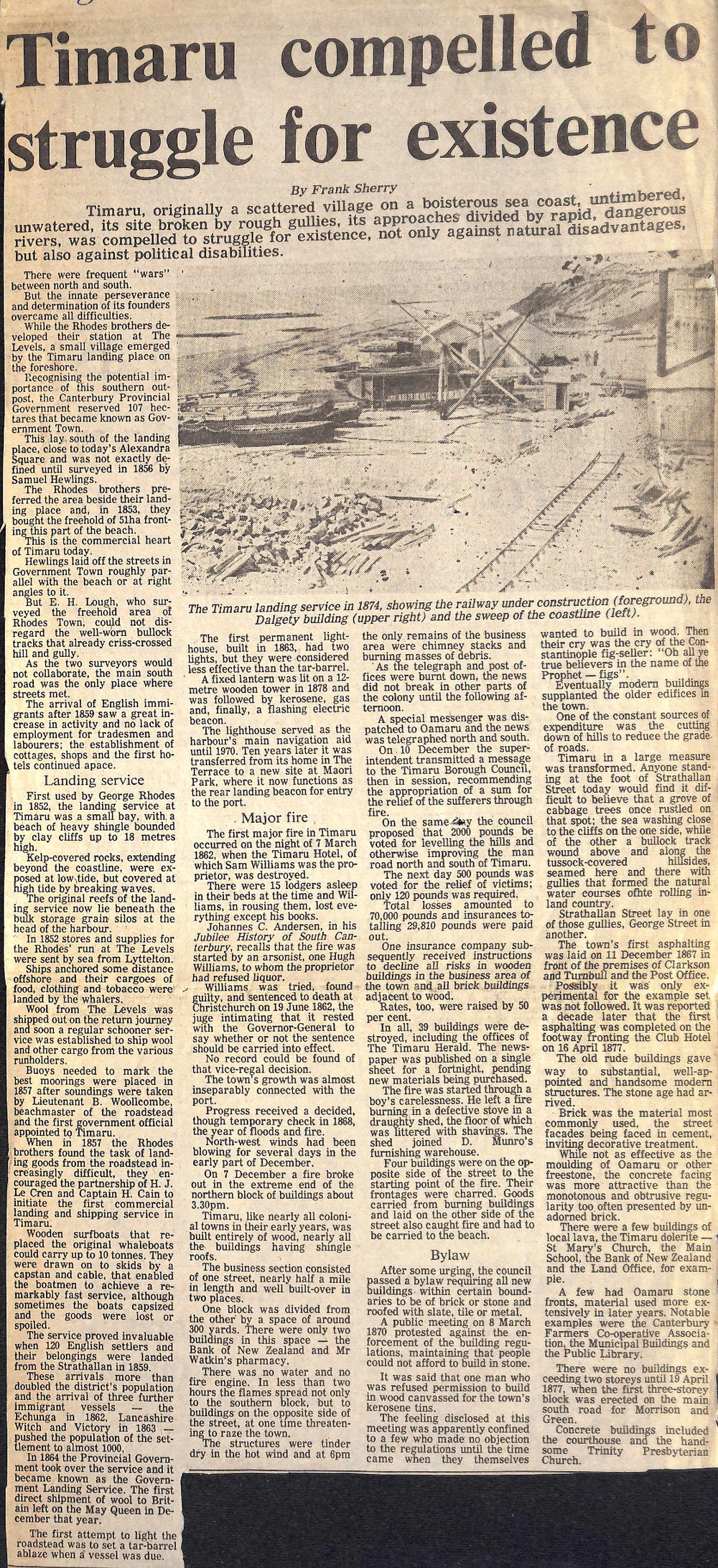
1874
- A photograph records the Timaru Landing Service.
- It shows:
- the railway under construction
- the Dalgety building
- the landing service
- Timaru’s original coastline.
16 April 1877
- A report records asphalting of the footpath in front of the Club Hotel.
- Sherry notes this because the earlier 1867 asphalting appears not to have immediately led to widespread adoption.
19 April 1877
- According to Sherry, Timaru’s first building exceeding two storeys is erected.
- The three-storey block stands on the main south road.
- It is built for Morrison and Green.
1870s onward
- Earlier timber buildings increasingly give way to substantial brick, stone and concrete structures.
- Brick becomes one of Timaru’s most common building materials.
- Many street facades are finished with decorative cement work.
- Oamaru stone is increasingly used for facades and architectural detailing.
- Local Timaru dolerite is also used.
Buildings identified by Sherry as using Timaru dolerite
- St Mary’s Church
- Main School
- Bank of New Zealand
- Land Office
Buildings identified as using Oamaru stone
- Canterbury Farmers’ Co-operative Association
- Municipal Buildings
- Public Library
Concrete buildings noted by Sherry
- Timaru Courthouse
- Trinity Presbyterian Church
1878
- A fixed lantern is installed on a 12-metre wooden lighthouse tower.
- Lighthouse technology subsequently changes from kerosene to gas and eventually to a flashing electric beacon.
1970
- The lighthouse ceases to serve as Timaru Harbour’s principal navigation aid.
1980
- The lighthouse is moved from The Terrace to Maori Park.
- It is subsequently used as a rear landing beacon for vessels entering the port.
6 August 1985
- Frank Sherry’s article, “Timaru compelled to struggle for existence”, is published in The Timaru Herald.
- Sherry looks back at Timaru’s transformation from a difficult coastal landing place into a permanent town built around its port, streets, public works and increasingly substantial architecture.
Side Quest: How Did They Take These Photographs?
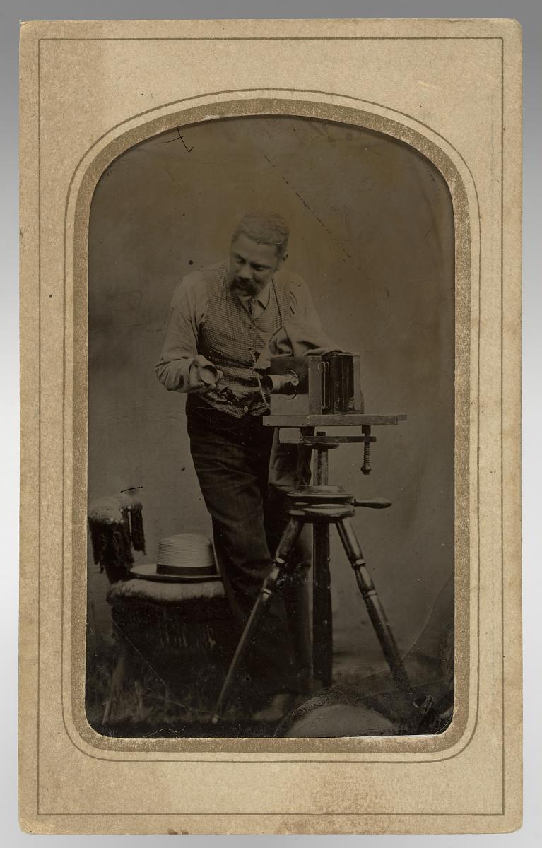
Look at this photographer in 1865. This is the sort of equipment being used when some of Timaru’s earliest photographs were being made.
By the 1860s and 1870s, many photographers were using the wet plate collodion process, introduced in 1851. The camera was usually a large wooden box mounted on a tripod, and instead of film the photographer used a sheet of glass.
The glass plate was coated with collodion and placed in silver nitrate to make it sensitive to light. While still wet, it was loaded into a light-tight holder and taken to the camera. The photographer focused the scene, inserted the plate and made the exposure. In good light this might take only a few seconds, although conditions could make it longer.
The tricky part was that the plate had to be developed before it dried.
That meant an outdoor photographer needed far more than a camera. They also carried fragile glass plates, chemicals, trays, water and often a portable darkroom.
Once the plate was developed, washed and fixed, the glass became a negative. Photographs could then be printed from it onto paper. Albumen prints, made using paper coated with egg white and silver salts, were common, while small card-mounted portraits known as cartes de visite became very popular.
Now think about making a photograph on a Timaru hillside in the 1860s. The photographer had to transport a wooden camera, tripod, glass plates and chemicals, prepare the plate, frame the view, make the exposure and develop it before the glass dried.
Add Timaru’s wind and changeable weather and it was no small job.
Knowing how these photographs were made gives us another way to read them. Each image was carefully prepared and physically made using glass, chemicals, light and considerable skill.
Image note: The 1865 photograph is an example of a photographer working with period equipment. It does not show a Timaru photographer or confirm the exact camera used for any particular Timaru photograph.