Signal the Ship! Woollcombe’s Flags: A Free Caroline Bay History Hunt
Explore Ashbury Park, the cliff walk, Blackett’s Lighthouse, CPlay, shipwreck stories and the Alexandra Lifeboat — and see if you can find the old harbour flags hidden in plain sight. Before Timaru had a man-made harbour, ships did not sail safely in beside wharves. They anchored offshore in the open roadstead, while people, wool, timber, coal, mail and supplies were ferried through the surf in small boats. That made Timaru exciting, busy — and dangerous.
This free history hunt follows clues from Ashbury Park to Caroline Bay. Along the way you will meet Captain Belfield Woollcombe, look for lighthouse details, find maritime clues, decode old harbour signals, and imagine how local rescuers helped ships in trouble. Bring curious eyes, walking shoes, and a pencil or crayon if you want to do a brass rubbing.
The history hunt route
Start: Ashbury Park, Evans Street entrance
Finish: Alexandra Lifeboat shelter near the Caroline Bay Soundshell
Good for: Families, school holiday exploring, heritage walks, curious locals, visitors
Cost: Free
Time: Allow 45–90 minutes, depending on how many clues you stop to explore
Stop 1: Ashbury Park — Woollcombe’s home and the lost lagoon
Start at the Ashbury Park gate off Evans Street. Captain Belfield Woollcombe was one of early Timaru’s great official multi-taskers. He had been a naval officer and, after settling in Timaru, became the Government’s local representative. His roles included Resident Magistrate, Immigration Agent, Postmaster, Customs Officer, Harbourmaster, Beachmaster, Pilot, Registrar and Health Officer. Woollcombe built his home, Ashbury, overlooking the Waimātaitai Lagoon. The reclaimed land later became Ashbury Park.
Your clues
- Can you find a memorial tree connected to Woollcombe?
- Can you stand near the hill and imagine the view before sports fields, roads and houses?
- Can you spy an artwork or playground clue that links back to tuna/eels and the lost wetland?
Wonder while you wander
Before this was a park, this area was part of the Waimātaitai lagoon and wetland landscape. Local heritage resources describe Waimātaitai as a hāpua, or lagoon, and an important mahinga kai place associated with tuna/eels and inaka/whitebait.
- What would you have heard here before the traffic?
- Birds? Water? Wind in harakeke? People gathering kai?
Stop 2: The cliff walk — looking out to the old roadstead
From Ashbury Park, head towards Caroline Bay along the cliff walk. Before Timaru’s artificial harbour was built, ships had to anchor offshore. Heritage New Zealand explains that Timaru’s landing services existed because the depth of water and lack of harbour facilities meant ships anchored off-shore while goods were loaded and unloaded. That meant the sea itself was part of the town’s working space. Cargo and people had to move between ship and shore in small boats, often through surf.
Your clues
- Look out to sea. Where would you anchor a ship if there was no safe harbour?
- Can you find a concrete post with a metal plate that remembers Timaru’s maritime past?
If you have a crayon and paper, try making a brass rubbing.
Wonder while you wander
- Would you rather be the captain of the ship, a sailor in the surf boat, or someone watching from the cliff?
Stop 3: Blackett’s Lighthouse — teeth, towers and navigation
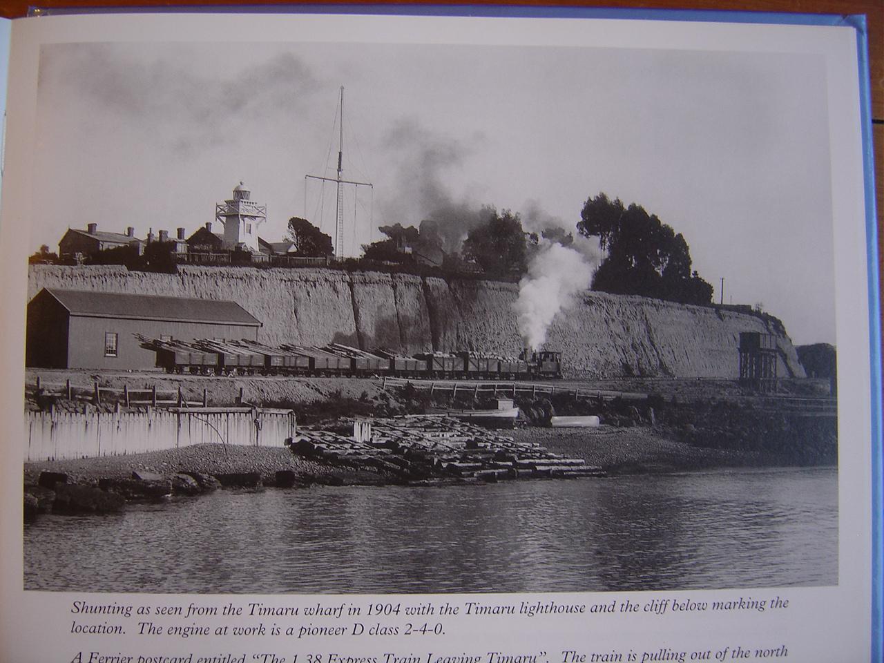
Find Blackett’s Lighthouse on the cliff. This little timber lighthouse was designed by John Blackett, the Government’s Marine Engineer. Heritage New Zealand records it as designed in 1876, with construction deferred to 1877–78. It originally stood overlooking the harbour and has been moved more than once. Today it is one of Timaru’s best-loved built heritage landmarks.
Your clues
- Can you find the red dome?
- Can you count the rows of tiny blocks under the roofline?
These little blocks are called dentils. They look like teeth — and the word links back to the Latin word for tooth.
Wonder while you wander
- Why do lighthouses need to be easy to recognise from the sea?
- What colours would you choose for a lighthouse?
Stop 4: CPlay lighthouse tower — find Woollcombe’s flags
Now head into CPlay and make your way to the lighthouse slide tower.
This is where the flag hunt begins... In 1861, Captain Belfield Woollcombe wrote to the Provincial Secretary in Christchurch explaining the meaning of the different flags flown at Timaru Harbour. These signal flags told approaching ships what action to take. The original letter is held by Archives New Zealand and is shared through DigitalNZ as “Flying the flag.”
These flags were instructions for safety. They were Timaru talking to ships before radios, port control or the harbour we know today.
Your clues
- Can you find the flags hidden at CPlay?
- Are they Woollcombe’s harbourmaster instructions?
- Or are they linked to Blackett’s lighthouse plans?
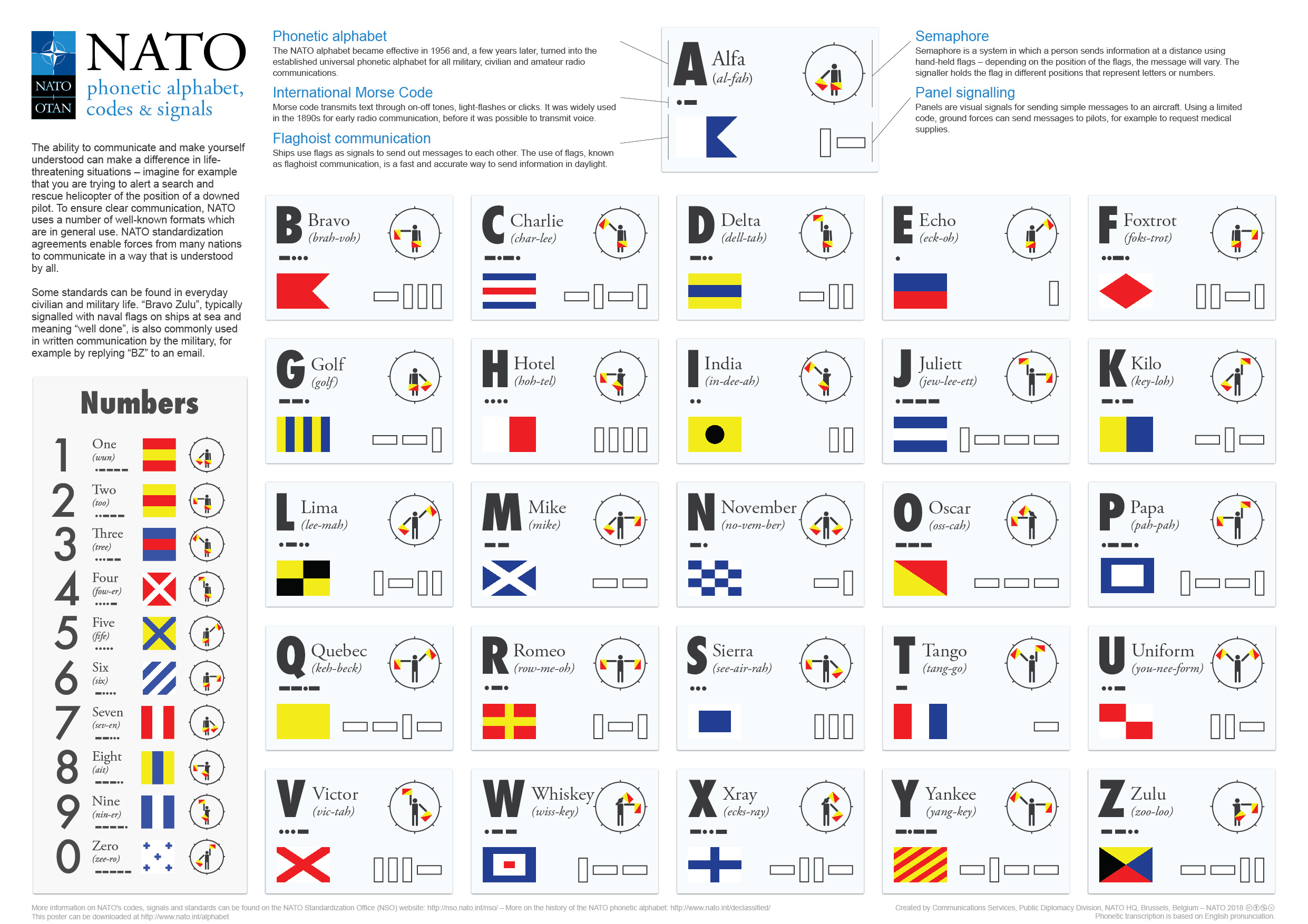
Decode the harbour signals
In Woollcombe’s 1861 flag note, the signals included:
No. 1 — Go to sea / keep to sea
No. 2 — In communication
No. 3 — Anchor — no danger
2 + 3 — Go to the large moorings
3 + 2 — Go to the small moorings
Ships were expected to answer the signal to show they had understood.
Try this
- Write your own message to a ship.
- Would you tell it to anchor?
- Keep out to sea?
- Go to the large moorings?
- Or call for help?
Stop 5: The shipwreck map — Timaru’s dangerous roadstead
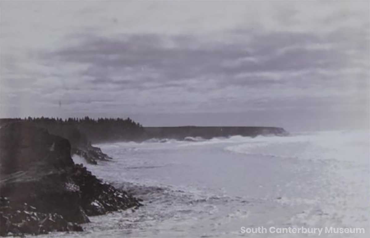
Now find the mouse wheel and shipwreck map at CPlay. Timaru’s coast has had its sad share of wrecks. Te Ara describes the Timaru roadstead as a place once dreaded for treacherous winds and reefs, and says that from November 1865 until 1890 the port was the graveyard of 28 ships. The harbour we see today was not inevitable. It was fought for, argued over, engineered, built and rebuilt because the open roadstead could be so dangerous.
Your clues
- Can you count the shipwrecks on the map?
- Can you find the names of any ships?
- Can you find where they came to grief?
Wonder while you walk
- How would a shipwreck change a town?
- Who would rush to help?
Stop 6: Rescue challenge — lifeboat crew or rocket brigade?
Find the ship in trouble at CPlay. When ships were in danger, Timaru people rushed to help. Some joined the lifeboat crew. Others used rocket rescue gear. A rocket line could be fired from shore to a stranded ship. Once the line was secured, people could be hauled back towards land in a breeches buoy — a kind of lifesaving seat or canvas “shorts” travelling over the waves.
Your clues
- How many masts does the ship have?
- Can you act out a rescue?
- Would you row the lifeboat?
- Fire the rocket line?
- Signal the harbourmaster?
- Or tap the cannon to summon your crew?
Make your own story... on the story-maker side of the mouse wheel, use the symbols to create your own shipwreck rescue.
- Who is in trouble?
- What is the weather doing?
- Who comes to help?
- What signal will you send?
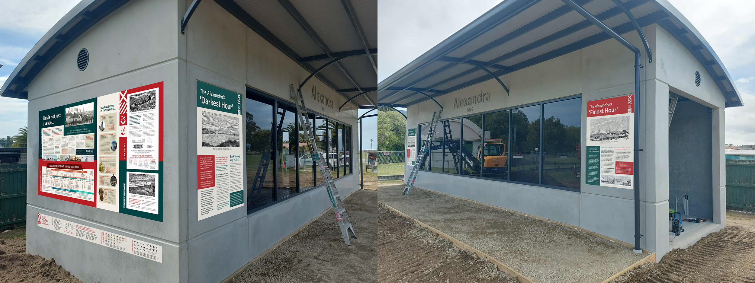
Bonus stop: Alexandra Lifeboat shelter
If you are up for one more history hunt, wander over to the Alexandra Lifeboat shelter behind the Soundshell. The Alexandra Lifeboat is part of Timaru’s maritime rescue story. NZHistory identifies the 1864 lifeboat Alexandra as one of the pieces of Timaru’s maritime history associated with the Landing Service Building.
Your clues
- Can you find the lifeboat shelter?
- Can you find any maritime codes?
- Can you create a secret message using flags or symbols?
Final challenge
- Write a secret harbour message.
- Give it to someone else to decode.
- Would your message save a ship?
Quick checklist for the hunt
Tick them off as you go:
☐ Find Woollcombe’s memorial tree
☐ Look across the lost Waimātaitai lagoon landscape
☐ Spot a tuna/eel or wetland clue
☐ Do a brass rubbing
☐ Find Blackett’s Lighthouse
☐ Count the dentils
☐ Find Woollcombe’s flags at CPlay
☐ Decode a harbour signal
☐ Count the shipwrecks
☐ Act out a rescue
☐ Visit the Alexandra Lifeboat shelter
☐ Write a secret flag message
Why these flags matter
It is easy to look at an old piece of paper and see only a pretty archive image... but Woollcombe’s 1861 flag letter is much more than that.
It shows us how a small coastal settlement managed risk before modern harbour systems. It connects Timaru’s cliffs, roadstead, officials, sailors, surf boats, moorings, lighthouse, rescue crews and shipwreck stories. It also reminds us why archives matter, a practical piece of paper, carefully drawn and painted more than 160 years ago, can still help children and families explore Timaru today.
That is the magic of free fun... the history is already here, we just have to look for it.
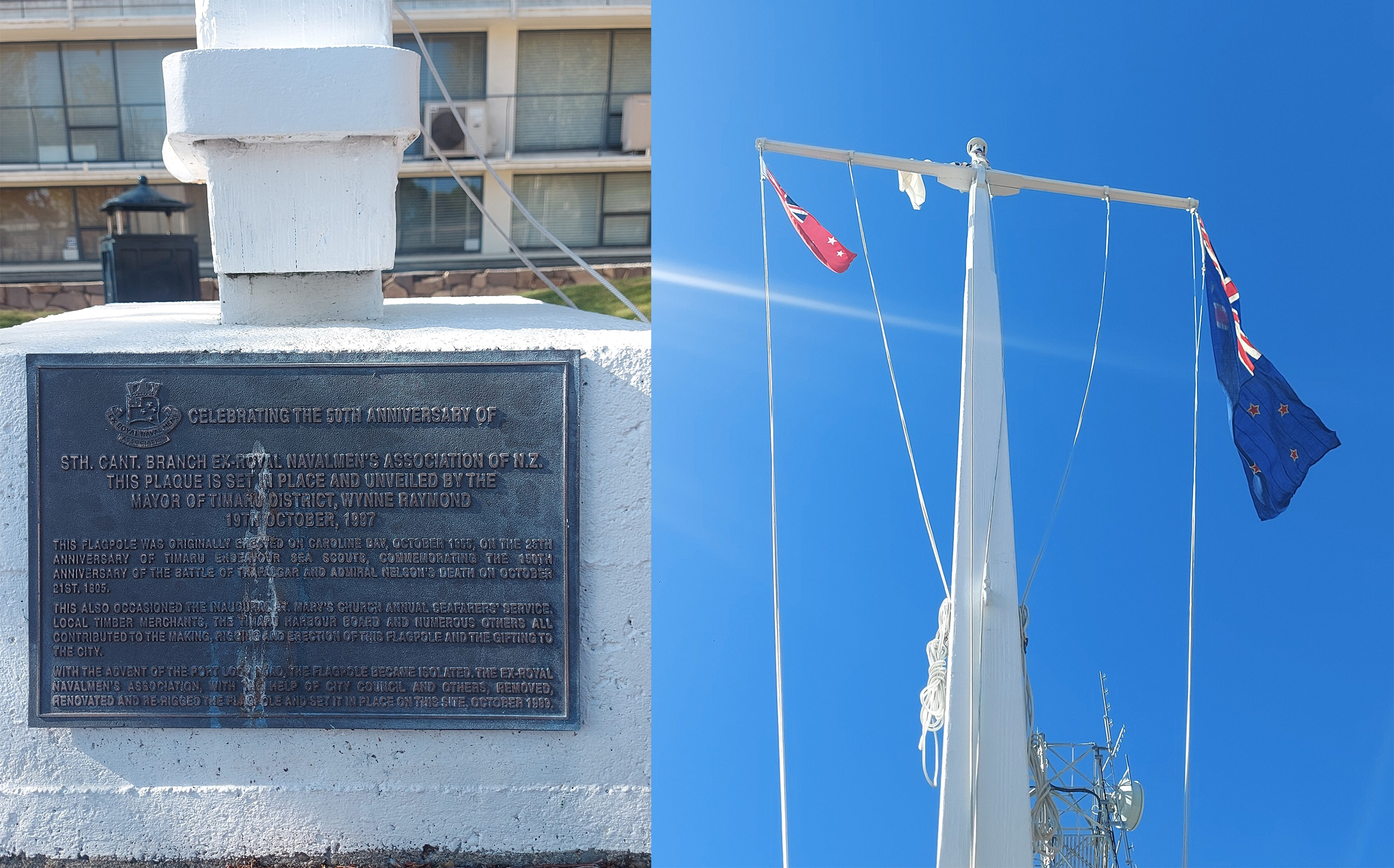
The Alexandra’s ‘Darkest Hour’
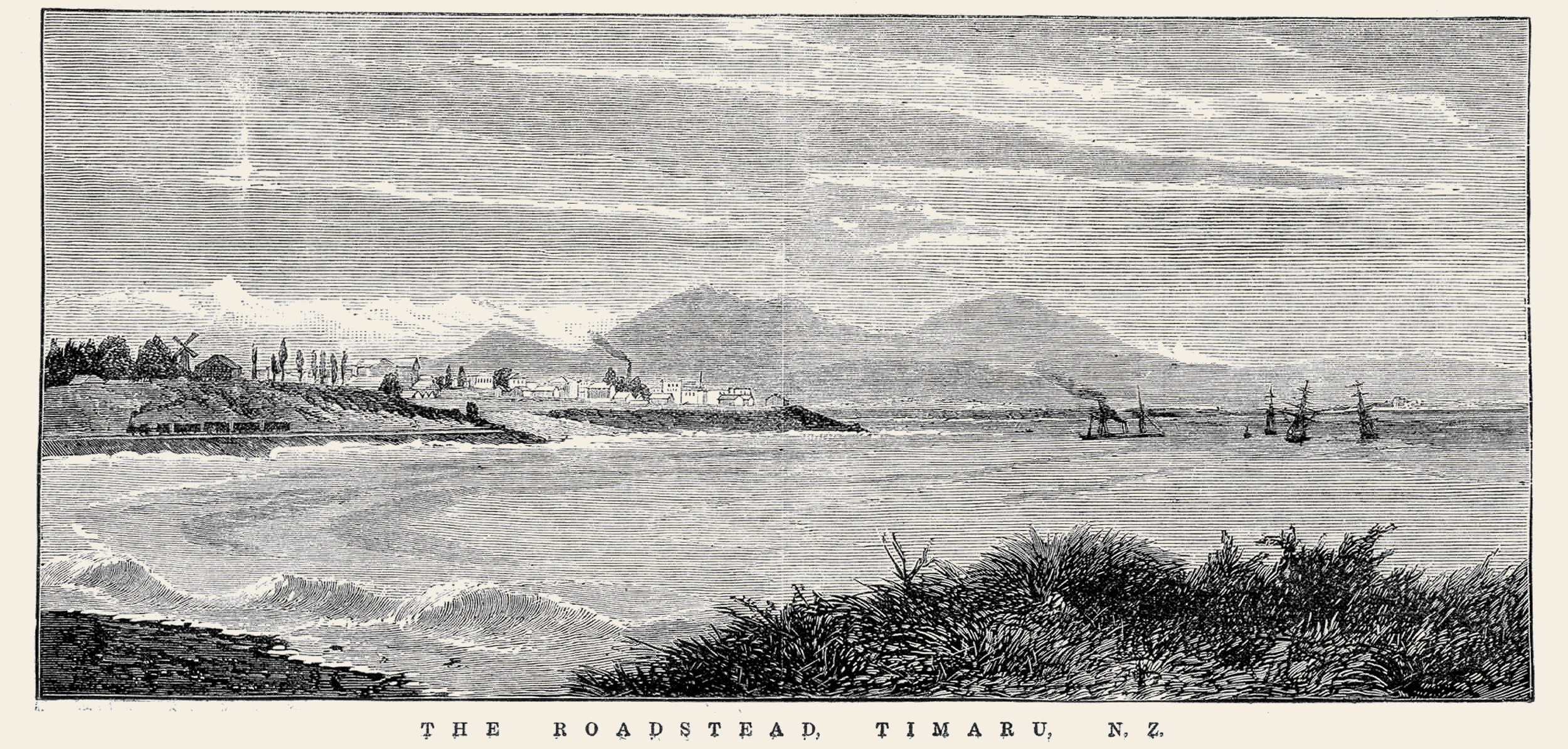
“The Roadstead, Timaru, N.Z. 1877.”) Published October 13, 1877 in The Illustrated Australian News by Ebenezer and David Syme. Wood engraving.
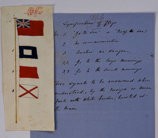
Flying the flag. Belfield Woollcombe was the Timaru Harbourmaster and Resident Magistrate, and wore several other official hats for the Provincial Government in the town during the 1850s and 60s. His roles necessitated much correspondence with Provincial officials in Christchurch, and this colourful 1861 letter is just one example. Here he is informing the Provincial Secretary of the significance of the different flags flown at Timaru Harbour, so approaching ships would know what actions to take. The signal flags have been carefully drawn and painted, and the colours remain bright even after 157 years. Archives New Zealand reference: CH287 - ICPS 1846/1861; R22190082

After the arrival at Timaru, Captain Woollbombe erected for himself a cob whare and was apparently engaged in this work when the Strathallan arrived in January 1859

A lifeboat crew rowing to rescue shipwrecked sailors. published 1893-02-11 The New Zealand Graphic and Ladies Journal, 11 February 1893, p.121 - New Zealand Graphic; Wright, Henry Charles Seppings, 1849-1937 - Auckland Libraries Heritage Collections NZG-18930211-0121-01

The wrecks at Timaru, New Zealand: Lifeboats rescuing sailors in heavy surf, one life boat named City of Perth. . Wood engraving by Ashton, Julian Rossi, 1851-1942 slv.vic.gov.au/permalink/f/1cl35st/SLV_ROSETTAIE670476

Wrecks at Timaru, N.Z. – This wood engraving, published by David Syme and Co. on June 10, 1882, depicts the wrecks of the Benvenue and City of Perth off the coast of Timaru during a fierce gale. Originally featured in the Illustrated Australian News, the engraving is composed of three separate, numbered images illustrating the storm, the wrecks' final positions, and the newly constructed breakwater. This work is out of copyright, with no restrictions on use. https://find.slv.vic.gov.au/permalink/61SLV_INST/1sev8ar/alma9917640603607636


The Wrecks at Timaru, New Zealand: The Ships on Shore – This wood engraving, created by A. C. Cooke and published by Martin Ebsworth on June 17, 1882, depicts the City of Perth and Benvenue shipwrecked on the shores of Timaru. Originally featured in The Australasian Sketcher, the engraving illustrates the aftermath of the shipwrecks. This work is out of copyright, with no restrictions on use. https://find.slv.vic.gov.au/permalink/61SLV_INST/1sev8ar/alma9917766133607636

Section of the HMS Ringarooma cruiser in Timaru Harbour where you can see the Blackett Lighthouse up on Le Cren Terrace 1895-02-23 - Auckland Libraries Heritage Collections NZG-18950223-0180-01

A set of the original plans for construction of the Timaru lighthouse hand drawn by John Blackett circa 1877.Courtesy South Canterbury Museum 2004/070.37

Detail from the original plans for construction of the Timaru lighthouse hand drawn by John Blackett circa 1877.Courtesy South Canterbury Museum 2004/070.37
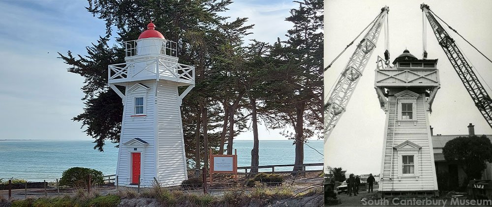
The Blackett Lighthouse was originally on the Terrace, No. 7. It was later relocated to the corner of Te Weka Street and Benvenue Ave, and then again to the Benvenue Cliffs. It is a Category II structure and the Historic Places Trust. LEFT: The Lighthouse at its current site in 2021. Courtesy of Roselyn Fauth. RIGHT: Timaru's lighthouse being relocated 1980. Courtesy of South Canterbury Museum 2014/107.73
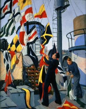
Signal Flag Hoist
Two sailors aboard a corvette hoist colourful signal flags in Donald Mackay's painting.
The colours and patterns of these flags were used in sending visual signals, and the flags themselves were stored in a rack called a flag locker (lower centre). Halifax native Mackay's paintings often speak to the excitement of the navy, and to the relationship between sailors and the maritime environment. The varied nature of naval service held great appeal for many Canadians. Navy life was often of particular appeal to volunteers from central Canada who, in many cases, had never seen an ocean before enlisting.
Signal Flag Hoist
Painted by Donald C. Mackay around 1945
Beaverbrook Collection of War Art
CWM 19710261-4251
www.warmuseum.ca/cwm/exhibitions/navy/galery_themes-e.aspx@section=3-A-2.html

The Timaru Harbour Board lighthouse and flagstaff, on the site of the Harbourmaster's house (in the background) on the Terrace, Timaru, circa 1920? South Canterbury Museum 2021/057.04
WuHoo Timaru volunteers Chris and Roselyn Fauith helped to research and bring design ideas to the Caroline Bay Playground surfacing. The Cyclops swing was designed to look like a life boat, inspired by the Alexandra life boat. People could pretend that when they are swinging on a double cyclpse that they are rocking over the breakers to act out a rescue with the life boat crew.
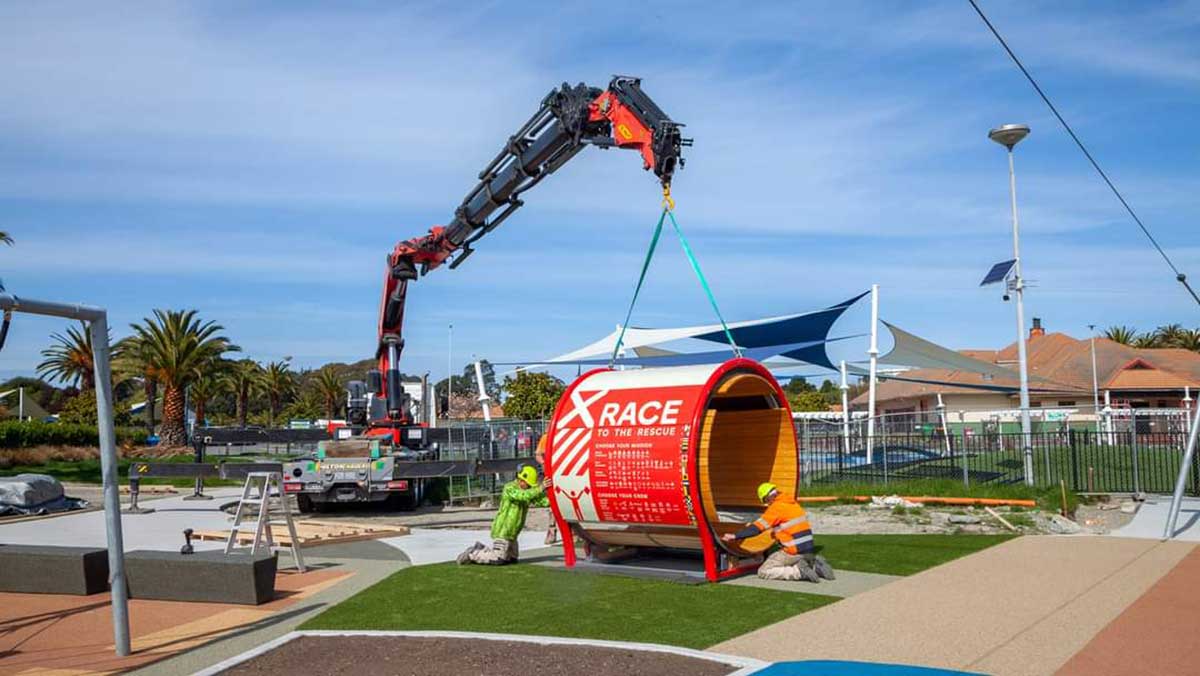
Race to the rescue with the Caroline Bay Playground Mousewheel. Signage was designed to help people connect to the sea rescue stories and choose the crew they wanted to race to the rescue with. The research and design for the signwriting was by Roselyn Fauth. Photo Geoff Cloake 2023

Timaru Rocket Brigade, c.1883 – This photograph, taken by William Ferrier in Timaru between 1882 and 1888, depicts the Timaru Rocket Brigade posed as if practicing on the rocks below the cliffs at Caroline Bay. The brigade was part of local lifesaving efforts, particularly important after shipwrecks such as the Benvenue disaster of May 1882. Notably, five men in the image are wearing their Benvenue medals, awarded for bravery in that rescue.
From left to right, the men are identified as: Alf Potts, Alf Allan, Arthur H. Turnbull (at back), Carl Vogeler (in front), Chris Gruhn, Adamson, Arthur Haylock, George Davies, W. Budd, James E. S. Jackson (First Lieutenant), W. Webster (Captain and Harbour Master), John McNab, W. J. Hughes, and George Shirtcliffe (manning the rocket trough).
The print, an original albumen POP photograph (275 x 195 mm), was captured at Timaru Harbour and is held under catalogue number 0847. Ferrier, William. Timaru Rocket Brigade, c.1883. Timaru Harbour, circa 1882–1888. Albumen POP photograph, 275 × 195 mm. Catalogue No. 0847. https://timdc.pastperfectonline.com/photo/8AD4780D-2050-40FB-AC62-704195806056
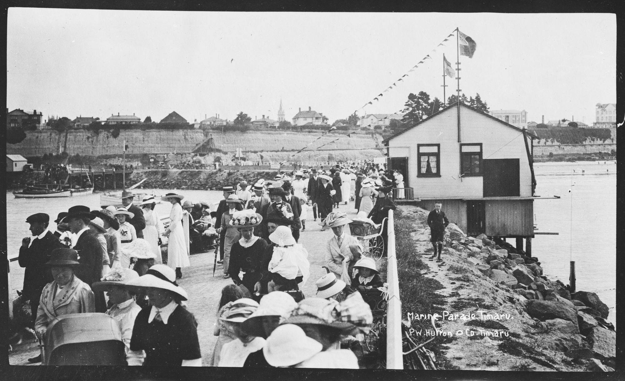
Looking along Marine Parade, Caroline Bay, Timaru showing a crowd gathered, pennants flying from building (right); boats anchored (left rear); buildings on skyline. Photo by P W Hutton & Co. Please acknowledge Auckland Libraries Heritage Collections 35-R1508. No known copyright restrictions.
Caroline Bay, Timaru, 1913, Dunedin, by Muir & Moodie. Te Papa (O.001836)
The 1862 Alexandra lifeboat is one of South Canterbury’s special maritime treasures.

Alexandra is named in honour of Princess Alexandra of Denmark in 1844. She married the future King Edward VII in 1863 and became Queen Consort when he ascended the throne in 1901. In UK colonies like New Zealand, naming streets, squares, and institutions after members of the royal family was more than token loyalty. It was a way to assert a sense of belonging. Alexandra, as consort to the heir for nearly 40 years, became a symbol of patience and steadfastness, qualities that were highly admired in a rapidly changing world. Invitation, 1901, New Zealand, by Benoni William Lytton White, A.D. Willis Ltd. Purchased 2001. Te Papa (GH009568)


The lifeboat Alexandra, manned by Waterside Workers for an unidentified parade, pictured on Sarah Street in Timaru, circa 1912. The lifeboat is shown harnessed to a team of Clydesdale horses and appears to be heading for or leaving a parade. Amongsat the flags flown are the American and Australian flags and the British ensign (among others), as well as a banner for "Timaru Waterside Workers". - South Canterbury Museum 1543
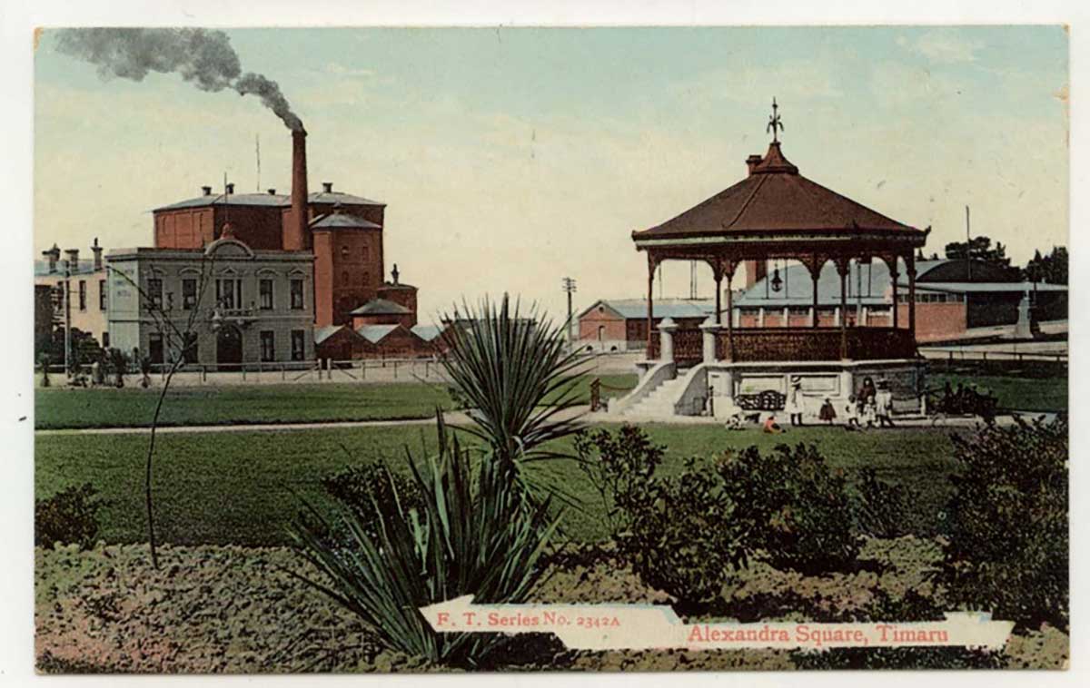
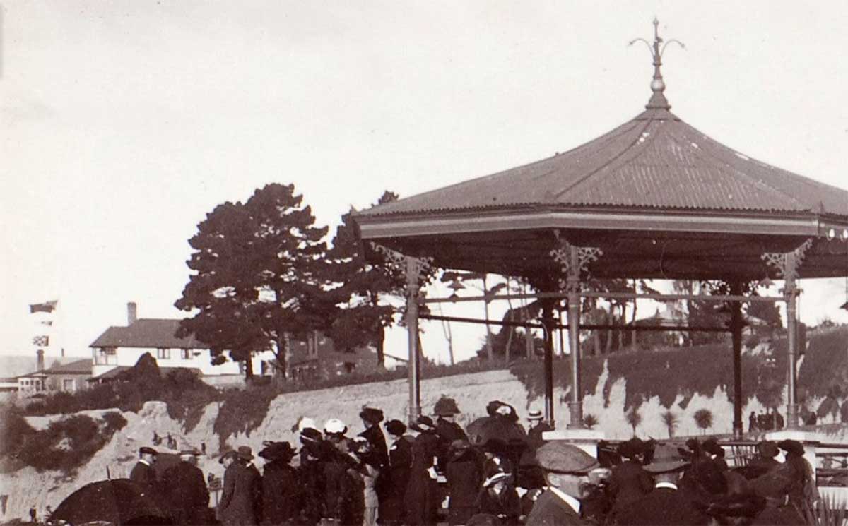
This bank rotunda and park iwas also named after her. Colour postcard entitled "Alexandra Square, Timaru", circa 1910. Features the band rotunda gifted by Charles Bowker in 1903 in the foreground, with the James Bruce & Co. (or Timaru Milling Co.) flour mill on High Street in the left background.
Seafarers monument on Perth Street. The first Seafarers’ Service was held at St Mary’s in 1955, organisers wanted not just to remember distant battles, but to root that remembrance in local waters. A century after those lifeboatmen risked everything, the wreath-laying at the Benvenue Monument became the local expression of that global tradition. Since 1965, it’s been the final stop of the annual Seafarers’ March — a place where history, faith, and community meet. Each wreath laid there links Timaru’s own stories of the sea with the wider story of all who serve upon it.
fun fact: New Zealand adopted its official national flag 1902
The lifeboat Alexandra, manned by Waterside Workers for an unidentified parade, pictured on Sarah Street in Timaru, circa 1912. The lifeboat is shown harnessed to a team of Clydesdale horses and appears to be heading for or leaving a parade. Amongsat the flags flown are the American and Australian flags and the British ensign (among others), as well as a banner for "Timaru Waterside Workers". - South Canterbury Museum 1543

Port Guards on a parade 1901 fundraising for Boer War South Canterbury Museum CN 1581. https://timdc.pastperfectonline.com/photo/F2AEFA31-B5FA-49EB-9EFC-577378580051