
By Roselyn Fauth
Have you ever explored Pātītī Point, reached the railing and looked down? Below the cliff sits a derelict concrete building covered in graffiti. It is the sort of thing that nags at me. Buildings do not usually end up below a cliff for no reason. What was it? Why was it there? And what used to happen on this edge of Timaru? So I went on a history hunt...
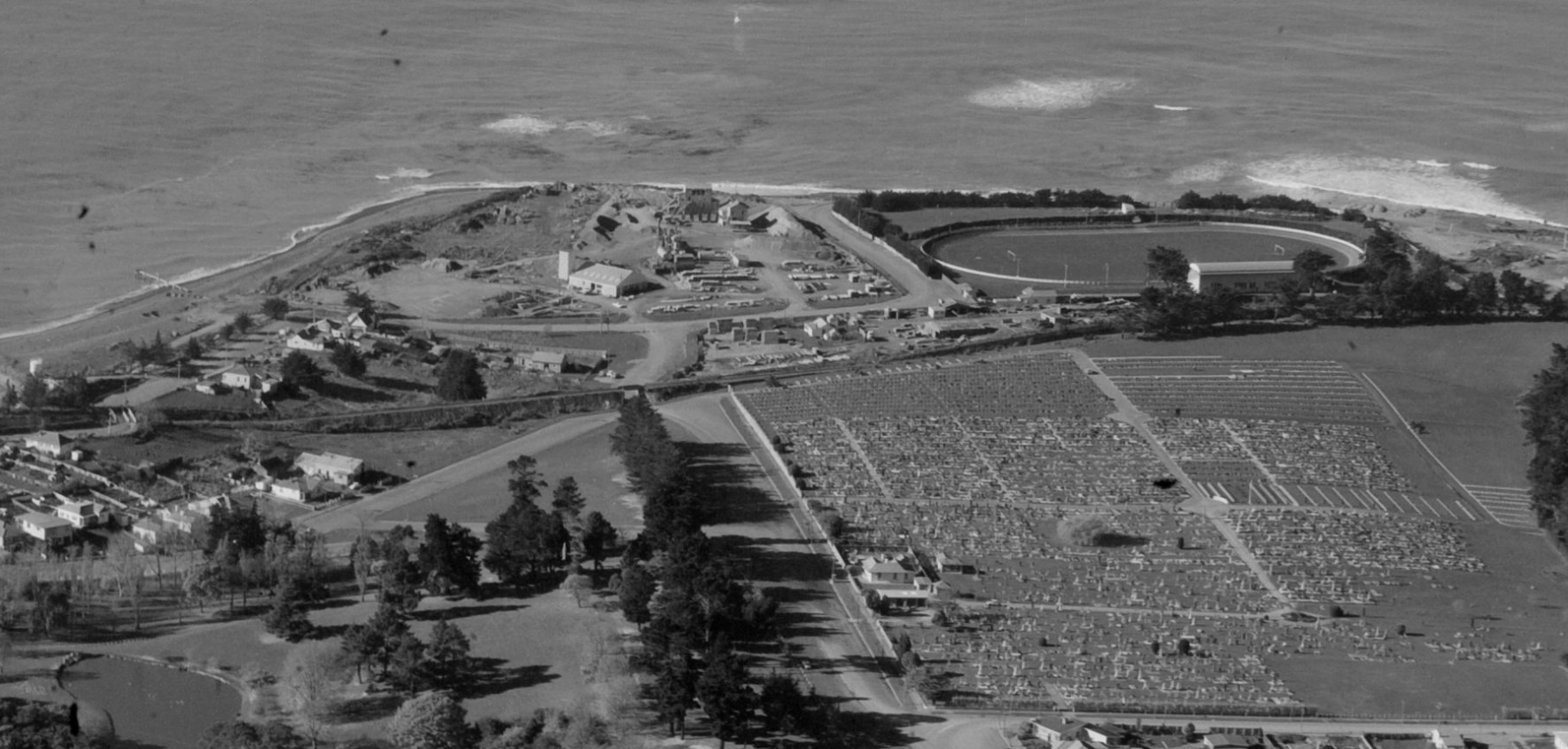
I still cannot prove exactly what the surviving building was used for yet, but I have discovered that Pātītī Point was once a busy working landscape, with a council stone crusher, a road-mixing plant and, later, a concrete company operating in the wider South Street area. Patiti Point Stone Crushing - Timaru. Whites Aviation Ltd Photographs - Timaru Whites Aviation Ltd-Alexander Turnbull Library Alexander Turnbull Library - Detail top
Timaru’s stone-crushing plant
The first firm clue came from the Timaru Herald.
On 20 May 1944, the newspaper reported that the Timaru Borough Council had re-erected its “crushing plant, bins and mixing plant” at Pātītī Point.
The machinery had previously operated at the corner of High and Queen Streets. According to the borough engineer, the new arrangement at Pātītī Point increased production by about 66 per cent.
That article finally explained what I was looking at. This was not simply a dumping ground or general council yard. It was a purpose-built system for crushing, sorting and mixing road material.
Source: Timaru Herald, 20 May 1944
https://paperspast.natlib.govt.nz/newspapers/THD19440520.2.18
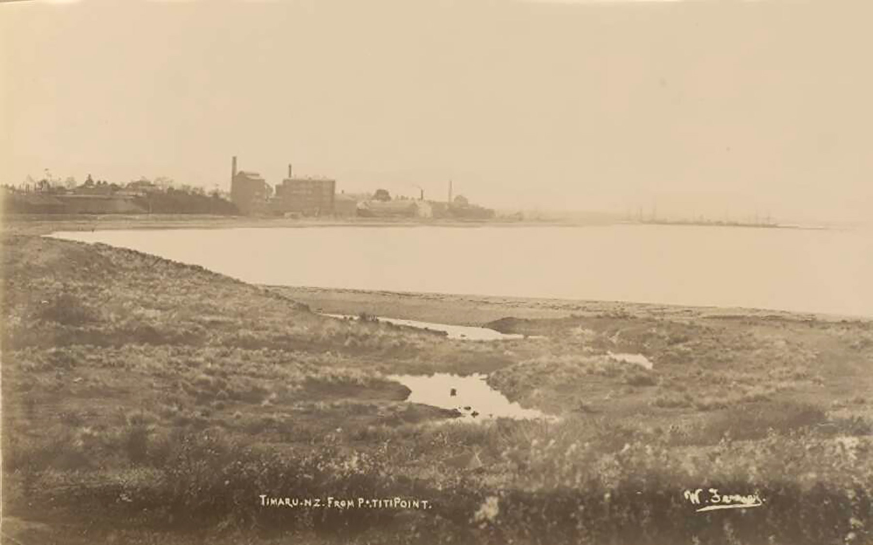
Timaru from Patiti Point1894-138616726 - 1-National Library of Australia - No Government Copyright Ownership
It was not a factory manufacturing cement.
It was a municipal stone or shingle crusher, combined with a plant that made material for Timaru’s roads. And Timaru’s roads, it turns out, had a recipe for the streets.
The same 1944 newspaper article described the ingredients used in the council’s “plant mix”.
It included crusher dust, quarter-inch screenings, sand and fine filler obtained from near the Ōpihi River. Bitumen was added to bind the mixture together.
The stones were crushed into carefully graded sizes, mixed with the finer material and stockpiled until council workers needed it.
Concrete uses cement and water to bind sand and aggregate together. The council’s plant mix used bitumen, the dark, sticky binder associated with sealed roads. So this was closer to an early road-mixing operation than a concrete works.
The searchable Papers Past transcription gives the amount of bitumen as “50 per cent”, but that is almost certainly a missing decimal point or another scanning error. Until the original newspaper page has been checked closely, I am not going to guess what the figure should be.
Sometimes an entire historical argument can hang on one tiny dot.

Timaru Foreshore. NZ Heritage Maps Platform, accessed 20/09/2025, https://maps.recollect.co.nz/nodes/view/404
Where did the stones come from?
This is where the story becomes less certain. While searching Papers Past, I found another useful clue in a 1941 report about a proposed factory for concrete electricity poles. During the discussion, the availability of shingle from the Timaru Borough Council crushing plant was mentioned as an advantage of building the factory in Timaru.
Source: Timaru Herald, 13 August 1941
https://paperspast.natlib.govt.nz/newspapers/THD19410813.2.45
That confirms the council plant was producing crushed shingle. It does not tell us where the raw stone came from. I have been told that the council had a yard near Domain Avenue and South Street, on the beach side of the road, and that stones were brought there during the horse-and-cart days.
That may be correct. The location beside the shingle coast certainly makes it plausible. But I have not yet found a council minute, engineering report or photograph proving that stones were collected directly from the beach or that the crusher had been operating there since the early 1900s.
The material may have come from the coast, a riverbed, a quarry or several different sources. For now, the horse-and-cart story is an important piece of local knowledge, but it still needs another document behind it.
What does the 1956 aerial photograph show?
The next clue came from above. A May 1956 aerial survey held in the national aerial photography collection shows Pātītī Point, South Street, the railway and the Caledonian Grounds. Beside the sports ground is a rough industrial yard containing buildings, tracks and pale areas that look like stockpiles or disturbed working surfaces.
Source: May 1956 aerial photograph, Land Information New Zealand collection
https://digitalnz.org/records/36434637
The location and appearance make the council crushing and works yard the most likely explanation. But aerial photographs have limits. They show shapes, shadows and tracks. They do not come with neat labels telling us what each building did. Without a council plan or an identified ground-level photograph, I cannot confidently say which structure was the crusher, which held storage bins, or whether the abandoned building below the cliff appears in the image.
It does, however, show that this was still an industrial landscape in 1956.
Then came Precision Concrete
I was also told that the South Street site was known as Precision Concrete Premix. That led me down another branch of the history hunt. Company records show that Precision Concrete Limited was incorporated in Timaru on 29 May 1961 and remained registered until November 1988.
Source: Precision Concrete Limited company record
https://www.companiesnz.com/company/126606/precision-concrete-limited
That date gives us one useful certainty. Precision Concrete did not exist when the 1956 aerial photograph was taken. The industrial yard visible in that image must belong to the earlier council operation or another use of the land.
Precision Concrete was a later chapter. Local recollection places its premixed-concrete plant on South Street, although I have not yet confirmed the plant’s exact address through a directory, property file or newspaper advertisement.
A premix plant would have combined cement, sand, aggregate and water to produce concrete for delivery to building sites. The council’s earlier plant used crushed aggregate and bitumen to make road material.
Two different mixtures. Two different operations. That probably explains why people remember both a stone crusher and a “cement plant” in the same area. The memories may be pointing to the right place, but compressing several decades of activity into one story.
Another concrete plant, somewhere else
There was one more concrete-related operation that needed to be ruled out. In 1941, the South Canterbury Electric Power Board considered establishing a factory to make concrete electricity poles. A Timaru site was discussed, partly because crushed shingle was available from the Borough Council plant. However, the factory was ultimately built at Washdyke. In June 1943, the Timaru Herald reported that a tender of £1,991 had been accepted for its construction there.
Source: Timaru Herald, 9 June 1943
https://paperspast.natlib.govt.nz/newspapers/THD19430609.2.27
So that was a third, separate operation. Timaru had a council stone crusher and road-mixing plant at Pātītī Point, a concrete-pole factory at Washdyke and, from the 1960s, Precision Concrete. No wonder the stories became muddled.
So what is the building?
The frustrating answer is that I do not know yet.
It appears to be a surviving clue from Pātītī Point’s former working landscape, but I have not found enough evidence to say whether it belonged to:
the Timaru Borough Council crushing and road-mixing plant
the wider council works yard
Precision Concrete
or another industrial or coastal operation
What we can prove is that by May 1944 the council had moved its crushing plant, bins and mixing equipment from High and Queen Streets to Pātītī Point.
We can also see an industrial yard beside the Caledonian Grounds in the 1956 aerial photograph.
Precision Concrete was incorporated five years later, in 1961, and is remembered as operating a premix plant in the South Street area.
The old building may be the last obvious fragment of that history.
Today, most people visit Pātītī Point to walk, watch sport, exercise their dogs or look out to sea. It is difficult to imagine the noise of crushers, carts, trucks and machinery operating nearby.
But look over the railing and there it is. Not quite an answer... a clue.
I would love to hear from anyone who remembers the council yard, Precision Concrete, the machinery or the building below the cliff. A photograph, job description, name or small family story may be enough to finish the history.
Sources
Timaru Herald, “Higher Output: Borough Plant Mix Process Described”, 20 May 1944
https://paperspast.natlib.govt.nz/newspapers/THD19440520.2.18
Timaru Herald, concrete-pole factory and Borough Council shingle discussion, 13 August 1941
https://paperspast.natlib.govt.nz/newspapers/THD19410813.2.45
Timaru Herald, concrete-pole factory tender at Washdyke, 9 June 1943
https://paperspast.natlib.govt.nz/newspapers/THD19430609.2.27
May 1956 aerial photograph of Pātītī Point and southern Timaru, Land Information New Zealand collection
https://digitalnz.org/records/36434637
Precision Concrete Limited company record
https://www.companiesnz.com/company/126606/precision-concrete-limited
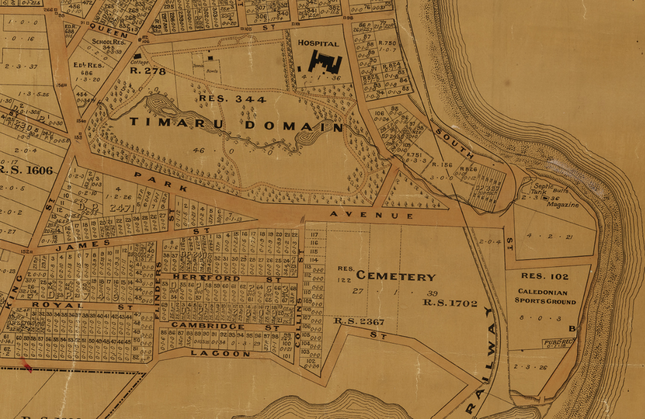
1911. Section of Miscellaneous Plans - Borough of Timaru, South Canterbury. R25538727. Borough of Timaru, South Canterbury. NZ Heritage Maps Platform, https://maps.recollect.co.nz/nodes/view/336
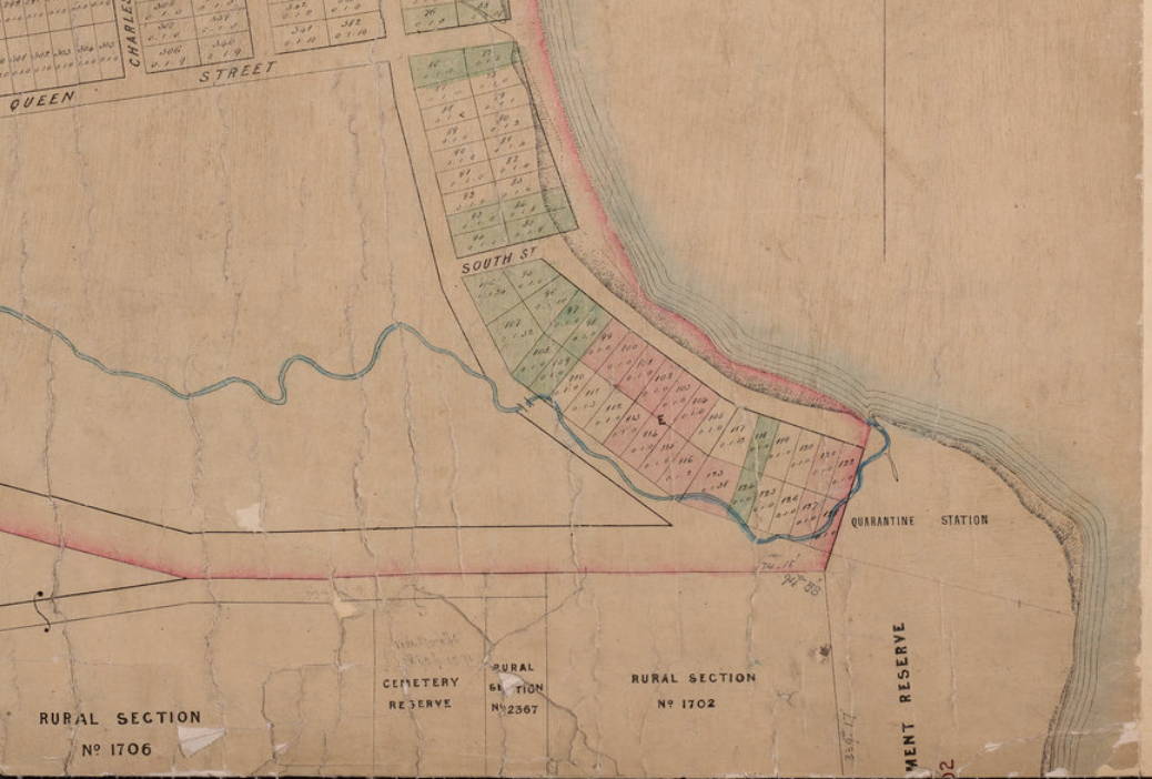
Timaru town. NZ Heritage Maps Platform, accessed 02/05/2026, https://maps.recollect.co.nz/nodes/view/1138
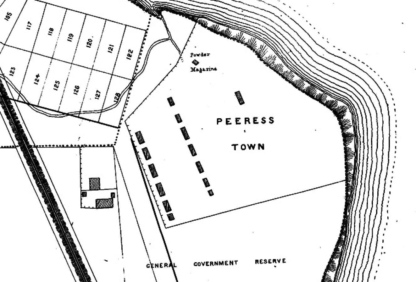
Section of a map showing detail of Peeress Town at Patiti Point 1875. Map Plan of Timaru Townships Canterbury Courtesy of the Timaru District Council

Pātītī "Patiti Point" Pātītī Point is located on the South Canterbury coastline at Timaru. Pātītī was a passenger on the Ārai-te-uru waka, which capsized off Matakaea on the North Otago Coastline. After the capsize, many of the passengers went ashore to explore the land. However, they needed to be back at the waka before daylight. Most did not make it, including Pātītī, and instead were transformed into many of the well-known landmarks of Te Waipounamu. In 1880, Hoani Kāhu from Arowhenua described Pātītī as “he kāinga nohoanga, mahinga kai, and he tauraka a waka” - kahurumanu.co.nz
Te Motumotu "Mutumutu Point" Te Motumotu is the correct spelling for Mutu Mutu Point on the coastline south of Timaru. In 1880, Hoani Kāhu from Arowhenua recorded that Te Motumotu was an awa (river) and tauraka waka (waka landing site). The foods gathered here included pipi, pāua, kina and kāeo. - kahurumanu.co.nz