
By Roselyn Fauth
What an old book can tell us about Timaru's significant coastal trees...
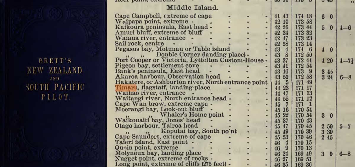
The book describes the coast south of Timaru as a long stretch of low cliffs and shingle beach running from Pātiti Point towards the Waitaki River, with several small streams and the Hunter Hills rising inland. It notes that the Waitaki was a powerful river, especially during the summer snowmelt, and marked a natural boundary between Canterbury and Otago.. Brett's New Zealand and South Pacific Pilot and Nautical Almanac for 1881,1882, and 1883. Published by H. Brett, Auckland, 1880 Brett_New_Zealand_and_South_Pacific_pilot.pdf and here https://archive.org/details/brettsnewzealand00tillrich
I had always been told that Timaru’s coastal trees were special, and that there was a heritage reason they had not been cut down when Blackett’s Lighthouse was relocated to the Benvenue Cliffs.
It was one of those local stories I had heard, but I haven't read hard evidence to cite and be sure. I had a vague idea that the trees had once helped sailors find Timaru, and that Captain Belfield Woollcombe may have planted them, but I did not know which trees the story referred to, where the information had come from or whether anyone had ever written it down.
I assumed that the lighthouse and the trees belonged to the same story. Once I started looking, however, the evidence led in several directions, and what emerged was much more interesting than I had expected to find...
The trail led first to a book printed in Auckland nearly 150 years ago...
It was not a local history or a book about trees. It was a practical handbook for the people responsible for navigating ships around New Zealand and the South Pacific.
Brett’s New Zealand and South Pacific Pilot with Nautical Almanac for 1881, 1882 and 1883 was printed by Henry Brett around 1880 and edited by Captain Thomas Capel Tilly. The surviving volume contains 288 pages of sailing directions, followed by a nautical almanac.
At first glance, let's be honest, to a non mariner, it is not especially inviting. Its pages are packed with place names, distances, bearings, reefs, anchorages, tides and instructions. It was not written to entertain anyone or preserve stories for future historians. It was made to be useful.
But that usefulness was important. Before electronic charts and GPS, a navigator had to compare what appeared from the deck of a ship with what was described in the sailing directions. The shape of the coast, the height of a headland, the position of a river mouth, the depth of the water, a building, a flagstaff or an unusual group of trees could all contribute to recognising a place.
So, the book was not just the work of one man remembering everything he had seen at sea... Pilot guides gathered information from surveys, official sailing directions, harbour authorities and mariners familiar with particular waters. Tilly organised that accumulated knowledge into a form that could travel from one ship to another. In some ways, it was a nineteenth-century navigation database made from ink and paper.
After a quick search, I spied a section with “Timaru”, where a small note explained the account had been “corrected from information received from Harbourmaster”.
The harbourmaster is not named and the note tells us is that the Timaru section incorporated information received from someone with local maritime responsibility. This was not simply a distant publisher describing our coast from an office in Auckland, it was validated.
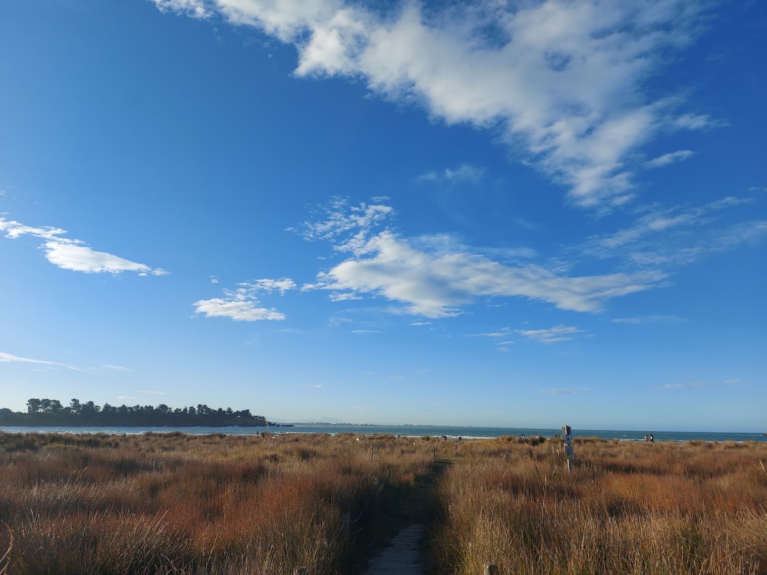
View from Caroline Bay to the Macrocarpa trees on Dashing Rocks cliffs - below is a natural basalt apron lava source from waipouri mt horrible. I have been told that macrocarpa and native Ngaio was planted in our cliffs as it was well known to be tolerant of salt laden sea air, is very fast growing and has a wide spreading root system that holds the hill sides. Photo Roselyn Fauth 2026 05 09
Then, on page 147, I found the sentence that changed the direction of the whole search: “Seven miles northward of Timaru two isolated clumps of trees will be seen about three miles inland.”
The book goes on to describe these clumps as the first wood seen along the coast south of Banks Peninsula. The description tells us not only that the trees existed, but why they were noticeable.
Today we are used to looking across a landscape marked by gardens, parks, plantations, farm shelterbelts and mature trees. The nineteenth-century coast encountered by mariners was more open, and two isolated clumps standing several miles inland could form a conspicuous shape against the surrounding country.
The language in the pilot is practical, it gives the navigator an approximate location and something distinctive to look for. The trees were not included because somebody thought they were attractive. They were included because they could be recognised from the sea. I dont think a captain would not have relied upon them alone to determine a ship’s position. The Timaru directions also described the coastline, distant ranges, soundings, reefs and other visible features. Navigation probably depended on comparing several clues, and the trees would have been part of that, helping turn an unfamiliar stretch of coast into a recognised place.
The book records another important part of Timaru’s navigational landscape. Blackett’s original lighthouse was operating above the town when the pilot was published, and the sailing directions described its fixed white light and how it could be used by vessels approaching the roadstead. Keep in mind that at that time the lightouse was not on its current perch above the Benvenue Cliffs, but over looking the Port from Le Crens Terrace.
This enabled mariners to read both constructed and landscape features: the formal harbour light, the cliffs, the distant hills, the depth of the water and conspicuous groups of trees.

The Blackett Lighthouse was originally on the Terrace, No. 7. It was later relocated to the corner of Te Weka Street and Benvenue Ave, and then again to the Benvenue Cliffs. It is a Category II structure and the Historic Places Trust. LEFT: The Lighthouse at its current site in 2021. Courtesy of Roselyn Fauth. RIGHT: Timaru's lighthouse being relocated 1980. Courtesy of South Canterbury Museum 2014/107.73
It was while following this trail that Captain Belfield Woollcombe returned to the story.
I remembered reading that Woollcombe had planted trees along Timaru’s coast to help people approaching from the sea. I eventually found the statement in my own WuHoo Timaru Tree Tour notes. The entries for macrocarpa at Patiti Point and Benvenue say they were planted by Woollcombe to aid navigation from the sea. While I now had my earlier notes that named the tree, the person, the purpose and two locations, it also creates a research problem... although the statement survives in our Tree Tour, I have not yet been able to trace the original source from which it came, a lesson I have learned on my history hunting, always record your sources! It may have been taken from a council tree record, museum note, interpretation panel, local publication, plaque or conversation with somebody who knew the history. Until we find that source, I cannot use my earlier website entry as independent proof of the claim, I will have to hunt it out.
However, for now, it is a useful reminder of how easily local information can begin to look authoritative. One person records a story, another repeats it, and eventually the original evidence becomes difficult to find.
What we can prove about Woollcombe makes the tradition worth taking seriously.
Belfield Woollcombe entered the Royal Navy as a young man and served for about 21 years before coming to Canterbury. He arrived in Timaru in 1857 as a government agent with a remarkable range of responsibilities. Contemporary and later records associate him with the duties of Resident Magistrate, Customs Officer, Beachmaster, Harbourmaster and Pilot. A report of his death in 1891 recalled his naval career and his arrival in Timaru as a government officer with “multifarious duties”.
These were not ceremonial titles, Timaru was an exposed roadstead, and ships generally remained offshore while people and cargo crossed the surf in smaller boats. Woollcombe’s duties required practical knowledge of the coastline, weather, shipping and the dangers faced by vessels approaching Timaru.
In 1861, while serving as Timaru’s beachmaster, Woollcombe wrote to the Provincial Council recommending that line-throwing rescue equipment be obtained for the port. That is a small but revealing example of his concern with maritime safety.
He remained involved in harbour affairs later in life and was still appearing in records concerning the Timaru Harbour Board during the late 1880s.
He was therefore exactly the sort of person who would have understood the value of a distinctive feature that could be recognised from the sea. A former naval officer, harbourmaster and pilot did not need to be told that trees, buildings or other marks on shore could help mariners read a coastline.
The type of tree also makes some practical sense.
Macrocarpa, also known as Monterey cypress, was introduced to New Zealand during the 1860s and planted widely for shelter. It grew well through much of lowland New Zealand and proved more tolerant of coastal wind and salt spray than radiata pine, making it a preferred shelter tree on coastal farms.
A mature group of macrocarpa could survive Timaru’s exposed conditions and form a dense, recognisable silhouette when seen from offshore. The timing is also broadly possible: macrocarpa was being introduced to New Zealand while Woollcombe was active in Timaru.
That botanical evidence helps explain why macrocarpa could have been chosen, but it does not prove that Woollcombe planted the trees at Patiti Point or Benvenue, nor that navigation was their original purpose.
There is also a geographical problem.
The pilot places its two clumps seven miles north of Timaru and approximately three miles inland. Patiti Point lies south of the town, while Benvenue is on Timaru’s northern coastal edge but not several miles inland. Woollcombe’s Ashbury property was also much closer to the town than the location described in the book.
- There were two isolated clumps north of Timaru that appeared in nineteenth-century sailing directions and were remarkable as the first wood seen south of Banks Peninsula.
- There is a local tradition, preserved in our Tree Tour notes, that Woollcombe planted macrocarpa at Patiti Point and Benvenue to assist navigation from the sea.
- There were trees associated with Woollcombe and his Ashbury property.
There are surviving coastal macrocarpa that continue to shape the appearance of Timaru.
There is also Blackett’s Lighthouse, originally erected in 1877–78, later moved to Māori Park and relocated to the Benvenue Cliffs in 2010. Heritage New Zealand’s listing confirms the importance of the lighthouse and identifies the listed place as the structure and its immediate site, but it does not identify the surrounding trees as Woollcombe plantings or historic navigation marks.
There is another important part of the story that cannot be ignored... maritime understanding of this coast did not begin with European pilot books, harbourmasters or lighthouses.
Māori had travelled, named and understood these waters for generations. Their knowledge of the coast included currents, winds, stars, reefs, river mouths, landing places, food-gathering areas, trails, seasons and named features within a cultural landscape.
Brett’s Pilot belongs to a later European system in which observations were gathered, standardised and distributed through books and charts. These were different knowledge traditions, but both depended upon people learning how to read place carefully.
So, what can we now say with confidence?
- We know that two clumps of trees north of Timaru were considered conspicuous enough to be included in a practical navigation guide.
- We know the Timaru section had been corrected using information received from a harbourmaster.
- We know Captain Woollcombe had the naval experience, local responsibilities and practical knowledge to understand the value of visible landmarks to shipping.
- We know macrocarpa was introduced during the period in which he lived here and was particularly well suited to exposed coastal conditions.
- We also know that our earlier Tree Tour notes attribute the Patiti Point and Benvenue macrocarpa to Woollcombe and describe them as navigation plantings.
- What we do not yet have is the original source proving that he planted those particular trees for that particular purpose.
Nor can we confidently identify the Woollcombe trees with the two clumps described in Brett’s Pilot. The geography does not currently match, and it may be that Timaru had several groups of trees that became useful to mariners for different reasons.
We began with a simple local tradition about trees and a lighthouse. The investigation has revealed an older navigational landscape in which mariners read the coast through a combination of water depth, hills, cliffs, lights, reefs and vegetation. It has restored Captain Woollcombe’s maritime experience to the story, while also reminding us not to turn a plausible connection into a proven fact before we find its source.
It has even made me question the information on our own website, which is exactly what good history hunting should do.
Sometimes we begin by trying to confirm something we have always believed, only to discover that the real story is larger, less tidy and far more interesting.
I now look at Timaru’s coastal trees differently. They are part of the landscape we have inherited, but this old pilot reminds us that a landscape is not only something people look at. It can also be read, used and remembered.
Somewhere north of Timaru, two clumps of trees once stood out clearly enough to be recorded in a South Pacific navigation guide.
Elsewhere along our coast, local tradition says Captain Woollcombe planted macrocarpa to help mariners recognise Timaru from the sea.
The two stories may eventually meet, or they may prove to belong to different trees and different places.
Either way, the trees were more than scenery.
For somebody standing on the deck of a ship and looking towards land, they could be information.
They could tell you that you were approaching Timaru.
The evidence trail
Brett’s New Zealand and South Pacific Pilot with Nautical Almanac for 1881, 1882 and 1883, edited by Captain T. C. Tilly and printed by Henry Brett around 1880.
Belfield Woollcombe’s 1891 death report, recording his naval service and his appointment in Timaru as a government agent with numerous duties.
A 1931 historical account recording Woollcombe’s work as beachmaster and his request for maritime rescue equipment in 1861.
Heritage New Zealand’s listing for Blackett’s Lighthouse.
Te Ara’s account of macrocarpa’s introduction and use as a salt-tolerant coastal shelter tree.
The next part of this history hunt is to find the source behind the Woollcombe statement.
Do you remember an old plaque, council publication, tree register or museum display describing the macrocarpa at Patiti Point or Benvenue? Does your family have an early photograph, map, farm history or harbour story that could help us identify the trees?
We have found the trees in the book.
Now we need to find the evidence that connects them to the landscape...
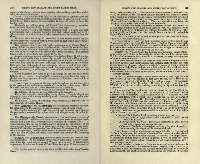
https://archive.org/details/brettsnewzealand00tillrich/page/148/mode/2up
BRETT'S new ZEALAND AND SOUTH PACIFIC PILOT.
Now always be launched under the breakwater. Vessels requiring a pilot may always, in daylight, rely upon being boarded.
From Patiti Point southward the coastline is again formed of low cliffs fronted by a shingle beach, and extends 30 miles in a south direction to Waitangi (chart, Waitaki) River, with several small streams intervening. A high mountain range, 3,500 feet (the Hunter's Hills) approaches within a few miles of the coast between Timaru and Waitaki River.
Waitaki River is a considerable stream ; its entrance may be known by the low tongue of land it appears to have thrown out from the hills near. Its velocity in summer, during the melting of the snows, is so rapid as to render it unfit even for boats to enter. This river may be said to form a natural boundary between the Canterbury and Otago settlements.
The Coast from Waitaki River trends S.S.W. 25 miles, to Look-out Bluff. The low cliffy coast with shingle beach continues for 15 miles, as far as Cape Wanbrow, a protecting bluff' of moderate height, thence it assumes a different aspect, being broken into sandy or shingle bays, with cliffy points between.
Oamaru. — (For description of breakwater, etc., at this important place see page 37). Close northward of Cape Wanbrow is Oamaru, a safe anchorage with all winds excepting those between N.N.E. to S.8.E.
Outer Anchorage. — There are no leading marks for this; vessels can stand in till within a mile of the breakwater and anchor in 5 and 5^ fathoms. The same remarks as for ships anchoring off' Timaru apply here; there is a good boat establishment.
Light. — A r^^/ light is shewn at the bluff, visible from seaward five to seven miles, on all points from N.N.W. to S. by W. K green light is shewn on the end of the breakwater in fine weather, and when that cannot be done the danger lights are hoisted on a flagstaff immediately south of the breakwater, viz., " Put to sea " or " Keep to sea " — by day, two balls horizontal on yard on either side of mast ; by night, two white lights horizontal, with red light between.
Caution. — Masters of vessels in the roadstead will have to exercise judgment as to the practicability of getting their vessels to sea, as these signals have at times to be exhibited during calm weather.
It is H.W. F. & C. 2h. 50m., range 5 to 7 feet.
Note. — The above is corrected from information received from local sources. When the works are completed, revised directions will be necessary.
Moeraki Bay. — Look-out Bluff (Awa-Mokihi) is the north point of this bay, Whalers Home Point being its southern extreme. The bay is five miles long north and south, and two in depth; the coast line is fronted with a sandy beach; a reef nearly three miles long, covered with kelp, extends nearly across its entrance from north to south, 1^ miles distant from the beach, and is a great protection to the bay; there is anchorage for coasters, though not prudent to remain with any symptoms of bad weather from the eastward.
Light. — K fixed white light is shewn from the southern point of Moeraki Peninsula, on a white tower 28 feet high. The light is 170 feet above the level of the sea, and is visible as far round as the land allows for 19 miles.
Whalers Home Point, the eastern extreme of a cliffy projection, is nearly three miles in length, with sandy coves on its north and south sides, forming good boat harbours. A small islet (White Islet) and some scattered rocks, underwater, covered with kelp, lie half a mile off its northern part; If miles eastward of its southern extreme is Fish Reef, extending in a northwest and south-east direction one mile, uncovered at low water, and has deep water close outside.
From Moeraki Bay a sandy bay extends five miles, the south extreme of which is Vulcan Point. Shoal water extends two miles southward of this point, at the extreme of which is Danger Reef, a sunken rock, marked by kelp. Three remarkable mountain cones rise just southward of Vulcan Point, two or three miles from the coast.
"Waikouaiti Bay, 17 miles southward of Whalers Home Point, and 10 miles north of Otago Harbour, has a clean sandy beach two miles in extent; its southern point is Mistaken Islet, close northward of which is the now always be launched under the breakwater. Vessels requiring a pilot may always in daylight rely upon being boarded.
From Patiti Point southward the coastline is again formed of low cliffs fronted by a shingle beach, and extends 30 miles in a south direction to Waitangi (chart, Waitaki) River, with several small streams intervening. A high mountain range, 3,500 feet (the Hunter's Hills), approaches within a few miles of the coast between Timaru and Waitaki River.
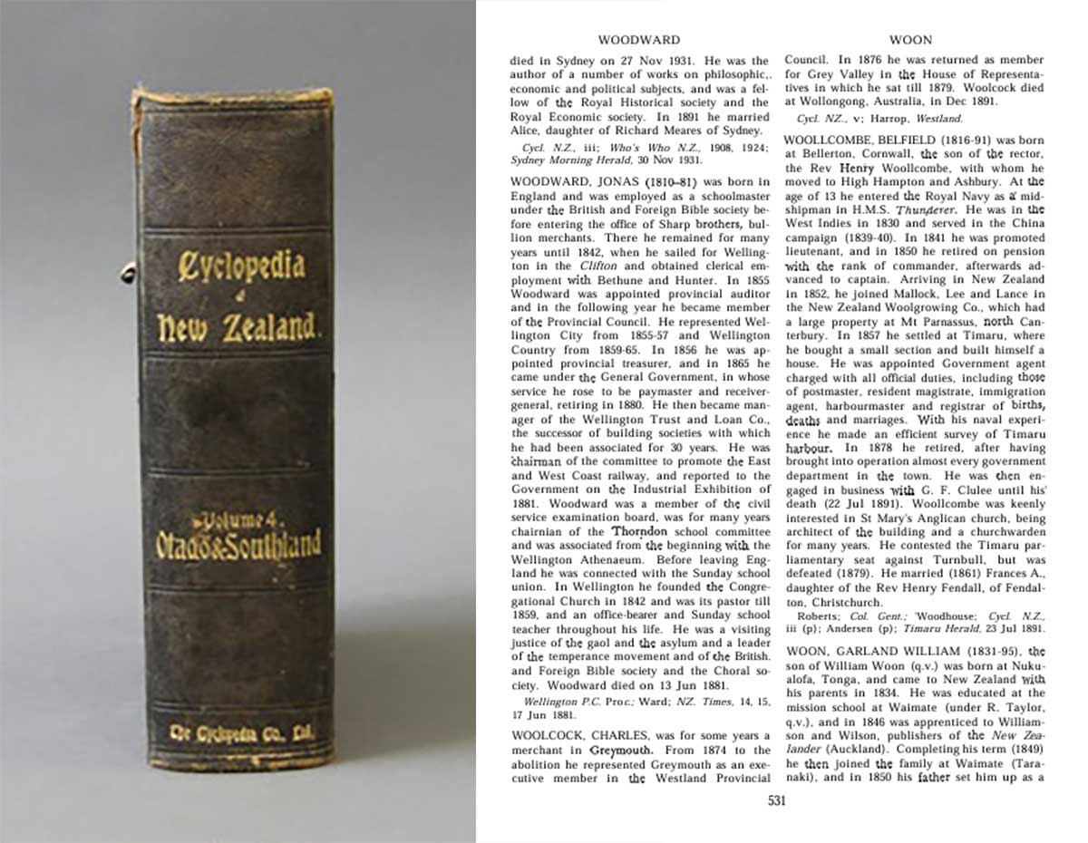
Belfield Woollcombe
WOOLLCOMBE, BELFIELD (1816-91) was born at Bellerton, Cornwall, the son of the rector, the Rev Henry Woollcombe, with whom he moved to High Hampton and Ashbury. At the age of 13 he entered the Royal Navy as a midshipman in H.M.S. Thunderer. He was in the West Indies in 1830 and served in the China campaign (1839-40). In 1841 he was promoted lieutenant, and in 1850 he retired on pension with the rank of commander, afterwards advanced to captain. Arriving in New Zealand in 1852, he joined Mallock, Lee and Lance in the New Zealand Woolgrowing Co., which had a large property at Mt Parnassus, north Canterbury. In 1857 he settled at Timaru, where he bought a small section and built himself a house. He was appointed Government agent charged with all official duties, including those of postmaster, resident magistrate, immigration agent, harbourmaster and registrar of births, deaths and marriages. With his naval experience he made an efficient survey of Timaru harbour. In 1878 he retired, after having brought into operation almost every government department in the town. He was then engaged in business with G. F. Clulee until his death (22 Jul 1891). Woollcombe was keenly interested in St Mary's Anglican church, being architect of the building and a churchwarden for many years. He contested the Timaru parliamentary seat against Turnbull, but was defeated (1879). He married (1861) Frances A., daughter of the Rev Henry Fendall, of Fendalton, Christchurch.
Roberts; Col. Gent.; Woodhouse; Cycl. N.Z., iii (p); Andersen (p); Timaru Herald, 23 Jul 1891. https://dict-bio.howison.co.nz/person/belfield-woollcombe https://nzhistory.govt.nz/sites/default/files/documents/dnzb-1940/scholefield-dnzb-v2.pdf

The view of the Caroline Bay coastline in 1874. This is a section of a watercolour painting by Sir Eliot Whately (1841-1927). Depicts Caroline Bay, Timaru in October 1874. nla.gov.au/nla.obj-138581877

J. S. Browning, (1831 – 1909), Timaru Looking North West, 1860, file copy print, Hocken Collections, Uare Taoka o Hākena, University of Otago.
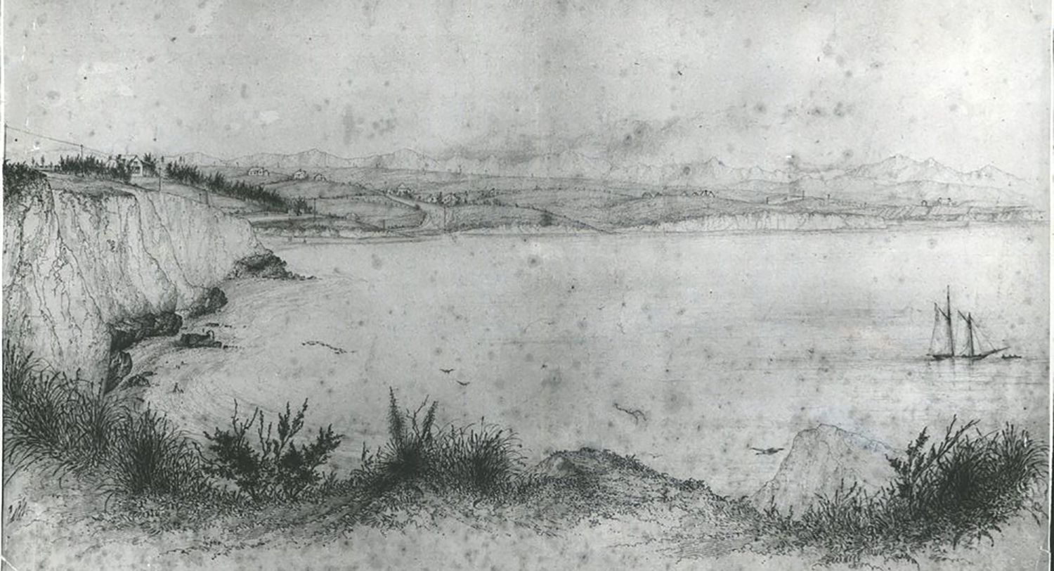
Sketch of Caroline Bay, Timaru By E. Norman - Copied from original held in South Canterbury Historical Museum, Timaru, 1870
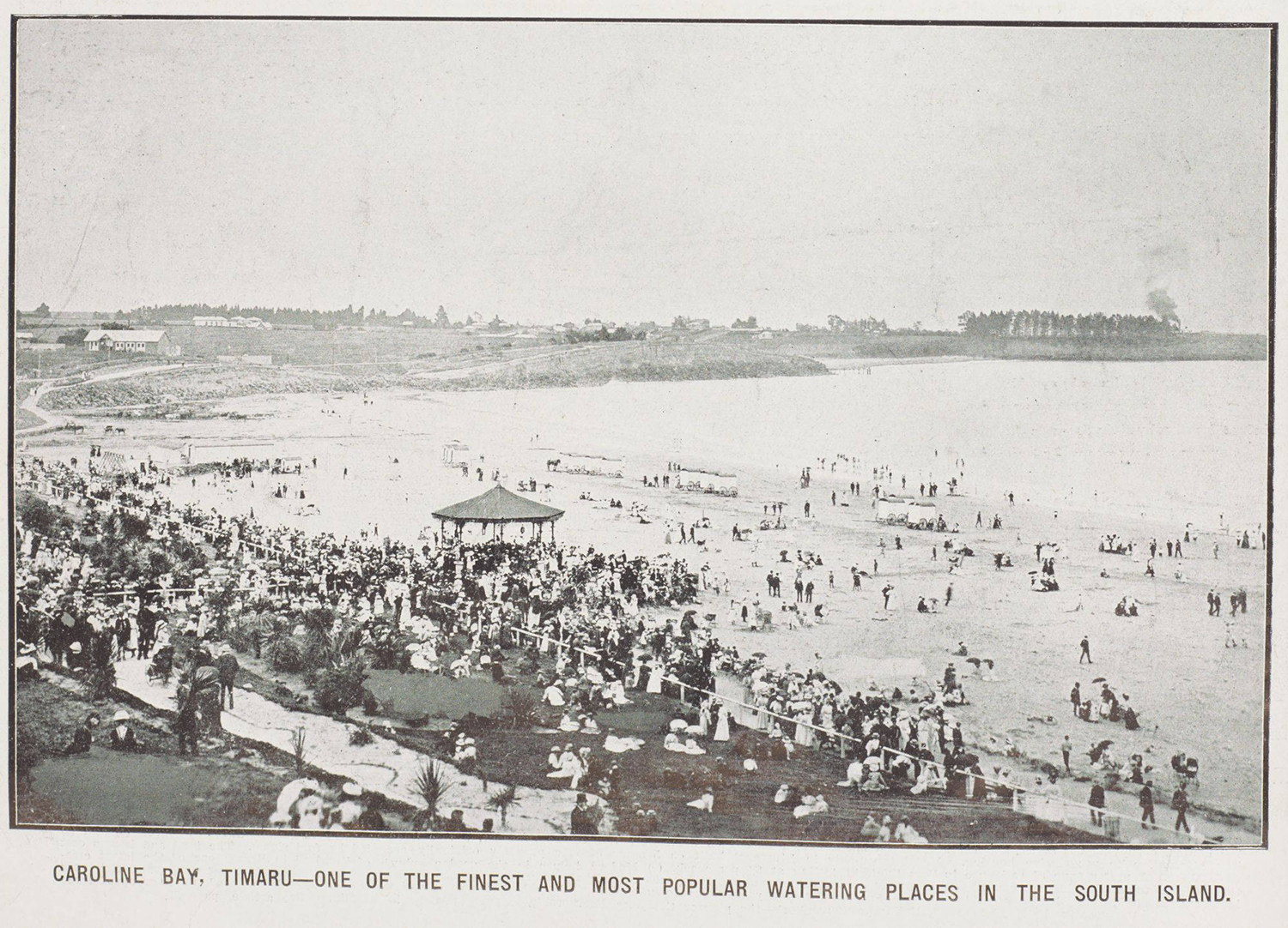
1912-01-03 - Caroline Bay Timaru - one of the finest and most popular watering places in the South Island. The New Zealand Graphic and Ladies Journal, 3 January 1912, p.32. Auckland Libraries Heritage Collections NZG-19120103-0032-02. https://kura.aucklandlibraries.govt.nz/digital/collection/photos/id/148072/rec/222 View on Papers Past: https://paperspast.natlib.govt.nz/periodicals/new-zealand-graphic/1912/01/03
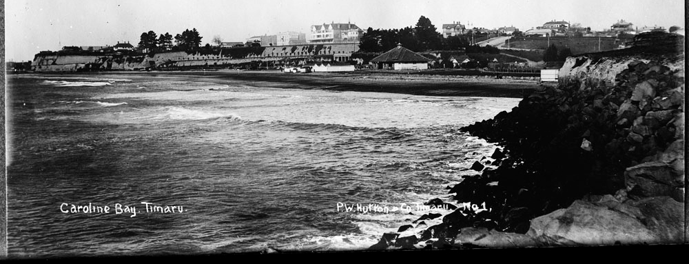
Caroline Bay. Timaru. P.W.Hutton and Co. Timaru. No.1. Looking south along Caroline Bay, Timaru. Showing (above bay, centre) the Dominion Hotel -Stafford Street North (John Reilly - proprietor), to the right of this is the gabled Hydro Grand Hotel. Below the hotel can be seen the Piazza. Beneath this (at beach level) are the bathing sheds. At right is the Pavillion, and far right the tennis courts. - Auckland Libraries Heritage Collections 35-R1501

Aerial view of Timaru, showing Caroline Bay, harbour and town by Frank Douglas Mill - 1927-1937 - Auckland Libraries Heritage Collections FDM-0690-G
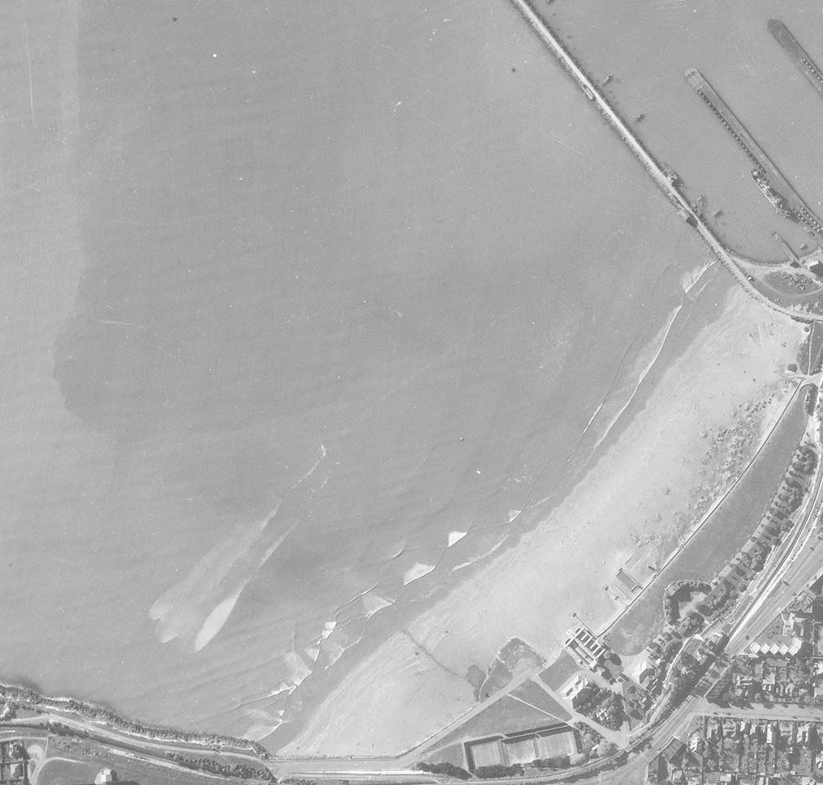
1938 - Caroline Bay arial photo taken 1938 - Retrolens-Linz-Survey Number: SN86
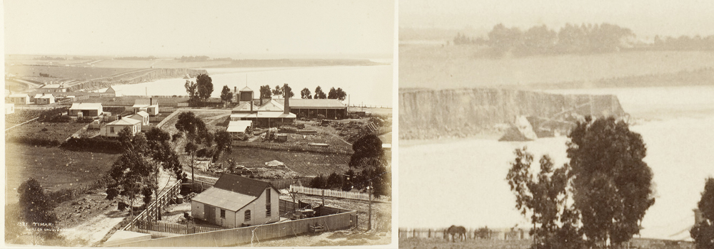
This photograph shows the Ben Venue wreck in the distance wrecked on the basalt rock apron below the cliff c1880s. Curtosey of Te Papa; Timaru, 1880s, Timaru, by Burton Brothers studio. Purchased 1991. Te Papa (O.034179)

Engraving showing the Timaru Breakwater 1888. Picturesque atlas of Australasia"; The Picturesque Atlas Publishing Co.
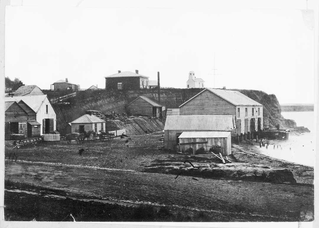
Government Landing Service at the foot of Strathallan Street, Timaru, 1860s. Shows buildings by the waterfront and possibly the shed where the lifeboat was stored. - tiaki.natlib.govt.nz/366331
 The Wrecks at Timaru, New Zealand: The Ships on Shore – This wood engraving, created by A. C. Cooke and published by Martin Ebsworth on June 17, 1882, depicts the City of Perth and Benvenue shipwrecked on the shores of Timaru. Originally featured in The Australasian Sketcher, the engraving illustrates the aftermath of the shipwrecks. This work is out of copyright, with no restrictions on use.
https://find.slv.vic.gov.au/permalink/61SLV_INST/1sev8ar/alma9917766133607636
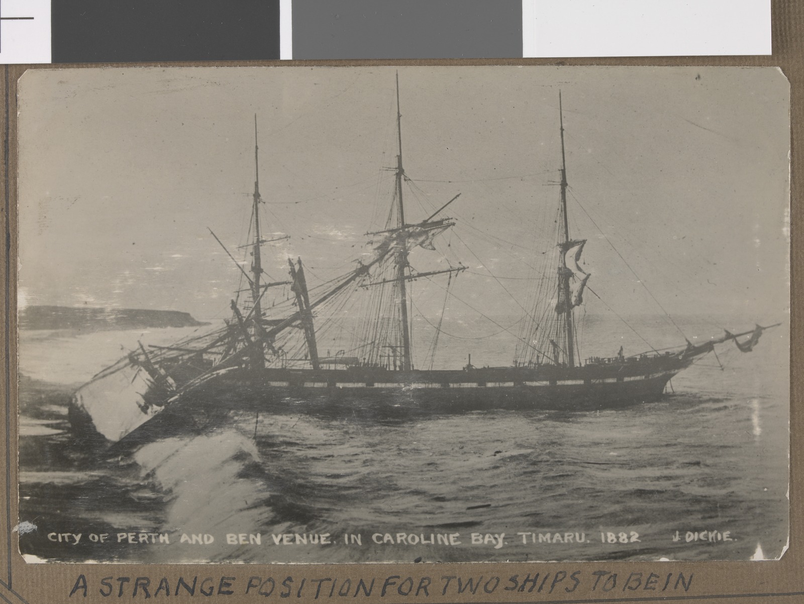
A Strange Position for Two Ships to Be In – Photograph by J. Dickie, featuring two wrecked sailing ships, City of Perth and Ben Venue, on the beach at Caroline Bay, Timaru, in 1882. The gelatin silver print measures 8.6 x 13.5 cm. This work is out of copyright, with no restrictions on use. https://find.slv.vic.gov.au/permalink/61SLV_INST/1sev8ar/alma9917507453607636
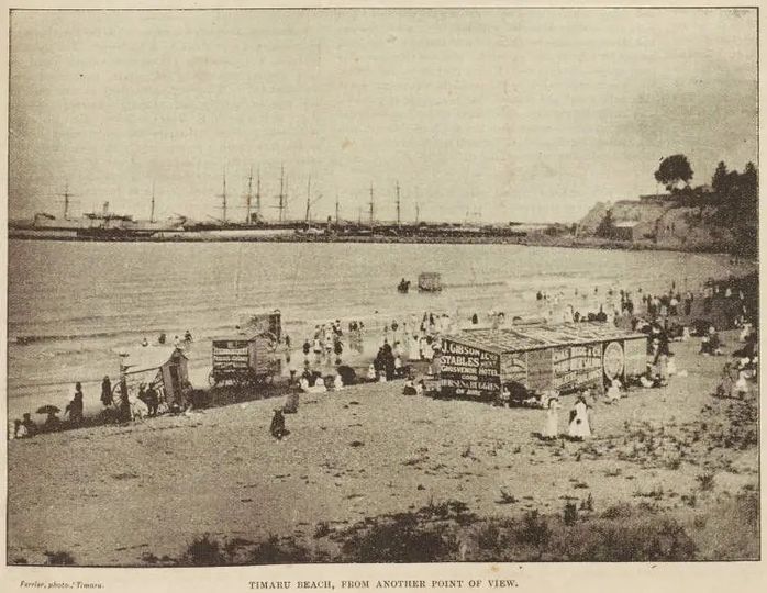
It's amazing to see how quickly the sand has built out at Caroline Bay since the breakwater at the Port was constructed in the 1880s. Before that, the sea lapped up to the bottom of the cliffs.
This is pretty close to the Tearooms and where the new playground is being constructed, except look how close the sea was to the cliffs back 129 years ago!
In this 1894 photo by William Ferrier, you can see bathing carts on Timaru's new Caroline Bay. People used carts moved by horses to get changed inside. And at one point they even backed into the sea, so ladies could keep their modesty while bathing. Interesting to see who has taken advantage of the advertising opportunity and sign written the carts.
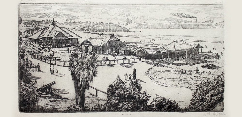
This detailed etching from 1923 shows a familiar view looking out over Caroline Bay. To the left is the Bay Hall built in 1914 which is still recognisable today. The cannon in the foreground was one of two cannons from the Crimean War (1853-56) that once stood either side of the Caroline Bay Sound Shell. In 1941 both cannons were melted down as scrap metal to be reused in World War II. A.J. RAE (1885-1971) Caroline Bay (1923). Etching on paper. Courtesy of Aigantighe Art Gallery
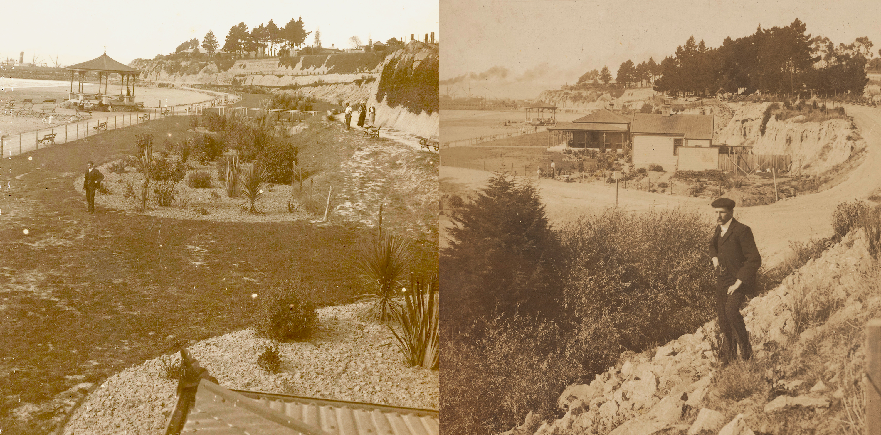
Left: The Esplanade, Caroline Bay, Timaru, circa 1900, Melbourne, by George Rose. Purchased 1999 with New Zealand Lottery Grants Board funds. Te Papa (O.022112)
Right: Caroline Bay, Timaru, New Zealand, circa 1900, Melbourne, by George Rose. Purchased 1991. Te Papa (O.004821)
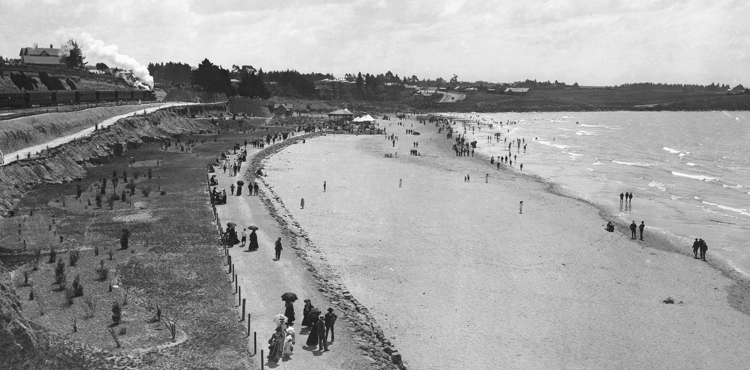
Caroline Bay, Timaru, 1900s, Dunedin, by Muir & Moodie. Te Papa (C.014386)
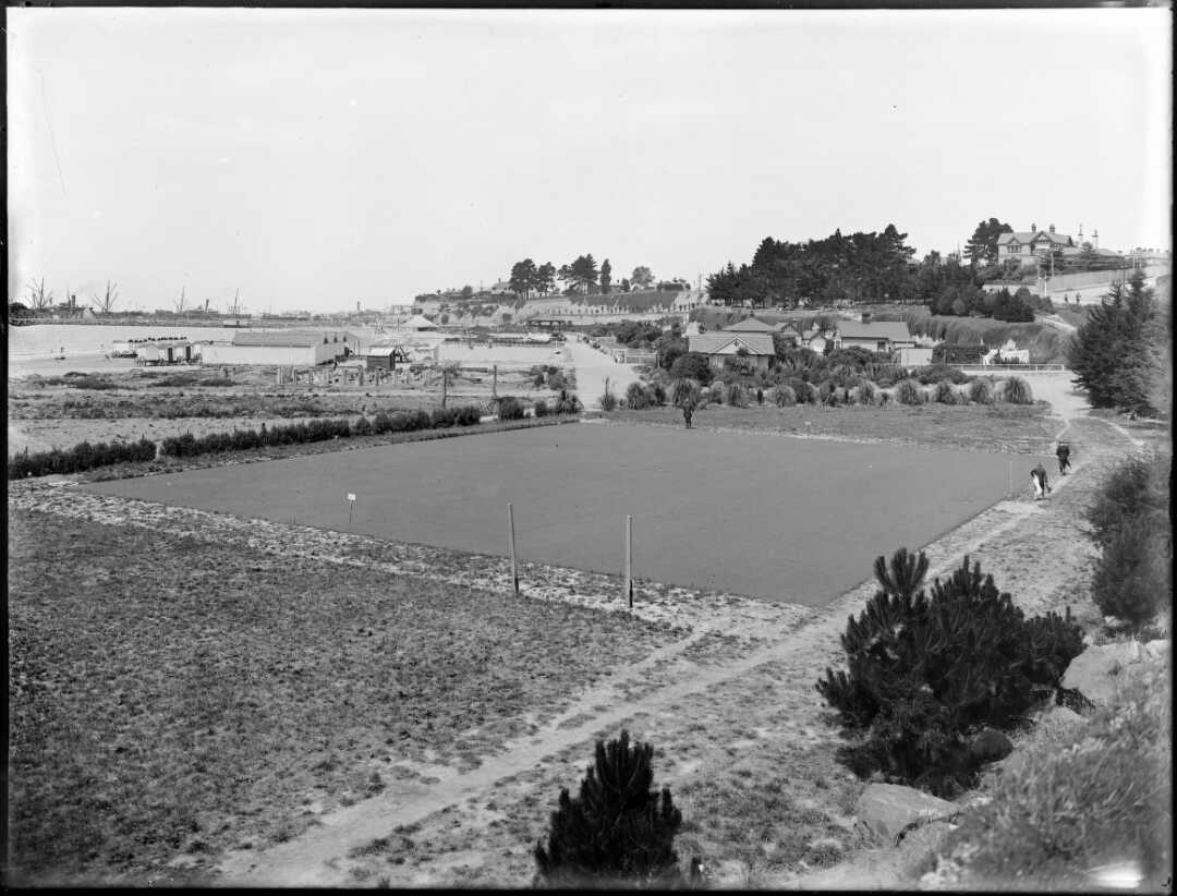
1910 - Scene at Caroline Bay, Timaru, near the beach with [bowling green ?] Photograph taken by an unidentified photographer employed or contracted by 'The Press' newspaper of Christchurch. Tiaki IRN: 692896. Tiaki Reference Number: 1/1-008906-G692896. Tiaki Reference Number: 1/1-008906-G
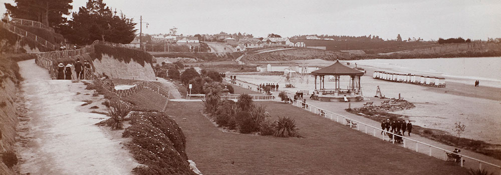
Beach at Timaru, Timaru, by Burton Brothers studio. Te Papa (O.019251)


The Timaru Lighthouse is icon for the District, learn about the engineer who designed it and the controversy... Download: Colourful Facts Blackett Lighthouse.pdf

The Timaru Lighthouse Lens on display at the South Canterbury Museum 2023 - Photo Roselyn Fauth

Blackett Lighthouse inside - pigeon holes - photo Roselyn Fauth 2025

Portrait of John Blackett taken circa 1889 by Wrigglesworth and Binns.. PAColl-8810: Blackett, John, 1819-1893 : Photographs. Tiaki IRN: 229554. Tiaki Reference Number: 1/2-080821-F https://ndhadeliver.natlib.govt.nz/delivery/DeliveryManagerServlet?dps_pid=IE140906&dps_custom_att_1=emu
Lighting Their Own Way
Before Wellington provided a permanent light, Timaru relied on its own resourcefulness. I am not sure who organised it or who paid for it, but before Timaru's lighthouse arrived there was a signal mast on the cliff at the Terrace overlooking the harbour and someone was lighting a tar barrel fire Patiti Point, I don't know if this was an example of local improvisation for safety but the systems were born of necessity. The point was the locals preferred location for a lighthouse. But it was also the location of the towns ammunition supply. And I have come across a few articles where the government was offering a lighthouse, but the locals warned a wooden structure with a kerosine lamp, next to explosives may not be the best idea. The lighthouse eventually did open here, the town wanted a concrete tower, but we got a wooden one placed at the top of the Terrace overlooking the harbour.
The 1875 report records none of this, probably too much detail for the level of information it needed to provide. The locals efforts saved lives and ships. They were acts of community in what could be interpreted as an absence of the government's attention.

Government Report "Appendices to the Journals of the House of Representatives, 1875" - AJHR 1875 I H 12a 7. The great thing about this document is that it contains authentic voices from government correspondence — especially Marine Engineer John Blackett’s 1874–75 memoranda — which give you factual grounding and period tone. Below are the key elements we can weave into the blog (either as direct quotes, reworded extracts, or background context).
What began as dry administrative detail in a government archive, has become a window into our locals courage and advocacy. The 1875 report may never have intended to tell a story about Timaru... but does. Between its figures and footnotes are the trace of a community that literally found light, fought for safety, and made it happen themselves. Every breakwater, every lighthouse, every archival return is part of that same conversation.

Return of the Total Ordinary Expenditure of the Marine Department for the Financial Year 1874–75. The Department came slightly under budget.
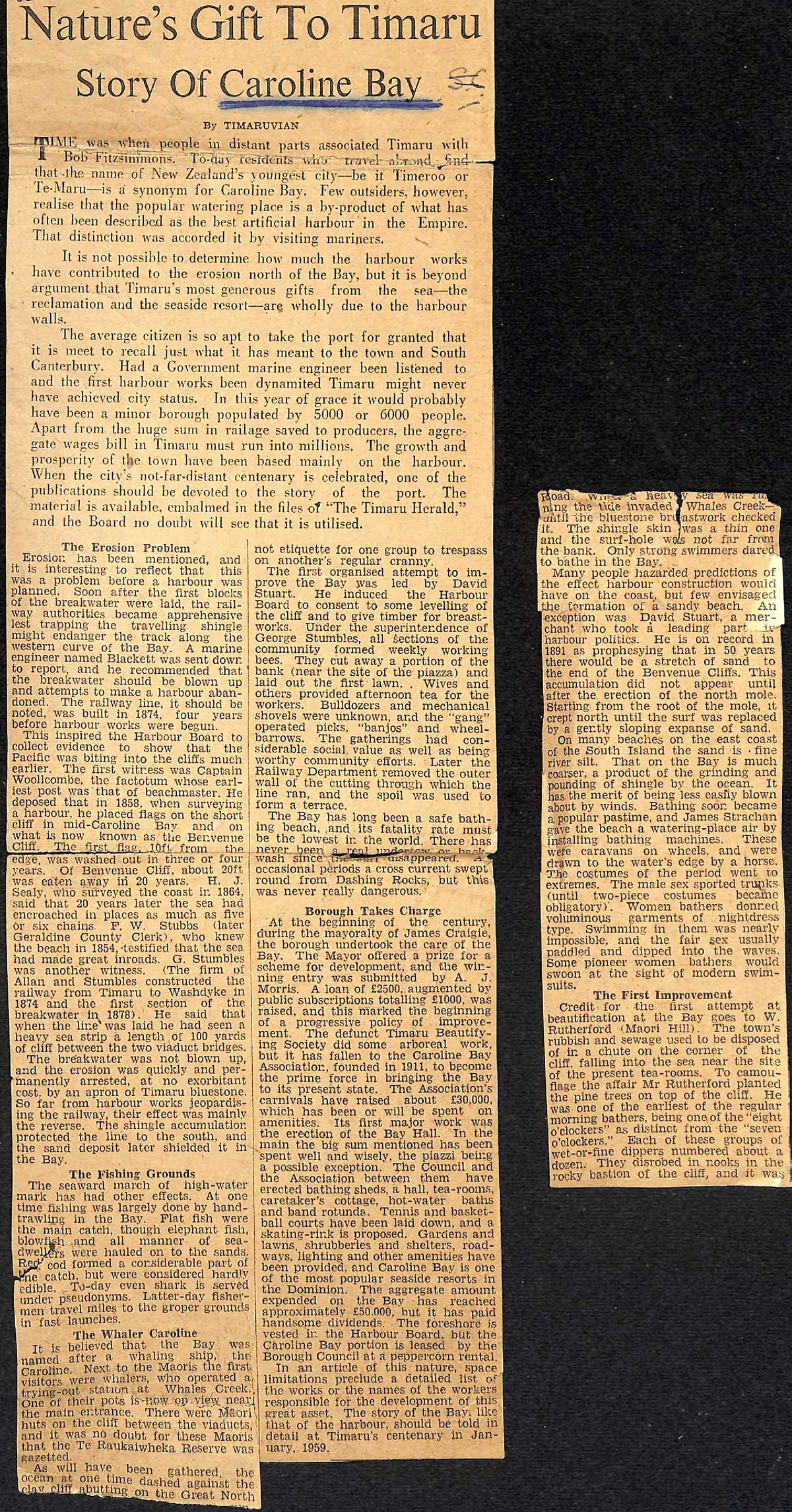
Timaruvian, Nature's Gift to Timaru: Story of Caroline Bay (1950s?). Aoraki Heritage Collection, accessed 23/06/2023, https://aorakiheritage.recollect.co.nz/nodes/view/363
Sources
https://www.maritimenz.govt.nz/public/lighthouses-of-new-zealand/history-of-new-zealand-lighthouses-and-their-keepers/
https://nzhistory.govt.nz/page/new-zealands-first-lighthouse-lit
https://digitalnz.org/stories/658b520bb9cb5200211926db
https://teara.govt.nz/en/lighthouses
https://teara.govt.nz/en/south-canterbury-region/page-6